
Saint-Trojan-les-Bains
| Saint-Trojan-les-Bains | ||
|---|---|---|

|
|
|
| region | Nouvelle-Aquitaine | |
| Department | Charente-Maritime | |
| Arrondissement | Rochefort | |
| Canton | Île d'Oléron | |
| Community association | Île d'Oléron | |
| Coordinates | 45 ° 51 ′ N , 1 ° 12 ′ W | |
| height | 0-35 m | |
| surface | 17.53 km 2 | |
| Residents | 1,262 (January 1, 2017) | |
| Population density | 72 inhabitants / km 2 | |
| Post Code | 17370 | |
| INSEE code | 17411 | |

Saint-Trojan-les-Bains is a southwestern French municipality with 1262 inhabitants (at January 1, 2017) in the department of Charente-Maritime in the region Nouvelle-Aquitaine ; it belongs to the Arrondissement of Rochefort and the Canton of Île d'Oléron .
geography
Saint-Trojan-les-Bains is the southernmost of the seaside resorts on the Île d'Oléron . It is surrounded by the sea on three sides (the Atlantic Ocean to the west and the Pertuis de Maumusson bay to the south and east) and is bordered by Le Grand-Village-Plage and Le Château-d'Oléron to the north . The west of the municipality consists of an extensive pine forest behind a long sandy beach; the settlement itself lies in the meteorologically more protected east.
history
During the revolution , the place was renamed “La Montagne”, although there is no elevation here that would justify the name. In 1793 it was renamed to Saint-Trojean, and in 1898 to Saint-Trojan-les-Bains. In 1949, the Le Grand-Village-Plage settlement in the north was separated.
Population development
| year | 1962 | 1968 | 1975 | 1982 | 1990 | 1999 | 2007 | 2016 |
| Residents | 1473 | 1666 | 1488 | 1275 | 1490 | 1624 | 1477 | 1323 |
Attractions
- Church of St-Trojan (see also: List of Monuments historiques in Saint-Trojan-les-Bains )
- Le p'tit train de Saint-Trojan, a narrow-gauge railway set up in 1963 that connects the town in the east with Plage de Gatseau, six kilometers to the west.

Coast in Saint-Trojan at low tide

Saint-Trojan church
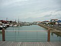
port

Plage de Gatseau
.jpg)


Town twinning
literature
- Le Patrimoine des Communes de la Charente-Maritime. Flohic Editions, Volume 1, Paris 2002, ISBN 2-84234-129-5 , pp. 194-195.