Fontaine-Uterte
| Fontaine-Uterte | ||
|---|---|---|
|
|
||
| region | Hauts-de-France | |
| Department | Aisne | |
| Arrondissement | Saint-Quentin | |
| Canton | Bohain-en-Vermandois | |
| Community association | Pays du Vermandois | |
| Coordinates | 49 ° 55 ' N , 3 ° 22' E | |
| height | 98-144 m | |
| surface | 5.77 km 2 | |
| Residents | 127 (January 1, 2017) | |
| Population density | 22 inhabitants / km 2 | |
| Post Code | 02110 | |
| INSEE code | 02323 | |
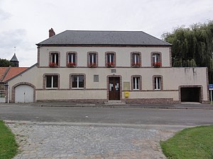
 Town Hall (Mairie) and Fontaine-Uterte School |
||
Fontaine-Uterte is a French municipality with 127 inhabitants (as of January 1 2017) in the Aisne department in the region of Hauts-de-France (before 2016 Picardy ). It belongs to the Arrondissement Saint-Quentin , the canton Bohain-en-Vermandois and the municipality association Pays du Vermandois .
geography
Fontaine-Uterte is surrounded by the neighboring communities of Sequehart in the west, Montbrehain in the north, Croix-Fonsomme in the east and the communities of Fonsomme in the canton of Saint-Quentin-2 in the south-east, Essigny-le-Petit in the south and Remaucourt in the south-west.
Population development
| year | 1962 | 1968 | 1975 | 1982 | 1990 | 1999 | 2005 | 2015 |
| Residents | 168 | 165 | 205 | 159 | 135 | 119 | 108 | 127 |
| Source: Cassini and INSEE | ||||||||
Attractions
- Saint-Pierre church, built in the 16th century
Web links
Commons : Fontaine-Uterte - collection of images, videos and audio files

