Le Catelet
| Le Catelet | ||
|---|---|---|

|
|
|
| region | Hauts-de-France | |
| Department | Aisne | |
| Arrondissement | Saint-Quentin | |
| Canton | Bohain-en-Vermandois | |
| Community association | Pays du Vermandois | |
| Coordinates | 50 ° 0 ′ N , 3 ° 15 ′ E | |
| height | 87-108 m | |
| surface | 0.41 km 2 | |
| Residents | 192 (January 1, 2017) | |
| Population density | 468 inhabitants / km 2 | |
| Post Code | 02420 | |
| INSEE code | 02143 | |
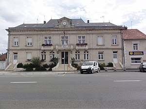
 City Hall (Mairie) of Le Catelet |
||
Le Catelet is a French municipality with 192 inhabitants (as of January 1 2017) in the Aisne department in the region of Hauts-de-France (before 2016 Picardy ). The municipality belongs to the arrondissement of Saint-Quentin .
geography
Le Catelet is located about 17 kilometers north of Saint-Quentin on the Scheldt (French: Escaut ), which borders the municipality in the north. Le Catelet is surrounded by the neighboring communities of Gouy in the north, east and south and Bony in the west.
history
At the end of the First World War in September 1918, Le Catelet was initially considered to be a strategic weak point of the so-called Siegfriedstellung , so that a breakthrough by the Allied troops was most likely expected here. The German troops were therefore considerably reinforced here.
Population development
| year | 1962 | 1968 | 1975 | 1982 | 1990 | 1999 | 2006 | 2013 |
| Residents | 249 | 243 | 272 | 243 | 223 | 218 | 201 | 197 |
| Source: Cassini and INSEE | ||||||||
Attractions
- Saint-Jean-Baptiste church, rebuilt after the First World War
- British war graves
Web links

