Forests
| Forests | ||
|---|---|---|

|
|
|
| region | Hauts-de-France | |
| Department | Aisne | |
| Arrondissement | Saint-Quentin | |
| Canton | Saint-Quentin-1 | |
| Community association | Pays du Vermandois | |
| Coordinates | 49 ° 49 ′ N , 3 ° 6 ′ E | |
| height | 63-91 m | |
| surface | 4.94 km 2 | |
| Residents | 165 (January 1, 2017) | |
| Population density | 33 inhabitants / km 2 | |
| Post Code | 02590 | |
| INSEE code | 02327 | |
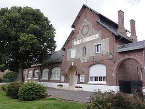
 Town Hall (Mairie) and Foreste School |
||
Foreste is a French municipality with 165 inhabitants (at January 1, 2017) in the Aisne department in the region of Hauts-de-France (before 2016 Picardy ). It belongs to the Arrondissement Saint-Quentin , the canton Saint-Quentin-1 (until 2015 Vermand ) and the municipality association Pays du Vermandois .
geography
Foreste is surrounded by the neighboring municipalities of Beauvois-en-Vermandois in the north, Germaine in the east, Douchy in the southeast, the municipality of Villers-Saint-Christophe in the south, which belongs to the canton Ribemont, and the municipalities of Douilly in the west and Ugny-l ' in the Somme department . Equipée in the northwest.
history
Between 1600 and 1843 the municipality was called Herouel / Hérouël .
Population development
| year | 1962 | 1968 | 1975 | 1982 | 1990 | 1999 | 2007 | 2015 |
| Residents | 175 | 170 | 163 | 199 | 165 | 143 | 179 | 173 |
| Source: Cassini and INSEE | ||||||||
Attractions
- Saint-Quentin Church
Personalities
- Antoine Quentin Fouquier-Tinville (1746–1795), revolutionary and public prosecutor (Accusateur Public) of the Revolutionary Tribunal during the French Revolution
Web links
Commons : Foreste - collection of images, videos and audio files

