Sommette-Eaucourt
| Sommette-Eaucourt | ||
|---|---|---|
|
|
||
| region | Hauts-de-France | |
| Department | Aisne | |
| Arrondissement | Saint-Quentin | |
| Canton | Ribemont | |
| Community association | Saint-Quentinois | |
| Coordinates | 49 ° 44 ' N , 3 ° 7' E | |
| height | 61-76 m | |
| surface | 6.28 km 2 | |
| Residents | 193 (January 1, 2017) | |
| Population density | 31 inhabitants / km 2 | |
| Post Code | 02480 | |
| INSEE code | 02726 | |
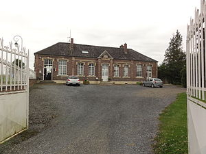
 Town hall (Mairie) of Sommette-Eaucourt |
||
Sommette-Eaucourt is a French commune of 193 inhabitants (at January 1, 2017) in the Aisne department in the region of Hauts-de-France (before 2016 Picardy ). It belongs to the arrondissement of Saint-Quentin , to the canton of Ribemont (until 2015 Saint-Simon ) and to the municipality of Saint-Quentinois .
geography
Sommette-Eaucourt is surrounded by the neighboring municipalities of Pithon and Dury in the north, Ollezy in the east, Cugny in the southeast and the municipality of Beaumont-en-Bein in the south , which belongs to the canton of Chauny, and borders the Somme department in the west . In Sommette-Eaucourt, the common border point of the Aisne, Somme and Oise departments lies in the middle of an old farm called Montalimont .
history
The municipalities of Sommette and Eaucourt formed during the French Revolution were amalgamated to Sommette-Eaucourt by royal decree of June 2, 1819.
Population development
| year | 1962 | 1968 | 1975 | 1982 | 1990 | 1999 | 2005 | 2015 |
| Residents | 188 | 172 | 173 | 139 | 150 | 157 | 140 | 186 |
| Source: Cassini and INSEE | ||||||||
Attractions
- Saint-Brice de Sommette church
- Saint-Martin d'Eaucourt church


