
Hargicourt (Aisne)
| Hargicourt | ||
|---|---|---|
.svg)
|
|
|
| region | Hauts-de-France | |
| Department | Aisne | |
| Arrondissement | Saint-Quentin | |
| Canton | Bohain-en-Vermandois | |
| Community association | Pays du Vermandois | |
| Coordinates | 49 ° 58 ′ N , 3 ° 11 ′ E | |
| height | 102-151 m | |
| surface | 8.12 km 2 | |
| Residents | 598 (January 1, 2017) | |
| Population density | 74 inhabitants / km 2 | |
| Post Code | 02420 | |
| INSEE code | 02370 | |
_mairie.JPG) Hargicourt Town Hall (Mairie) |
||

Hargicourt is a French municipality with 598 inhabitants (as of January 1 2017) in the Aisne department in the region of Hauts-de-France (2015 Picardy ). It belongs to the Arrondissement Saint-Quentin , the canton Bohain-en-Vermandois (until 2015 Le Catelet ) and the municipality association Pays du Vermandois .
geography

From a geological point of view, the region around Hargicourt belongs to the Paris Basin . Many fossils have been discovered in the municipality. The industrial mining of phosphates took place in the Hargicourt valley until 1914. The Cologne , a tributary of the Somme , has its source in Hargicourt.
Hargicourt is around 16 kilometers northwest of Saint-Quentin . The A 26 autoroute crosses the municipality. Hargicourt is surrounded by the neighboring communities Bony in the Northeast, Bellicourt the east, Villeret in the south and from the Somme located communities Hesbécourt in the southwest, Templeux-le-Guérard in the west and Ronssoy in the northwest and north.
history
During the First World War , Hargicourt was occupied by German troops a week after the Battle of the Marne in 1914 . In March 1917, the German army strategically withdrew on the Hindenburg line to the Saint-Quentin Canal a few kilometers east of Hargicourt. After the evacuation of the civilian population, the village was systematically destroyed by the German troops. In April 1917 British troops occupied the territory of Hargicourt, which was recaptured by the Germans on March 21, 1918 during the German offensive on the Aisne. On September 18, 1918, Hargicourt was captured by Australian troops.
Population development
| year | 1962 | 1968 | 1975 | 1982 | 1990 | 1999 | 2006 | 2015 |
| Residents | 620 | 559 | 561 | 540 | 557 | 559 | 538 | 587 |
| Source: Cassini and INSEE | ||||||||
Attractions
- Saint-Pierre church
- Hargicourt Communal Cemetery Extension, CWGC military cemetery with 75 war graves.

Saint-Pierre church
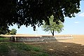
Hargicourt Communal Cemetery Extension


Web links