
Gronau (Leine)
| coat of arms | Germany map | |
|---|---|---|
.png)
|
Coordinates: 52 ° 5 ' N , 9 ° 47' E |
|
| Basic data | ||
| State : | Lower Saxony | |
| County : | Hildesheim | |
| Joint municipality : | Leinebergland | |
| Height : | 79 m above sea level NHN | |
| Area : | 88.13 km 2 | |
| Residents: | 10,736 (Dec. 31, 2019) | |
| Population density : | 122 inhabitants per km 2 | |
| Postal code : | 31028 | |
| Area code : | 05182 | |
| License plate : | HI, ALF | |
| Community key : | 03 2 54 043 | |
| City structure: | 13 districts | |
City administration address : |
Blanke Str. 16 31028 Gronau (Leine) |
|
| Website : | ||
| Mayor : | Ulf Gabriel ( SPD ) | |
| Location of the city of Gronau (Leine) in the Hildesheim district | ||
 _in_HI.svg) |
||

The small town of Gronau (Leine) is located in the Hildesheim district in Lower Saxony and is the administrative seat of the Leinebergland an der Leine municipality . Gronau is a member of the Leinebergland region , a voluntary association of various cities and municipalities in southern Lower Saxony founded according to the Leader approach . On November 1, 2016, some surrounding communities were incorporated into the city. As a result, the number of inhabitants has doubled to around 10,900 and the area has more than quadrupled to around 90 km².
geography
location
Gronau is located southwest of Hildesheim between Leinebergland in the west and Innerstebergland in the east. It is located west of the Hildesheim Forest and north of the Seven Mountains . The city is traversed by the leash .
A section of the B 3 passes west of Gronau .
City structure
The following districts belong to the city of Gronau:
|
history

The city was systematically founded around 1298 by Bishop Siegfried II of Hildesheim on a Leinewerder as Gronowe as a south-western fortification of the Hildesheim Monastery . The name Gronowe goes back to the green floodplains on the two arms of the river Leine, which supplied the city with water. At the same time, this situation offered a certain protection for the population. The former Gronau was made up of the inhabitants of three previously unfortified villages: Lehde, Bekum and Empeda. These villages then fell desolate.
In 1427 Gronau joined the Saxon Tohopesate and thus became a Hanseatic city.
There is evidence of a Jewish community in Gronau since the beginning of the 18th century. The synagogue was built in the first years after the city fire of 1702. The Jewish inhabitants of Gronau formed a joint synagogue community with Banteln belonging to the Hildesheim state rabbinate . From 1828 a Jewish elementary school existed, but in 1890 it was converted into a purely religious school due to the decline in student numbers.
Until 1885, Gronau was the seat of the bailiff in the Gronau department , then the district town in the newly formed Gronau district until it was dissolved and incorporated into the Alfeld district on October 1, 1932.
After centuries of existence as an agricultural town , the town experienced an upswing at the beginning of the 20th century due to industrialization and the connection to the Prussian railway network ( Elze – Bodenburg railway line ), which was noticeable in an increasing population.
During the Second World War , Gronau was hit by twelve incendiary bombs on November 6, 1940, which set a roof structure and a bowling alley on fire. On January 27, 1941, four high-explosive bombs caused minor property damage in Gronau. On June 16, 1941, eight high explosive bombs and 20 incendiary bombs fell north of the city, damaging a residential building and a stable. Many windows were destroyed, one was injured.
In the 1980s and 1990s, the economy underwent considerable structural change . Traditional industrial companies cut jobs to a large extent ( metal industry , chemical industry ) or disappeared completely ( sugar factory , paper manufacture). Gronau is still a comparatively strong industrial location for the metal, chemical and paper industries. The designation of the industrial area Gronau-West with good transport connections opened up new perspectives since 2008.
At the beginning of the 21st century, Gronau (Leine) is home to many commuters to neighboring towns and cities such as Hildesheim and Hanover .
Incorporations
On March 1, 1974, the community Dötzum was incorporated.
In 2014, the communities of Banteln , Betheln , Brüggen , Despetal and Rheden and the city of Gronau decided to merge on November 1, 2016. The merged municipality took over the name city of Gronau (Leine). At the same time the city a member of the merger by the likewise on November 1, 2016 was Samtgemeinden Duingen and Gronau (Leine) incurred Samtgemeinde Leinebergland . Gronau (Leine) was previously the administrative seat of the integrated community of Gronau (Leine).
religion

The old town is dominated by the mighty, 65 meter high tower of the Evangelical- Lutheran St. Matthäi Church.
The medieval Lehder St. Johannis Church is located in the Evangelical Cemetery and is used today for funeral services and occasional services.
There are also the Roman Catholic St. Joseph's Church , the monastery church of never officially repealed monastery .
The New Apostolic Church , consecrated in 1983, is also located near the city park .
politics
.jpg)
City Council
The council of the city of Gronau consists of 5 councilors and 26 councilors from the following parties:
(Status: local election September 11, 2016)
mayor
The mayor of the city of Gronau is Ulf Gabriel (SPD). His deputies are Günter Falke (SPD), Eduard Plachta (CDU) and Christine Evers (SPD).
coat of arms
The city was awarded the municipal coat of arms on August 28, 1940 by the President of the Province of Hanover . The district administrator from Alfeld presented it on September 10th of the same year.
|
|
Blazon : "In the red shield a golden diagonal right ladder with three vertical rungs." |
| Justification of the coat of arms: This coat of arms, which has been documented since the beginning of the 18th century (first documented in 1705), was changed in the last quarter of the 19th century in an ugly and meaningless way: shield divided diagonally by red and green and topped with a silver diagonal ladder to the right. When this change of the city and coat of arms colors was made cannot be seen from the files and council minutes of the city, and it has never been recognized in higher places. After hearing the city councilors and councilors, the mayor decided on March 20, 1940 to return to the old city colors of red and gold and to the coat of arms in this tinging . |
seal
The earliest seal dates from the middle of the 14th century and has been handed down as an impression from 1434. It shows a saint next to each other, presumably St. Matthew and Mary with the Christ child, who also holds a staff of lilies in her left hand. Later images from the 17th century only show the Madonna growing above the split shield of Hildesheim Monastery, which is covered with a sloping bar as a place symbol. On a weather vane from 1705, the ladder is documented for the first time, which arose from the earlier sloping beams.
Town twinning
-
 Dovre , Norway, since 2000
 -
 Honiton , England
 -
 Mézidon-Canon , France
 -
 Wermsdorf , Germany
Culture and sights
Buildings
The cityscape is characterized by numerous half-timbered houses in eaves construction, as they are typical for southern Lower Saxony. Since the end of the Second World War and with the immigration of refugees and displaced persons from the formerly German eastern areas, several new building areas have emerged. This development continues to this day.
- In the aerial photo, the core of the small town can still be seen, on the edge of which the city wall and ramparts ran between the arms of the Leine. At the place of the ramparts there are now appropriately titled footpaths and cycle paths, which remind of the course (north wall and south wall).
- Gronau was surrounded by a city wall, the remains of which can still be seen on the north wall. There is a former watchtower on the south wall.
- A railway line ran on the north side of Gronau , which was closed in the 1980s. The former railway bridge, which led the railway over the Leine, is now a bicycle and pedestrian bridge.

- In 1309 the church in Gronau, consecrated to St. Matthew, was first mentioned in a document. Construction of today's St. Matthäi Church began in 1457. The core of the tower is a bit older. The church and tower suffered from the numerous fires that destroyed the city of Gronau over the centuries. In the middle of the 19th century, the church had become so dilapidated that a completely new building was initially considered, but the church was ultimately preserved and rebuilt. From 1856 to 1859 it was given its current appearance as a three-aisled neo-Gothic hall church by the Hanoverian architect Daughtermann based on plans by the Oberhof building director Laves. The carved winged altar inside is said to have been made in the Hamburg master workshop Bertram in 1415. A valuable crucifixion group was once installed in a niche in the south wall of the choir above the sacristy door, which is now more evident in the north aisle. The figures, carved from linden wood, were made in a workshop in Hildesheim in 1520. In 1860 the old dilapidated organ was replaced by a new one from the organ builder Philipp Furtwängler, who was then based in Elze . With its 58 registers it is his largest and most important work and one of the largest organs of its time in the Hanover regional church . It was classified as a historical monument by the regional church office in 1936 and was last restored in 2017 by the Hillebrand brothers .

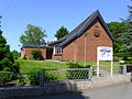
Administration building II of the joint municipality
New Apostolic Church

Gronau (Leine), market square

The Gronau Museum


_Marktplatz.jpg)

Green spaces and recreation
- The nature reserve Gronauer Masch is located north of Gronau (Leine) in a former clay quarrying area in the Leine Niederung and puts abandoned clarification ponds under protection. The area is characterized by a juxtaposition of ponds, silting zones and reed zones and subsequent wet meadows . The area is an important breeding, resting and wintering habitat for water birds .
- The nature reserve Leineaue under the Rammelsberg lies between Gronau (Leine) and Elze and places a section of the middle course of the Leine with its floodplain and parts of the slopes of the Uthberg and the Großer Rammelsberg in the east under protection. The periodically flooded lowland is characterized by the meandering river course with oxbow lakes and flood channels. The line is often accompanied by remains of alluvial forest . In addition, there are wet meadows and fallow land rich in shrubs . The slopes included in the nature reserve are characterized by forests and shrubbery as well as remnants of poor grassland and orchards .
Personalities
sons and daughters of the town
- Conrad Breihan († 1570), brewer and inventor of a type of beer named after him
- Conrad Wiedemeyer (1533–1598), Brunswick-Lüneburg Grand Bailiff
- August Basilius Disper (1633–1700), Princely Waldeck steward of Arolsen
- Hermann Plathner (1831–1902), painter of the Düsseldorf School
- Philipp Heinrich Ast (1848–1921), shepherd and herbalist
- August von Rheden (1853–1907), royal Prussian district administrator and politician
- Adolf Plathner (1861–1937), Hanoverian lawyer and senator
- Armin Kaufmann (1922–1985), born in Banteln, law scholar and university professor
- Dieter von Levetzow (* 1925), painter, sculptor and medalist
- Werner Bumann (1931–1986), athlete
- Andreas Schmidt-Colinet (* 1945), classical archaeologist
- Jürgen Mlynek (* 1951), physicist
- Hartwig Othmer (* 1963), lawyer
People connected to the city
- Heinrich Bünting (1545–1606), theologian and geographer , a. a. Creator of the four-leaf clover world map, was pastor in Gronau an der Leine from 1572 to 1591
- Christoph Friedrich Plathner (1671–1755), comes palatinus in Goslar
- Georg Sauerwein (1831–1904), linguist, poet, publicist and pacifist, his grave is in the Evangelical Cemetery in Gronau, where he grew up
literature
- 700 years of Gronau (Leine). Festival book for the anniversary . Gronau (Leine) 1997.
- Rathschlag: Agriculture in the Alfeld district 1895–1955 . Festschrift, published on the occasion of the 60th anniversary of the agricultural school and business advice center Gronau / Hann. and the 50th anniversary of the Alter Gronauer Agricultural School Students Association. Gronau 1954.
- Th. Siegemann, W. Schramme: History of the city of Gronau . Gronau (Hann.) 1931.
Web links
Individual evidence
- ↑ State Office for Statistics Lower Saxony, LSN-Online regional database, Table 12411: Update of the population, as of December 31, 2019 ( help ).
- ↑ Hanseatic City of Gronau (Leine), website.
- ^ Federal Statistical Office (ed.): Historical municipality directory for the Federal Republic of Germany. Name, border and key number changes in municipalities, counties and administrative districts from May 27, 1970 to December 31, 1982 . W. Kohlhammer, Stuttgart / Mainz 1983, ISBN 3-17-003263-1 , p. 204 .
- ↑ Lower Saxony State Chancellery (Ed.): Law on the unification of the communities of Banteln, Betheln, Brüggen, Despetal, Rheden and the city of Gronau (Leine) as well as on the new formation of the Duingen area and the Leinebergland community, Hildesheim district . Lower Saxony Law and Ordinance Gazette (Nds. GVBl.). No. 22/2015 . Hanover December 15, 2015, p. 399-400 ( Digitalisat ( Memento of 13 May 2019 Internet Archive ) [PDF; 278 kB ; accessed on June 29, 2019] pp. 17–18).
- ↑ a b Council members and mayor of the city of Gronau (Leine). In: Website of the Samtgemeinde Gronau (Leine). Retrieved February 20, 2020.
- ^ A b Wilhelm Barner : Coat of arms and seal of the Alfeld district . Rebinding. Lax GmbH & Co. KG, Hildesheim 1998 ( digitized version of the text part of the first edition from 1940 [PDF; 10.0 MB ; accessed on June 9, 2019]).
- ↑ a b Coat of arms of the city of Gronau. (PDF; 53 KB) In: Website of the Samtgemeinde Gronau (Leine). Retrieved June 10, 2019 .
- ↑ Klemens Stadler: German coat of arms Federal Republic of Germany . The municipal coats of arms of the federal states of Lower Saxony and Schleswig-Holstein. tape 5 . Angelsachsen-Verlag, Bremen 1970, p. 44 .
- ↑ Chronicle of the St. Matthäi Church. Retrieved September 8, 2017 (PDF; 1.6 MB).
- ↑ http://www.kruenitz1.uni-trier.de/xxx/h/kh00703.htm
- ↑ Conrad Wiedemeyer's grave slab. In: November , loose-leaf collection, presumably from a calendar from the 1970s, with a photograph of the grave slab after a photo by J. Wisch .
- ^ Hermann Thomas (arrangement): The houses in Alt-Korbach and their owners. Booklet 4, Lengefelder Straße - Schulstraße - Im Sack - Am Tylenturm, Korbach City Archives (Ed.) 1959, p. 10.
- ^ Klaus Mlynek : Platner, Adolf , in: Hannoversches Biographisches Lexikon , p. 287; limited preview in Google Book search
- ↑ Archive for Stamm- und Wappenkunde , Volumes 14-16, Wellers, 1914, p. 17; limited preview in Google Book search
Alfeld (Leine) | Algermissen | Bad Salzdetfurth | Bockenem | Diekholzen | Duingen | Eime | Elze | Freden (leash) | Giesen | Gronau (Leine) | Harsum | Hildesheim | Holle | Lamspringe | Nordstemmen | Sarstedt | Ringed | Sibbesse | Söhlde
Dumbbells | Barfelde | Betheln | Brüggen | Dötzum | Eddinghausen | Eitzum | Gronau (Leine) | House Escherde | Heinum | Nienstedt | Rheden | Wallenstedt