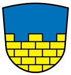
District of Bautzen (1994-2008)
| coat of arms | Germany map |
|---|---|

|

Coordinates: 51 ° 11 ′ N , 14 ° 26 ′ E |
| Basic data (as of 2008) | |
| Existing period: | 1994-2008 |
| State : | Saxony |
| Administrative region : | Dresden |
| Region : | Neisse |
| Administrative headquarters : | Bautzen |
| Area : | 961.12 km 2 |
| Residents: | 146,197 (Dec. 31, 2007) |
| Population density : | 152 inhabitants per km 2 |
| License plate : | BZ |
| Circle key : | 14 2 72 |
| Circle structure: | 30 parishes |
| Address of the district administration: |
Bahnhofstrasse 9 02625 Bautzen |
| Website : | |
| District Administrator : | Michael Harig ( CDU ) |
| Location of the Bautzen district in Saxony | |
The district of Bautzen ( Upper Sorbian Wokrjes Budyšin ) formed in 1994 was a district in Eastern Saxony with Bautzen and Bischofswerda as major district towns . It bordered the Kamenz district to the west and north , the Lower Silesian Upper Lusatia district to the east, the Löbau-Zittau district to the southeast and the Czech Republic and the Saxon Switzerland district to the south . The district was a member of the Neisse Euroregion .
geography
The district stretched from the Upper Lusatian heath and pond landscape in the north over the Lusatian mountains around Wilthen and Cunewalde (colloquially referred to as the Oberland ) to the Czech border at Sohland on the Spree . The largest river in the district was the Spree , which flows through Bautzen. Smaller rivers were the Löbauer Wasser , the Kleine Spree and the Wesenitz , on which Bischofswerda lies. The largest body of water in terms of area was the Bautzen dam . In the northern part of the district there were numerous ponds and lakes that were created for the purpose of fishing. The 955 km² large former district area was predominantly covered with pine forest in the north, the middle part was intensively cultivated, while spruce or mixed forest predominated in the Lausitzer Bergland.
traffic
By the county which ran highways 6 ( Dresden -Bautzen- Görlitz ), 96 ( Hoyerswerda -Bautzen- Zittau ), 98 (Bischofswerda- Oppach ) and 156 ( white water - Bautzen ). In addition, the federal motorway 4 (Dresden – Görlitz) ran over the area of the district. In this there were six connection points, namely Burkau , Uhyst am Taucher , Salzenforst , Bautzen-West , Bautzen-Ost and Weißenberg . A commercial airport was in Litten east of Bautzen, a glider airport in Klix , about 12 kilometers north of the city. There were railway connections from Dresden to Görlitz via Bischofswerda and Bautzen (formerly the Saxon-Silesian Railway Company ) and the Bischofswerda – Zittau railway branching off (formerly part of the Cottbus Reich Railway Directorate ).
history
The district was given its shape as part of a Saxon district reform on August 1, 1994, when the former district of Bautzen was enlarged by the largest part of the Bischofswerda district . It was united by another district reform on August 1, 2008 with the district of Kamenz and the previously independent city of Hoyerswerda to form the new district of Bautzen .
politics
Horst Gallert (CDU) was the district administrator of the Bautzen district from 1994 to 2001 . Then Michael Harig (also CDU) held this office until the regional reform of 2008 .
District council
The 62 seats in the district council were ultimately distributed among the individual parties as follows:
- CDU : 29 seats
- LEFT : 12 seats
- Free voters: 8 seats
- FDP : 5 seats
- SPD : 5 seats
- DSU : 2 seats
- GREEN : 1 seat
District partnerships
-
 Main-Tauber-Kreis , Baden-Württemberg, since 1990
cities and communes
|
(Population figures as of December 31, 2006)
|
|
Of a total of 30 municipalities, 16 were wholly or partly in the official Sorbian settlement area .
License Plate
At the beginning of 1991 the district received the distinctive sign BZ . It is still issued today.

