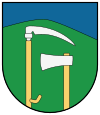
Lazisko
| Lazisko | ||
|---|---|---|
| coat of arms | map | |

|
|
|
| Basic data | ||
| State : | Slovakia | |
| Kraj : | Žilinský kraj | |
| Okres : | Liptovský Mikuláš | |
| Region : | Liptov | |
| Area : | 23.986 km² | |
| Residents : | 383 (Dec. 31, 2019) | |
| Population density : | 16 inhabitants per km² | |
| Height : | 670 m nm | |
| Postal code : | 032 11 ( Svätý Kríž post office ) | |
| Telephone code : | 0 44 | |
| Geographic location : | 49 ° 2 ' N , 19 ° 33' E | |
| License plate : | LM | |
| Kód obce : | 510581 | |
| structure | ||
| Community type : | local community | |
| Administration (as of November 2014) | ||
| Mayor : | František Púčik | |
| Address: | Obecný úrad Lazisko č. 140 032 11 Svätý Kríž |
|
| Website: | www.lazisko.sk | |
| Statistics information on statistics.sk | ||
Lazisko (until 1927 Slovak also "Lazište"; Hungarian Laziszkó or older Lazistye ) is a municipality in the north of Slovakia with 383 inhabitants (as of December 31, 2019), which belongs to the Okres Liptovský Mikuláš , part of the Žilinský kraj , and belongs to the traditional Landscape Liptov is counted.
geography
The municipality is located in the middle of the Liptovská kotlina basin (part of the larger Podtatranská kotlina ) below the Low Tatras on the Palúdžanka . More than two thirds of the municipality are located in the Low Tatras and largely include the valley of the Mošnica stream . There is the entrance to the 420 meter long Mošnica Cave. The center of the village is at an altitude of 670 m nm and is 12 kilometers from Liptovský Mikuláš .
Neighboring communities are Svätý Kríž in the north, Pavčina Lehota in the east, Demänovská Dolina in the south-east, Dolná Lehota and Jasenie in the south and Dúbrava in the west.
history
Lazisko was mentioned in writing for the first time in 1352 in a donation document from Ludwig I as Lazan and for years was owned by the noble family Okolicsányi . Other historical names were among others Lazan or Lason (1391), Lasische (1396), Lazistye (1773) and Lazysste (1808). In 1784 the village had 15 houses and 138 inhabitants, in 1828 there were 21 houses and 198 inhabitants, most of whom were employed as farmers. Furthermore, there was a tradition of weaving and there was a saw and a water mill, as well as an antimony mine .
The place in Liptov County belonged to the Kingdom of Hungary until 1918 and then came to Czechoslovakia and finally to Slovakia.
population
According to the 2011 census, there were 409 inhabitants in Lazisko, 392 of them Slovaks , three Czechs and one Pole . 13 residents did not provide any information on ethnicity .
214 residents committed themselves to the Evangelical Church AB, 105 residents to the Roman Catholic Church and one resident each to the Jehovah's Witnesses and to the Evangelical Methodist Church. 71 inhabitants had no denomination and the denomination of 17 inhabitants was not determined.
Buildings and monuments
- Bell tower from 1930
Individual evidence
- ↑ Slovenské slovníky: názvy obcí Slovenskej republiky (Majtán 1998)
- ↑ Results of the 2011 census (Slovak) ( Memento of the original from March 5, 2016 in the Internet Archive ) Info: The archive link was inserted automatically and has not yet been checked. Please check the original and archive link according to the instructions and then remove this notice.
Web links
- Entry on e-obce.sk (Slovak)

