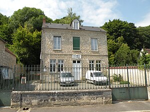
Menouville
| Menouville | ||
|---|---|---|
|
|
||
| region | Île-de-France | |
| Department | Val d'Oise | |
| Arrondissement | Pontoise | |
| Canton | Pontoise | |
| Community association | Sausseron Impressionnistes | |
| Coordinates | 49 ° 9 ' N , 2 ° 7' E | |
| height | 47-112 m | |
| surface | 2.78 km 2 | |
| Residents | 60 (January 1, 2017) | |
| Population density | 22 inhabitants / km 2 | |
| Post Code | 95810 | |
| INSEE code | 95387 | |
 Mairie |
||
Menouville is a French commune with 60 inhabitants (as of January 1, 2017) in the Val-d'Oise department of the Île-de-France region ; it belongs to the Arrondissement of Pontoise and the Canton of Pontoise . The inhabitants call themselves Menouvillois or Menouvilloises .
geography
The municipality of Menouville is located 36 kilometers northeast of Paris . It is located in the Vexin français Regional Nature Park .
Neighboring communities of Menouville are Theuville in the west, Arronville in the north, Frouville in the northeast, Labbeville in the southeast and Vallangoujard in the southwest.
history
Menouville was already at the time of the Merovingian settled
Since there was no church in the village, the residents were allowed to celebrate their services in the chapel of the castle of Balincourt, which is in the neighboring village of Arronville .
Population development
| year | 1962 | 1968 | 1975 | 1982 | 1990 | 1999 | 2006 |
| Residents | 65 | 68 | 55 | 50 | 63 | 84 | 80 |
Attractions
- Domaine de Balincourt, partly in the area of Menouville ( Monument historique )
- Pigeon tower
literature
- Le Patrimoine des Communes du Val-d'Oise. Flohic Éditions, Volume 2, Paris 1999, ISBN 2-84234-056-6 , pp. 669-671.
Web links
- Menouville at annuaire-mairie.fr (French)
Individual evidence
- ↑ Domaine de Balincourt in the Base Mérimée of the French Ministry of Culture (French)
