Testicle
| Testicle | ||
|---|---|---|

|
|
|
| region | Île-de-France | |
| Department | Val d'Oise | |
| Arrondissement | Pontoise | |
| Canton | Vauréal | |
| Community association | Vexin-Val de Seine | |
| Coordinates | 49 ° 9 ′ N , 1 ° 46 ′ E | |
| height | 49-140 m | |
| surface | 4.37 km 2 | |
| Residents | 214 (January 1, 2017) | |
| Population density | 49 inhabitants / km 2 | |
| Post Code | 95420 | |
| INSEE code | 95309 | |
| Website | http://www.hodent.fr/ | |
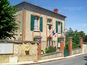
 Mairie (Town Hall) |
||
Hodent is a French commune with 214 inhabitants (as of January 1, 2017) in the Val-d'Oise department in the Île-de-France region . The residents call themselves Hodentois or Hodentoises or Hodentais or Hodentaises .
geography
The municipality of Hodent is located about 70 kilometers northwest of Paris , it is crossed by the Aubette river. The municipality is part of the Vexin français Regional Nature Park .
Neighboring municipalities of Hodent are Saint-Gervais in the north, Charmont in the east, Genainville in the south and Omerville in the west.
history
The manorial rule in Hodent passed to the Abbey of Saint-Germain-des-Prés in Paris in 1670 , where it remained until the end of the Ancien Régime .
Population development
| year | 1962 | 1968 | 1975 | 1982 | 1990 | 1999 | 2007 |
|---|---|---|---|---|---|---|---|
| Residents | 192 | 196 | 212 | 181 | 180 | 267 | 266 |
Attractions
See also: List of Monuments historiques in Hodent
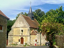
- Chapel of Sainte-Marguerite , built in the 16th century ( Monument historique )
economy
Hodent owns an industrial park where medium-sized companies have settled.
Personalities
literature
- Le Patrimoine des Communes du Val-d'Oise , Flohic Éditions, Volume 2, Paris 1999, ISBN 2-84234-056-6 , pp. 554-556.
Web links
- Community presentation (French)
- Hodent at annuaire-mairie.fr (French)

