
Montastruc (Tarn-et-Garonne)
| Montastruc | ||
|---|---|---|
|
||
| region | Occitania | |
| Department | Tarn-et-Garonne | |
| Arrondissement | Montauban | |
| Canton | Quercy-Aveyron | |
| Community association | Coteaux et Plaines du Pays Lafrançaisain | |
| Coordinates | 44 ° 6 ′ N , 1 ° 18 ′ E | |
| height | 73-213 m | |
| surface | 4.67 km 2 | |
| Residents | 311 (January 1, 2017) | |
| Population density | 67 inhabitants / km 2 | |
| Post Code | 82130 | |
| INSEE code | 82120 | |

Montastruc is a French commune with 311 inhabitants (as of January 1, 2017) in the Tarn-et-Garonne department in the Occitanie region . The municipality is located in the arrondissement of Montauban and is part of the canton of Quercy-Aveyron (until 2015: canton of Lafrançaise ). The inhabitants are called Montastrucois .
Geographical location
Montastruc is about nine kilometers north-north-west of Montauban . The Aveyron flows along the southern edge of the municipality . Montastruc is surrounded by the neighboring communities of Lafrançaise in the north and west, Piquecos in the east and Villemade in the south.
Population development
| year | 1962 | 1968 | 1975 | 1982 | 1990 | 1999 | 2006 | 2017 |
|---|---|---|---|---|---|---|---|---|
| Residents | 257 | 253 | 206 | 189 | 209 | 217 | 259 | 311 |
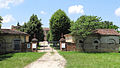
Attractions
- Saint-Pierre church in Campredon from the 13th century, additions from the 17th century, almost completely rebuilt in 1876 in neo-Gothic style
- Mill

Saint-Félix church
Castle and palace complex Piquecos


Web links
Commons : Montastruc - collection of images, videos and audio files
Individual evidence