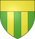
Verlhac-Tescou
|
Verlhac-Tescou Verlhac |
||
|---|---|---|

|
|
|
| region | Occitania | |
| Department | Tarn-et-Garonne | |
| Arrondissement | Montauban | |
| Canton | Tarn-Tescou-Quercy vert | |
| Community association | Quercy Vert-Aveyron | |
| Coordinates | 43 ° 56 ' N , 1 ° 32' E | |
| height | 110-220 m | |
| surface | 22.69 km 2 | |
| Residents | 519 (January 1, 2017) | |
| Population density | 23 inhabitants / km 2 | |
| Post Code | 82230 | |
| INSEE code | 82192 | |
| Website | http://www.verlhac-tescou.fr/ | |
Verlhac-Tescou ( Occitan : Verlhac ) is a French commune with 519 inhabitants (as of January 1, 2017) in the Tarn-et-Garonne department in the Occitanie region . It belongs to the arrondissement of Montauban and the canton of Tarn-Tescou-Quercy vert (until 2015: canton of Villebrumier ). The inhabitants are called Verlhacois .
geography
Verlhac-Tescou is located about 15 kilometers southeast of Montauban on the Tescou River . Verlhac-Tescou is surrounded by the neighboring communities of La Salvetat-Belmontet in the north, Montdurausse in the northeast, Saint-Urcisse in the east, Montgaillard in the southeast, Beauvais-sur-Tescou in the south and southeast, Le Born and Villemur-sur-Tarn in the south, Varennes to the south and west and Saint-Nauphary to the west and northwest.
history
The bastide was founded in 1249 by Raymond VII of Toulouse . During the wars of religion, the place was fortified until the 17th century.
Population development
| year | 1962 | 1968 | 1975 | 1982 | 1990 | 1999 | 2006 | 2012 |
| Residents | 421 | 435 | 406 | 409 | 411 | 421 | 402 | 496 |
| Source: Cassini and INSEE | ||||||||
Attractions
- medieval bridge
