
Peissenberg
| coat of arms | Germany map | |
|---|---|---|

|
Coordinates: 47 ° 48 ' N , 11 ° 4' E |
|
| Basic data | ||
| State : | Bavaria | |
| Administrative region : | Upper Bavaria | |
| County : | Weilheim-Schongau | |
| Height : | 584 m above sea level NHN | |
| Area : | 32.68 km 2 | |
| Residents: | 12,589 (Dec. 31, 2019) | |
| Population density : | 385 inhabitants per km 2 | |
| Postal code : | 82380 | |
| Area code : | 08803 | |
| License plate : | WM, SOG | |
| Community key : | 09 1 90 139 | |
| LOCODE : | DE PBG | |
| Market structure: | 25 parts of the community | |
Market administration address : |
Hauptstrasse 77 82380 Peißenberg |
|
| Website : | ||
| Mayor : | Frank Zellner ( CSU ) | |
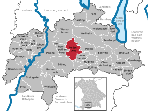
| Location of the Peißenberg market in the Weilheim-Schongau district | ||
  |
||


Peißenberg is a market in the Upper Bavarian district of Weilheim-Schongau . The original place was called Unterpeißenberg until 1919.
geography
Peißenberg is located in the middle of the Pfaffenwinkel in the Alpine foothills, between the Hohen Peißenberg and the Guggenberg on the left bank of the Ammer . The area is rural.
Community structure
The community has two larger parts: north ("village") and south ("Wörth"), which are separated by the mining dump.
The municipality has 25 officially named municipal parts (the type of settlement is given in brackets ):
|
|
Neighboring communities
Neighboring communities are clockwise, starting in the north: Wessobrunn (districts of Forst and Paterzell) , Polling , Oberhausen , Böbing and Hohenpeißenberg .
geology
Peißenberg is located at the junction of the foreshore molasse to Faltenmolasse . Coming from the north, the so-called Peißenberger Schuppe (formerly called Mulde) forms the first geologically distinctive area of the fold molasse in the Peißenberg area. The Rottenbucher Mulde follows further south. In the steeply sloping troughs or shed legs, the coal-bearing layers originally located deeper also come very close to the surface of the earth, which enabled the coal to be extracted there. The Hohe Peißenberg is located on the southernmost part of the foreland molasse, the layers of which have been erected steeply upwards (erect molasses). Both the deposition of the layers and their later unfolding took place in the age of the Tertiary . Below the molasse rocks, in the Malm limestone, large thermal water deposits are suspected that could be used geothermally. The tertiary layers are overlaid towards the top by Quaternary layers of different thicknesses (especially gravel and moraine ).
climate
The climate in Peißenberg is relatively cool, with an annual average temperature of 7.5 ° C. The average precipitation is 1200 mm. The wettest months are June and July, with a high value also being registered in January. This is spread over roughly 160 days, while snow falls in half of these days.
Flood events
In 1999 the Ammer flooded. Apart from a few full cellars, nothing happened in the village itself, but the campsite near the sewage treatment plant was completely flooded.
The next flood came in August 2005. This time, too, the dam was able to save the place thanks to its elevation after 1999, but an unfinished bridge for the bypass road was destroyed by the tree trunks building up - even a deliberately initiated dam failure could not prevent this. During the months of June and July the bridge had not been allowed to be built due to flood protection measures (at that time, however, the Ammer had low water), and when construction work resumed in August, the flood occurred. The campsite was also badly affected in 2005. A heavy rain event in the summer of 2016 in the area of Schongauer Strasse and Bachstrasse caused great damage when the Wörthersbach overflowed its banks.
history
Until the church is planted
The oldest finds of human activity in the Peißenberg area date from the Bronze Age and Hallstatt Age . There were also coin finds from Roman times, and row graves date from the Merovingian period.
The first written mentions come from the 11th century, including from records of the Benediktbeuern monastery , which had possessions here since the 10th century. The oldest document in the Peißenberg archive bears a seal from 1659 and refers to a previous letter from 1602. An important event was the title health resort for the north-western part of the town, at that time Sulz , which thus became Bad Sulz .
The place belonged to the Rentamt München and to the regional court Rauhenlechsberg of the Electorate of Bavaria . In the course of the administrative reforms in the Kingdom of Bavaria , today's municipality was created with the municipal edict of 1818 .
Name change, market
The community of Unterpeißenberg was officially renamed Peißenberg on March 1, 1919 and made the market .
Mining
In the early 19th century, the systematic mining of pitch coal on the Hohen Peißenberg began. The occurrences had been known since around 1580, when a shepherd boy wanted to make a campfire and suddenly the whole ground caught fire. Due to the growing demand for coal in the course of industrialization , the natural resources became more and more interesting for mining. As a result, Peißenberg developed into a mining village, still visible today in the many tunnels and in the new and old mine dump . It is assumed that the spa source of Bad Sulz dried up due to mining, which is why it lost its spa status. A maximum of around 3500 people worked in the Peißenberg mine. From 1927 the mine was operated by the BHS . In December 1919, 15 miners were killed in explosions in the Peißenberg mine. Although it was state-of-the-art at the time, mining was initially discontinued at the Hausham and Penzberg sites in 1966 and finally abandoned in Peißenberg in 1971. In order to create new jobs for the miners in a targeted manner after the mine was closed, production sites and companies were established in Peißenberg. The place keeps the memory of the mining era alive through the establishment of the mining museum.
During the Second World War there was an air raid on Peißenberg on February 27, 1945 , which probably should have hit the mine. Instead, buildings between Maistraße and Landesweg were hit and people died.
Incorporations
In the course of the regional reform in Bavaria , on January 1, 1978, parts of the dissolved municipality of Ammerhöfe with around 600 inhabitants at that time and St. Georg, a formerly remote farm, i.e. mainly agricultural properties mainly south of the place in a loose arrangement, became part of the municipality.
Population development
Between 1988 and 2018 the market grew from 10,694 to 12,595 by 1,901 inhabitants or 17.8%.
| year | 1840 | 1871 | 1900 | 1925 | 1939 | 1950 | 1961 | 1970 | 1987 | 1991 | 1995 | 2000 | 2005 | 2010 | 2015 |
| Residents | 881 | 1,095 | 2,544 | 5,376 | 6,780 | 8,993 | 9,707 | 10,309 | 10,675 | 11,392 | 11,658 | 12,271 | 12,503 | 12,555 | 12,516 |
Religions
With around 7500 members, 56% of the population belong to the Roman Catholic Church , almost 1500 profess to be Protestant (11%). The rest are non-denominational or belong to another religious group.
The most important parishes are the Catholic Parish Community Peißenberg-Forst with the churches of St. Johannes Baptist in the north and St. Barbara in the south, as well as the Evangelical Lutheran parish, to which the neighboring towns of Hohenpeißenberg, Böbing, Rottenbuch and Oderding also belong, with the Friedenskirche.
politics
Municipal council
| Party / list | 2020 election | Election 2014 | 2008 election | Election 2002 | ||||
|---|---|---|---|---|---|---|---|---|
| % | Seats | % | Seats | % | Seats | % | Seats | |
| CSU | 28.9 | 7th | 33.7 | 8th | 41.3 | 10 | 55.8 | 14th |
| SPD | 17.0 | 4th | 27.4 | 6th | 34.2 | 8th | 31.4 | 7th |
| Peissenberg list | 15.3 | 4th | 23.7 | 6th | - | - | - | - |
| Green | 12.5 | 3 | - | - | - | - | - | - |
| Peißenberg Citizens' Association | 11.4 | 3 | 15.2 | 4th | 24.5 | 6th | 12.8 | 3 |
| FW | 9.7 | 2 | - | - | - | - | - | - |
| AfD | 5.2 | 1 | - | - | - | - | - | - |
| total | 100 | 24 | 100 | 24 | 100 | 24 | ||
| voter turnout | 58.6% | 57.7% | 65.6% | 61.0% | ||||
mayor
| Term of office | Mayor | Party / note |
|---|---|---|
| 1870-1890 | Josef Weinbuch | |
| 1890-1893 | Josef Hutter | |
| 1894-1911 | Ulrich Schwaller | |
| 1912 | Johann Hofer | |
| 1912-1919 | Karl Mangold | |
| 1919-1933 | Kaspar Höck | from 1930 full-time |
| 1933-1937 | Alexander Forthoffer | |
| 1937-1945 | Otto Walter | |
| 1945-1946 | Fritz Beyerlein | provisionally in office |
| 1946-1955 | Josef Zerhoch | SPD |
| 1955-1959 | Johann Baudrexl | |
| 1959-1972 | Hans Leibold | SPD |
| 1972-1990 | Matthias Führler | SPD |
| 1990-2008 | Hermann Schnitzer | CSU |
| 2008-2020 | Manuela Vanni | independent (until March 2011 SPD ) |
| 2020– | Frank Zellner | CSU |
Partner communities
Peißenberg has had a partnership with the French community of Saint-Brevin-les-Pins since 1986 . It is located at the mouth of the Loire in the Atlantic Ocean and thus approx. 1,300 km away. Furthermore, through an exchange that has existed since 1980, there is an unofficial partnership with Apremont , a village in the French Alps ( Savoy ).
badges and flags
The coat of arms of Peißenberg consists of crossed mallets and iron with a golden handle, tools that were previously used in mining and that represent the mining tradition. It also shows three golden bees, which indicate the beekeeping that was once very widespread in the municipality. They also symbolize the hard work of the miners and the population. In addition, the Polling monastery had bees and beekeeping in its coat of arms and the village of Unterpeißenberg was part of the Hofmark Polling until the secularization of 1804. The coat of arms has a black background. It stands for the pitch coal and its great importance for the development of the community in the past.
The flag is black and yellow according to the coat of arms colors.
Economy and Infrastructure
traffic
The two train stations in Peißenberg are:
- Peißenberg (formerlycalled Sulz works station) and
- Peißenberg Nord (formerlycalled Unterpeißenberg ) on the Weilheim – Peißenberg railway line
The Peißenberg station is the end of the Weilheim – Peißenberg and Schongau – Peißenberg lines . The first section from Weilheim to Unterpeißenberg station was opened in 1866. In 1875, a works railway for the coal transport of the Peißenberg mine from Unterpeißenberg to the Sulz works station went into operation. The previous works line was opened for passenger traffic in 1879, and Sulz station was renamed Peißenberg in 1880 . In 1917 the Royal Bavarian State Railways started operating on the local railway from Peißenberg via Peiting to Schongau . The line from Weilheim to Peißenberg was electrified by the Deutsche Reichsbahn in 1925 due to coal traffic. After the cessation of coal production in 1971, the overhead lines were no longer renewed and dismantled in 1983 because the line was no longer economical for the Deutsche Bundesbahn . Today, trains of the Bayerische Regiobahn (BRB) from Augsburg-Oberhausen to Schongau stop every hour at the Peißenberg and Peißenberg Nord stations , which are boosted to half-hourly intervals in the afternoon rush hour by booster trains between Geltendorf and Peißenberg.
The B 472 runs through the town center from Irschenberg to Marktoberdorf. In December 2008, a bypass road was opened to relieve the town, which leads past the market to the south and east. Not far to the east, near Huglfing , the B 2 (Munich - Garmisch-Partenkirchen) passes. The motorway junction is near Sindelsdorf, about 30 km east of the community.
Established businesses
- Agfa Health Care (medical technology)
- Aerotech Peissenberg GmbH & Co. KG (aviation industry, former production site of the Motoren- und Turbinen-Union (MTU) Munich)
- Peissenberger Kraftwerksgesellschaft mbH, operator of the Peissenberg motor-driven thermal power station
- TQ-Systems production site
- PRIMACON Maschinenbau GmbH (founded 1995)
- Weckerle Group (Weckerle Cosmetics, Weckerle Machines)
Public facilities
Educational institutions
The following educational institutions exist in the municipality:
- two primary schools:
- Josef Zerhoch
- St. Johann
- Josef Zerhoch Middle School
- State secondary school
- Montessori elementary and secondary school
- a community college
Leisure and sports facilities
Peißenberg owns a sports facility with a football stadium, two gyms and two training grounds. There is also the heated “Rigi Rutsch'n” leisure pool, which attracts a large number of guests in summer. The campsite on the Ammer and the Ammer itself are also popular for a swim. In addition Peißenberg has an ice rink where the hockey teams of the winter TSV Peißenberg play in summer the Rolling Bears and Weilheim Street Kings. Important clubs are the sports club TSV Peißenberg and the shooting club VSG Peißenberg.
Culture and sights
Museums
Peißenberg has a mining museum that reminds us of the time of coal mining . You can also visit an old tunnel while visiting the museum.
Buildings

In Peißenberg there is the medieval chapel St. Georg , which is privately owned but can be visited; Those interested can ask for the key at the St. Georg farm. The only pictorial representation of the martyrdom of St. Georgs from the 5th century instead of the well-known knight dragon representation.
Until the beginning of the 14th century, the Bisenperc Castle of the Counts of Seefeld, who belonged to the Counts of Andechs-Meranien, stood on the site of the chapel. The Berg des Biso or Burg des Biso is probably the namesake of the mountain and the village.
There is also the deep tunnel hall, formerly the work hall of the Peißenberg mine, which is used as an event hall after its renovation.
The crooked house was also on the main road . It was built by a miner on a moorland, which is why it tilted over time, so the owner had to straighten the soil every ten years. Today the moor was drained and in the meantime there is a new house in the place of the house.


The Mining Memorial Association has built a chapel on the Guggenberg to commemorate the miners. The altar of the chapel is a former mining hunt . The chapel is called the Knappen Gedächtniskapelle , or unofficially the Guggenberg Chapel ; some footpaths lead to her up the mountain.
Regular events
- On the last Sunday in October, the Leonhardifahrt takes place with around 200 horses, motif carriages and brass bands.
Trivia
The pitch coal mine was used in the 1960s as the backdrop for several external shoots of the television series Raumpatrouille - The Fantastic Adventures of the Orion Spaceship .
Personalities
Honorary citizen
| person | job | awarded in the year |
|---|---|---|
| Michael Zieglmeier | Oberbergdirektor | 1934 |
| Hans Leibold | Miner and mayor | 1973 |
| Matthias Führler | Miner, union secretary and mayor | 1990 |
| Josef Lindauer | Agricultural machinery salesman | 1992 |
Sons and daughters of the church
- Ignaz Lengelacher (1698–1780), sculptor
- Matthäus Günther (1705–1788), Rococo painter
- Joachim Günther (1720–1789), brother of Matthäus Günther; Court sculptor at Bruchsal in the Principality of Speyer
- Anton Roiderer (born September 22, 1944), Wiesn host and innkeeper in Straßlach
- Albert Gilg (born February 12, 1956), mathematician
- Thomas Schlemmer (born April 7, 1967), historian and private lecturer at the Ludwig Maximilians University in Munich
- Alexander Dobrindt (born June 7, 1970), Federal Minister of Transport in the Merkel III cabinet
- Josef Staltmayr (born September 2, 1980), ice hockey player
- Monika Bittner (born January 29, 1988), ice hockey player
- Thomas Oppenheimer (born December 16, 1988), ice hockey player
- Marco Pfleger (born August 21, 1991), ice hockey player
- Philipp Floritz (born December 14, 1991), table tennis international
Other personalities associated with the place
- Carl Spitzweg (1808–1885), painter; finally made the decision to become a painter during a spa stay in Bad Sulz
literature
- Max Biller: Peißenberger Heimat-Lexikon. 2nd, expanded edition from 1984, available from the market
- Fritz Beyerlein, Simon Dusch: Historical development of the market Peißenberg and its surroundings. Printed in Peißenberg in 1923
An extensive bibliographic index of literature about the community is in the Peißenberger Heimat-Lexikon , second edition from 1984, under the entry "Heimatschrifttum" on pp. 303-325.
Web links
- Entry on the coat of arms of Peißenberg in the database of the House of Bavarian History
- Peißenberg: Official statistics of the LfStat (PDF; 1.24 MB)
References and comments
- ↑ "Data 2" sheet, Statistical Report A1200C 202041 Population of the municipalities, districts and administrative districts 1st quarter 2020 (population based on the 2011 census) ( help ).
- ^ Community Peißenberg in the local database of the Bavarian State Library Online . Bayerische Staatsbibliothek, accessed on September 4, 2019.
- ↑ Merkur.de: Land under in Peißenberg (accessed on June 2, 2019)
- ↑ a b c local history. In: Max Biller: Peißenberger Heimatlexikon. 2nd, expanded edition 1984, p. 438.
- ^ Wilhelm Volkert (ed.): Handbook of Bavarian offices, communities and courts 1799–1980 . CH Beck, Munich 1983, ISBN 3-406-09669-7 , p. 591 .
- ↑ Local history. In: Max Biller: Peißenberger Heimatlexikon. 2nd, expanded edition from 1984, p. 440.
- ↑ cf. Max Biller, Peißenberger Heimatlexikon , 2nd, expanded edition from 1984, p. 132, with source reference to: Christine Erhard.
- ↑ Weilheimer Tagblatt , weekend edition from February 28/1. March 2015, local section, p. 7 (Saturday page)
- ↑ Peißenberg: Wir über uns, No. 26, May – June 2015, p. 2 , accessed on July 27, 2015.
- ^ Federal Statistical Office (ed.): Historical municipality directory for the Federal Republic of Germany. Name, border and key number changes in municipalities, counties and administrative districts from May 27, 1970 to December 31, 1982 . W. Kohlhammer, Stuttgart / Mainz 1983, ISBN 3-17-003263-1 , p. 595 .
- ↑ municipality area. In: Max Biller: Peißenberger Heimatlexikon. second expanded edition. from 1984, p. 248.
- ↑ Municipal statistics from Peißenberg , accessed on October 21, 2010.
- ↑ Population statistics , accessed on February 8, 2010.
- ↑ Facts and figures: Markt Peißenberg (accessed on June 2, 2019)
- ↑ Markt Peißenberg - Election of the market council on March 15 , 2020, accessed on March 29, 2020
- ^ Result of the 2014 local elections , accessed on March 18, 2014.
- ↑ Weilheimer Tagblatt of March 18, 2014, local section p. 8.
- ^ Local council Peißenberg , accessed on February 8, 2010.
- ^ Result of the 2002 local elections , accessed on January 6, 2011.
- ↑ Mayor. In: Max Biller, Peißenberger Heimatlexikon , 2nd, expanded edition from 1984, p. 176 ff.
- ^ Chronicle: SPD Peißenberg , accessed on February 8, 2010.
- ↑ In a runoff election on March 30, 2014 against Hans Streicher from the SPD, she was confirmed in office as a candidate on the Peißenberg list with 58.7 percent of the votes.
- ↑ Vanni resigns from the SPD , accessed on August 4, 2011.
- ^ Max Biller: Peißenberger Heimat-Lexikon. Ed .: Market Peißenberg. 3. Edition. Peißenberg 1998, p. 247.
- ↑ Peter Rasch: The branch lines between Ammersee, Lech and Wertach. With the Ammerseebahn, Pfaffenwinkelbahn & Co around the Bavarian Rigi . EOS Verlag, St. Ottilien 2011, ISBN 978-3-8306-7455-9 , pp. 158-166 .
- ↑ Query of the course book route 962 at Deutsche Bahn.
- ↑ Bergehalde Peißenberg on April 23, 2003 and 38 years earlier, on an obviously rainy early summer day. In: orionspace.de . Retrieved May 7, 2019 (PDF; 1.10 MB).
- ^ Rainer Freder: Halde Peißenberg in April 2006. In: orionspace.de , October 19, 2011. Accessed on May 7, 2019 (PDF; 2.10 MB).
- ↑ Honorary citizen and guarantor medalist. from Peißenberg. Website operator: Municipality of Peißenberg, accessed on November 18, 2008.
- ^ René Gilbert: Ignaz Lengelacher . In: stadtlexikon.karlsruhe.de , 2015. Retrieved on April 6, 2017.
- ↑ A hearty toast for the anniversary . Mercury Online.

Cities: Penzberg | Schongau | Weilheim in Upper Bavaria
Markets: Peißenberg | Peiting
Other municipalities: Altenstadt (Upper Bavaria) | Antdorf | Bernbeuren | Bernried am Starnberger See | Böbing | Burggen | Eberfing | Eglfing | Habach | Hohenfurch | Hohenpeissenberg | Huglfing | Iffeldorf | Ingenried | Oberhausen (near Peißenberg) | Obersöchering | Pähl | Polling (near Weilheim) | Prem | Raisting | Rottenbuch | Schwabbruck | Schwabsoien | Seeshaupt | Sindelsdorf | Steingaden | Wessobrunn | Wielenbach | Wildsteig