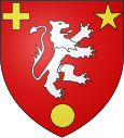
Etampes-sur-Marne
| Etampes-sur-Marne | ||
|---|---|---|

|
|
|
| region | Hauts-de-France | |
| Department | Aisne | |
| Arrondissement | Château-Thierry | |
| Canton | Château-Thierry | |
| Community association | Region de Château-Thierry | |
| Coordinates | 49 ° 2 ′ N , 3 ° 25 ′ E | |
| height | 59-213 m | |
| surface | 2.24 km 2 | |
| Residents | 1,253 (January 1, 2017) | |
| Population density | 559 inhabitants / km 2 | |
| Post Code | 02400 | |
| INSEE code | 02292 | |
| Website | http://www.etampes-sur-marne.com/ | |
 Town hall (Mairie) of Étampes-sur-Marne |
||
Étampes-sur-Marne is a French commune with 1,253 inhabitants (as of January 1 2017) in the region of Hauts-de-France . It is located in the Aisne department , in the Château-Thierry arrondissement . Étampes-sur-Marne is part of the canton of Château-Thierry and the Région de Château-Thierry municipal association . The inhabitants are called Étampois .
geography
Étampes-sur-Marne is located about 81 kilometers east-northeast of Paris in the Marne Valley . Étampes-sur-Marne is surrounded by the neighboring communities of Château-Thierry in the north and north-west, Chierry in the east and north-east, Nesles-la-Montagne in the south and Nogentel in the west and south-west.
Population development
| year | 1962 | 1968 | 1975 | 1982 | 1990 | 1999 | 2006 | 2013 |
| Residents | 880 | 1,363 | 1,224 | 1,246 | 1,358 | 1.313 | 1,235 | 1,176 |
| Source: Cassini and INSEE | ||||||||
Attractions
- Church of Sainte-Marie de l'Assomption
Web links
Commons : Étampes-sur-Marne - Collection of images, videos and audio files

