
Romont FR
| FR is the abbreviation for the canton of Friborg in Switzerland and is used to avoid confusion with other entries of the name Romont . |
| Romont | |
|---|---|
-coat_of_arms.svg) |
|
| State : |
|
| Canton : |
|
| District : | Glane |
| BFS no. : | 2096 |
| Postal code : | 1680 |
| UN / LOCODE : | CH ROM |
| Coordinates : | 560181 / 171603 |
| Height : | 780 m above sea level M. |
| Height range : | 683–817 m above sea level M. |
| Area : | 10.89 km² |
| Residents: | 5280 (December 31, 2018) |
| Population density : | 485 inhabitants per km² |
| Website: | www.romont.ch |
 Romont |
|
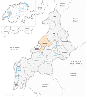
| Location of the municipality | |
  |
|
Romont ([ ʀɔˈmɔ̃ ]; Friborg Patois ) is a political municipality and capital of the Glane district in the canton of Friborg in Switzerland . The former German name Remund is rarely used today. The historic town with a surrounding wall was built on a hill in the upper Glânetal.
geography
Romont is 780 m above sea level. M. (town center - the train station at 708 m), 22 km southwest of the canton capital Friborg (linear distance). The historic town extends on an isolated hill, which is bordered in the east by the upper reaches of the Glâne , in the west and north by its side stream Glaney , and is located in the southwestern Freiburg Central Plateau .
The area of the 10.66 km² municipal area comprises a section of the Molasse plateau of the Freiburg Central Plateau. The central part of the municipality is formed by the hill of Romont, which towers up to 90 m above the Glâne valley. This hill with a lengthwise extension (southwest-northeast) of around 1 km and a width of 600 m is a drumlin of the Ice Age Rhone glacier . The valley of the Glâne connects to the east of the town hill, further to the east the area extends to the slope of the Les Brévires ridge (at the farm La Montagne 777 m above sea level ). To the north and west of the hill of Romont is the valley of the Glaney brook , which flows into the Glâne a little northeast of the town. To the west and north-west, the municipality extends to the ridge of the wide ridge between the middle Broyetal and the upper Glânetal. Here are the forest heights of Dailles (up to 790 m above sea level ), Bois de Bossens ( 811 m above sea level ) and Bois de Boulogne ( 811 m above sea level ), the two highest peaks of Romont, as well as Combloney ( 809 m above sea level ). In 1997, 16% of the municipal area was in settlements, 13% in forests and woodlands, 70% in agriculture and a little less than 1% was unproductive land.
Romont includes the station settlement at the south-west foot of the city hill, the hamlets Les Chavannes ( 694 m above sea level ) at the north foot of the hill, Le Glaney ( 700 m above sea level ) north of the stream of the same name, Bossens ( 768 m above sea level). ) on the slope southeast of the Bois de Bossens, Arruffens ( 722 m above sea level ) and L'Halle ( 708 m above sea level ) in the Glâneniederung south of the town as well as numerous individual farms. Neighboring municipalities to Romont are Villaz , Mézières , Siviriez and Billens-Hennens in the canton of Friborg and Prévonloup , Dompierre , Villars-Bramard and Villarzel in the canton of Vaud .
population
With 5280 inhabitants (as of December 31, 2018) Romont is one of the medium-sized communities in the canton of Friborg. 83.8% of the residents are French-speaking, 6.2% Portuguese-speaking and 2.4% German-speaking (as of 2000). The population of Romont was 2210 in 1900. During the 20th century, the population grew steadily (2931 inhabitants in 1950).
economy
Romont has always been an agrarian town. The agricultural products of the surrounding area were processed and sold here. Agricultural implements were also manufactured here. For example, the manufacture of scythes and sickles has been documented since the 15th century; A bell foundry was added in the 16th century. Weaving also played an important role in Romont.
Today Romont offers around 2,700 jobs. With 4% of the workforce still employed in the primary sector, agriculture only has a minor role in the employment structure of the population. Around 39% of the workforce is employed in the industrial sector, while the service sector accounts for 57% of the workforce (as of 2001).
Agriculture in the Romont area focuses on dairy farming and cattle breeding , while only a relatively small proportion of the area is used for arable farming. Since the second half of the 19th century, an industrial quarter has developed near the train station southwest of the old town. Today, companies in the glass industry, mechanical engineering, the furniture industry, the construction of air conditioning systems as well as Holcim (Vaud-Friborg) SA and Tetra Pak (Suisse) SA are based there. There is a tank farm northeast of Romont. The community is the location of a gun field .
The municipality and district administration are located in the old town. There are smaller shops, boutiques, restaurants and cafes, which are mainly geared towards day tourism. The Musée Suisse du Vitrail (Swiss Museum for Glass Painting), opened in 1981, is a major tourist attraction.
Nestlé Nespresso invested CHF 300 million (2012–2015) in Romont in its third production center.
traffic

The community is very well developed in terms of transport. It is located at the intersection of the roads from Freiburg to Oron-la-Ville or Moudon and from Bulle to Lucens . The closest connections to the A12 motorway are at Vaulruz (in the south, around 11 km from the center) and at Matran (in the northeast, around 16 km from the center).
On September 4, 1862, the railway line from Lausanne to Freiburg with a train station in Romont was put into operation. On July 1, 1868, the sidelines from Romont to Bulle were inaugurated. The bus lines, which leave Romont in all directions and open up the hinterland, ensure the fine distribution in public transport. Postbus courses run to Payerne and Avry , and the Freiburg public transport bus routes to Bulle, Freiburg, La Verrerie , Moudon , Palézieux and Prez-vers-Siviriez .
history
Traces from the Bronze Age and the remains of a Roman manor have been found in the municipality of Romont . The settlement of Romont was founded in the 10th century by the dukes of Burgundy and initially had the Latinized name rotundus mons (round mountain, based on the shape of the town hill); from 1228 the name Rommon has been handed down. At that time Romont belonged to the Lords of Billens, who built the first castle on the hill in the 12th century.


The fortified city of Romont was founded in 1240 by Peter II of Savoy and developed into an important Savoyard military base in the Swiss Plateau. The town received market rights as early as 1244. From that time on, the lords of the castle called themselves Counts of Romont. Because Count Charles the Bold supported his raids in Vaud, Romont was besieged, captured and pillaged by the Confederates in 1476 after the Battle of Grandson. As a result, the town belonged to Freiburg until 1478, before it was returned to the Savoy suzerainty.
When the Bernese conquered Vaud in 1536, Romont placed himself under the protection of Friborg. The Freiburg lords established the Bailiwick of Romont, which encompassed the upper part of the Glâne valley. The castle remained the residence of the bailiffs of Romont, and was almost completely rebuilt for this purpose. In the period up to the collapse of the Ancien Régime in 1798, 55 bailiffs resided at the castle. After that, the town was the seat of the Freiburg prefect of the Romont district until 1848. With the entry into force of the new cantonal constitution in 1848, Romont became the capital of the Glâne district. The old town was hit several times by devastating fires, the last time in 1863. In 1868 the previously independent municipality of Arrufens was merged with the town. In 1981, the dispersed settlement community of Les Glânes , which included the farms on the right side of the Glâne, was incorporated into Romont.
Attractions
Even from a distance, the town on the hill forms an impressive silhouette. Romont has preserved its picturesque townscape with numerous town and patrician houses from the 17th to 19th centuries. The city plan covers an area of 550 m × 200 m. There are two long streets that are connected by several cross streets. A large part of the old curtain wall from the 13th century (renewed and expanded several times later) is still preserved. The most important fortification structure is the mighty Tour à Boyer round tower (13th century) at the southern end of the old town. The square Tour de Billens and the Tour de Sauvage are also part of the city fortifications. In contrast, the city gates were demolished in 1842.
At the top of the hill is Romont Castle, built in the 13th century under Peter of Savoy on the site of an older castle. The oldest parts of the castle (built when it was founded) are the curtain wall and the round keep. In contrast, the residential buildings were practically completely rebuilt between 1588 and 1590. In the inner courtyard of the palace there is a fountain wheel from 1772 with a diameter of 4.5 m. Today the castle houses the Musée Suisse du Vitrail.

Diagonally across from the castle is the Gothic collegiate church Notre-Dame-de-l'Assomption, which was built in the 15th century on the site of a previous Romanesque building. The south aisle of the previous building was incorporated into the church, consecrated in 1451. The three-aisled church has a rectangular choir, a narthex from the 14th and 15th centuries and in the tympanum of the portal an important representation of Majestas from 1250. The interior of the church is also remarkable: richly carved choir stalls (1466–69), a stone relief Pulpit from 1520, a crucifixion group from the 15th century as well as old stained glass from the 14th and 15th centuries and modern stained glass from the 19th and 20th centuries.
Among the houses in the old town, the Restaurant de la Croix Blanche (16th century) near the castle and the Hôtel du Cerf (also from the 16th century, remodeled in the 19th century) should be mentioned.
In the valley of the Glâne to the northeast of the city hill is the Cistercian nuns - Notre Dame de la Fille-Dieu Abbey , which belongs to the strict observance of the order. The monastery, founded in 1268, achieved economic prosperity especially during the 14th century. The convent buildings arranged around an inner courtyard show a strict baroque style .
partnership
Romont has had a partnership with the Mondolfo municipality in Italy since 1980 .
Personalities
- Théodore Ayer (1905–1974), politician, State Councilor of the Canton of Friborg
- Thierry Lang (* 1956), jazz musician
- Steven Barras (born 1983), ice hockey player
Web links
- Official website of the Municipality of Romont (French)
- Florian Defferrard / MD: Romont (FR). In: Historical Lexicon of Switzerland .
- Aerial views of Romont
- Glass museum: Musée Suisse de vitrail et des arts du verre
- Internet presence of the Trappist Abbey Fille-Dieu
Individual evidence
- ↑ Permanent and non-permanent resident population by year, canton, district, municipality, population type and gender (permanent resident population). In: bfs. admin.ch . Federal Statistical Office (FSO), August 31, 2019, accessed on December 22, 2019 .
- ↑ NZZ : Nespresso builds third production center in Romont
- ^ François Guex: Romont, collegiate church and former Capuchin church. (Swiss Art Guide, No. 928, Series 93). Ed. Society for Swiss Art History GSK. Bern 2014, ISBN 978-3-03797-123-9 .
- ↑ Gérard Pfulg: Vitraux Modern de Romont et environs. (Swiss Art Guide, No. 499/500, series 50). Ed. Society for Swiss Art History GSK. Bern 1991, ISBN 978-3-85782-499-9 .
Auboranges | Billens-Hennens | Chapelle (Glâne) | Châtonnaye | Ecublens | Grangettes | Le Châtelard | Massonnens | Mezieres | Montet (Glâne) | Romont | Rue | Siviriez | Torny | Ursy | Villaz | Villorsonnens | Vuisternens-devant-Romont
Former parishes: Arrufens | Berlens | Bionnens | Billens | Blessens | Chavannes-les-Forts | Chavannes-sous-Orsonnens | Eschiens | Esmonts | Estévenens | Fuyens | Gillarens | Grange-la-Battiaz | Hennens | La Folliaz | La Joux | La Magne | La Neirigue | Le Saulgy | Les Ecasseys | Les Glânes | Lussy | Lieffrens | Macconnens | Middes | Morlens | Mossel | Orsonnens | Prez-vers-Siviriez | Promasens | Sommentier | Torny-le-Grand | Vauderens | Villangeaux | Villaraboud | Villaranon | Villargiroud | Villariaz | Villarimboud | Villarsiviriaux | Villaz-Saint-Pierre | Vuarmarens
Canton of Friborg | Districts of the canton of Friborg | Municipalities of the canton of Friborg