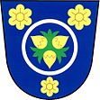
Leština u Zábřeha
| Leština | ||||
|---|---|---|---|---|
|
||||
| Basic data | ||||
| State : |
|
|||
| Region : | Olomoucký kraj | |||
| District : | Šumperk | |||
| Area : | 523 ha | |||
| Geographic location : | 49 ° 52 ' N , 16 ° 56' E | |||
| Height: | 270 m nm | |||
| Residents : | 1,274 (Jan 1, 2019) | |||
| Postal code : | 789 71 | |||
| License plate : | M. | |||
| traffic | ||||
| Street: | Zábřeh - Leština | |||
| structure | ||||
| Status: | local community | |||
| Districts: | 1 | |||
| administration | ||||
| Mayor : | Pavel Hojgr (as of 2019) | |||
| Address: | Družstevní 92 789 71 Leština u Zábřeha |
|||
| Municipality number: | 537713 | |||
| Website : | ou-lestina.cz | |||
Leština (German Lesche ) is a municipality in the Czech Republic . It is located four kilometers east of Zábřeh and belongs to the Okres Šumperk .
geography
Leština is located at the foot of the Úsovská vrchovina (Aussee hill country) in the Müglitzer Furche (Mohelnická brázda). The village is on the left bank of the March . The Vitošovský náhon artificial moat runs to the east . In the east rise the Trlina (523 m) and the Bílý kámen ( White Stone , 588 m). To the southeast are the Vitošov limestone quarries. The Moravská Sázava and the Vitošovský náhon canal flow into the March south of the village .
Neighboring towns are Nový Dvůr and Postřelmov in the north, Lesnice and Dolní Brníčko in the north-east, Rohle in the east, Vitošov in the south-east, Lukavice and Zvole in the south, Rájec in the south-west, Ráječek in the west and Zábřeh in the north-west.
history
Archaeological finds show that the area has been inhabited since the Bronze Age . The village of Zálavčí, located at the foot of the Aussee hill country between Leština and Postřelmov on the March, was first mentioned in documents in 1371. The first mention of Lestyna took place from 1392 in the Olomouc country table in the course of the sale of parts of the extinct village Zálavčí with the fortress Víšek to Ondřej from Leznice. The border between Leznice and Lestyna was also established. Leština was part of the Hohenstadt rule . After the Tunkl von Brünnles had acquired it in 1442, several fish ponds were created around the place. In the 16th century Leština became the seat of a free judge. The corridors of the Zálavčí desert also belonged to the Leština Bailiwick. Because of its location on an important medieval trade route, a bridge was built over the March near Leština, on which tolls have been collected since the 16th century. Because of its location on the trade route, the village grew and soon recovered from the aftermath of the Thirty Years' War. In 1670 Leština consisted of 12 farms, five gardeners and seven cottagers. During this time the court was converted into an inn by the Hohenstädter rule. A fulling mill and an oil mill were built on the March. There is evidence of a school since 1770. At the beginning of the 19th century the ponds were drained and used as arable land. Leština was hit several times by the March floods. In 1834 597 inhabitants lived in the 87 houses of the village.
After the abolition of patrimonial Leština / Lesche formed a community in the Hohenstadt district from 1850. At the beginning of the 20th century, most of the residents lived off wage labor in the factories of Hohenstadt and Zautke and the Witschau limestone quarries. The place was a stronghold of the social democrats and from 1921 the communists. He was therefore given the local name Malá Moskva ( Little Moscow ) during the First Republic . In 1930 Leština had 1030 inhabitants, the majority of whom were Czech.
After the Munich Agreement , Lesche was added to the German Reich in 1938 and belonged to the Hohenstadt district until 1945 . In 1939 there were 1,097 people in Lesche. A part of the communist-oriented workforce was deported to re-education camps of the Todt organization in Ukraine during the Second World War . In early May 1945 the place became the scene of the Leština massacre . After the end of the war, most of the inhabitants left the village in May 1945 and moved to the Sudeten areas . After the communists came to power in 1948, a large number of offices in Okres Zábřeh were filled with functionaries from Leština. In 1961 the parish came to Okres Šumperk . In May 2000, the victims of the pogrom of May 9, 1945 were exhumed. In 2008 the events of 1945 were dealt with in the documentary “Kde se valíkomy” ( Where the stones roll ).
Community structure
No districts are shown for the municipality of Leština.
Attractions
- Chapel of St. Wenceslas, built in 1754, on the village square
- Statue of St. Philomena
- Homestead No. 9, erected in the 19th century using folk architecture
- Monument to the Heroes of the Soviet Union, erected in 1951 according to plans by V. Brzobohatý
- Mourning hall
- Nature reserve "Pod Trlinou", east of the village on the Trlina

