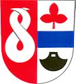
Chromeč
| Chromeč | ||||
|---|---|---|---|---|
|
||||
| Basic data | ||||
| State : |
|
|||
| Region : | Olomoucký kraj | |||
| District : | Šumperk | |||
| Area : | 548 ha | |||
| Geographic location : | 49 ° 56 ' N , 16 ° 54' E | |||
| Height: | 297 m nm | |||
| Residents : | 556 (Jan. 1, 2019) | |||
| Postal code : | 789 01 | |||
| License plate : | M. | |||
| traffic | ||||
| Street: | Olšany - Postřelmov | |||
| Railway connection: | Česká Třebová - Mohelnice | |||
| structure | ||||
| Status: | local community | |||
| Districts: | 1 | |||
| administration | ||||
| Administrator : | František Brdečka (as of 2009) | |||
| Address: | Chromeč 71 789 01 Zábřeh |
|||
| Municipality number: | 569305 | |||
| Website : | chromec.zabrezsko.cz | |||
Chromeč (German Krumpisch ) is a municipality in the Czech Republic . It is located seven kilometers southwest of Šumperk and belongs to the Okres Šumperk .
geography
Chromeč is on the right side of the March in the north of the Müglitzer Furche ( Mohelnická brázda ). The Chromečský náhon trench runs through Chromeč, and the Hraniční strouha trench runs to the west. To the north, the town is affected by the state road I / 11 between Bludov and Červená Voda . The railway line Česká Třebová - Mohelnice runs along the left bank of the March, the railway station "Bludov lázně" is a good kilometer to the northeast.
Neighboring towns are Bohutín and Radomilov in the north, Bludov in the northeast, Bludovský Mlýn in the east, Sudkov and Postřelmov in the southeast, Šikulův Mlýn in the south, Postřelmůvek in the southwest, Vyšehoří in the west and Klášterec in the northwest.
history
The first written mention of the village came in 1353 when Kolda von Postřelmov sold his share of the village, including half the mill, to Svatobor von Závořice. In the 1580s the Bukuvky von Bukuvka bought the property in Chromeč. Sigmund Bukuvky von Bukuvka had a renaissance fortress built in Chromeč with an attached farm and brewery. After the Battle of the White Mountain , the Krumpisch estate was sold to Christoph Paul von Liechtenstein-Kastelkorn . In 1710 Johann Joachim von Zierotin inherited Krumpisch.
After the abolition of patrimonial Krumpisch / Chromeč formed a political municipality in the Schönberg district from 1850 . In 1930 619 people lived in the village.
After the Munich Agreement , the village was added to the German Reich in 1938 and belonged to the Mährisch Schönberg district until 1945 . In 1939 Krumpisch had 594 inhabitants. After the end of the Second World War, Chromeč came back to Czechoslovakia.
Between 1976 and 1990 the place was incorporated into Bludov .
Community structure
No districts are shown for the municipality of Chromeč.
Attractions
- baroque chapel of St. John of Nepomuk, from the second half of the 18th century
- Hraniční strouha, the moat was part of the from 1489 under Johann d. Ä. Tunkl pond system created along the March

