Bratrušov
| Bratrušov | ||||
|---|---|---|---|---|
|
||||
| Basic data | ||||
| State : |
|
|||
| Region : | Olomoucký kraj | |||
| District : | Šumperk | |||
| Area : | 1153 ha | |||
| Geographic location : | 50 ° 1 ′ N , 16 ° 57 ′ E | |||
| Height: | 398 m nm | |||
| Residents : | 624 (Jan. 1, 2019) | |||
| Postal code : | 787 01 | |||
| License plate : | M. | |||
| traffic | ||||
| Street: | Šumperk - Hanušovice | |||
| structure | ||||
| Status: | local community | |||
| Districts: | 2 | |||
| administration | ||||
| Mayor : | Jiří Matýs (as of 2008) | |||
| Address: | Bratrušov 176 787 01 Šumperk 1 |
|||
| Municipality number: | 569437 | |||
| Website : | www.bratrusov.cz | |||
Bratrušov (German Brattersdorf ) is a municipality in the Czech Republic . It is located five kilometers north of Šumperk and belongs to the Okres Šumperk .
geography
Bratrušov extends along the Bratrušovský potok in a valley in the Hannsdorfer Bergland . To the north of Smrk (rises Ficht mountain , 742 m), in the northeast of Ořešník (702 m), east of the Městské skály (689 m) and to the west of Lovak (606 m), Vašková hora (626 m) and the Chmelná ( Hopfenberg , 570 m) and northwest of the Čapí vrch ( Storchenberg , 646 m) and Ptačí vrch (622 m). The remains of the Nový hrad castle are also located in the northwest over the March valley .
Neighboring towns are Lužná and Kopřivná in the north, Osikov and Rejchartice in the northeast, Rapotín in the east, Šumperk in the southeast, Temenice in the south, Hostice in the southwest, Bohdíkov in the west and Raškov and Dvůr Raškov in the northwest.
history
The first written mention of the village took place in 1371 in the will of Margrave Johann Heinrich , who ascribed the place along with other villages to his son Prokop . The place is named after a locator Bratruš. It is believed that the village was a Slavic foundation, which was expanded into an elongated forest hoof village in the course of German colonization in the 13th and 14th centuries . In 1603 a Protestant church was consecrated, which was handed over to the Catholics during the re-Catholicization. In 1784 it was elevated to parish church. In 1834, 809 people lived in the 140 houses in Brattersdorf. The place was a purely agricultural village and there was a water mill.
After the abolition of patrimonial Brattersdorf / Bratrošov formed a community in the Mährisch Schönberg district from 1850 . In 1900 Brattersdorf had grown to 149 houses and had 1016 inhabitants, 1014 of whom belonged to the German ethnic group. In 1930 980 people lived in the village, including 88 Czechs.
As a result of the Munich Agreement , the municipality was annexed to the German Reich in 1938 and belonged to the Mährisch Schönberg district until 1945 . In 1939 Brattersdorf had 893 inhabitants. Between 1945 and 1948 the German residents were expelled and the Czechs were resettled.
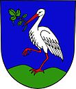
In 1960 Osikov was incorporated. Between 1980 and 1990 the village was part of Šumperk . The community has existed again since 1990 and since 2004 it has had a coat of arms and a banner.
Community structure
The municipality Bratrušov consists of the districts Bratrušov ( Brattersdorf ) and Osikov ( Aspendorf ).
Attractions
- Church of All Saints, the early Renaissance building from 1603 was expanded in 1833 to include an entrance hall in the Empire style.
- Chapel in Osikov

