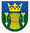
Lehnice
| Lehnice | ||
|---|---|---|
| coat of arms | map | |

|
|
|
| Basic data | ||
| State : | Slovakia | |
| Kraj : | Trnavský kraj | |
| Okres : | Dunajská Streda | |
| Region : | Podunajsko | |
| Area : | 25.338 km² | |
| Residents : | 2,851 (Dec 31, 2019) | |
| Population density : | 113 inhabitants per km² | |
| Height : | 121 m nm | |
| Postal code : | 930 37 | |
| Telephone code : | 0 31 | |
| Geographic location : | 48 ° 3 ' N , 17 ° 27' E | |
| License plate : | DS | |
| Kód obce : | 501735 | |
| structure | ||
| Community type : | local community | |
| Structure of the municipality: | 5 districts | |
| Administration (as of November 2018) | ||
| Mayor : | František Szitási | |
| Address: | Obecný úrad Lehnice Hlavná 833/57 930 37 Lehnice |
|
| Website: | www.lehnice.sk | |
| Statistics information on statistics.sk | ||
Lehnice (German Legendorf , Hungarian Lég ) is a municipality in the Okres Dunajská Streda des Trnavský kraj in southwest Slovakia , with 2851 inhabitants (December 31, 2019) .
geography
The municipality is located in the middle of the Great Schüttinsel , a river island of the Danube , which is part of the Slovak Danube lowlands , and is 13 kilometers from the town of Dunajská Streda .
history
Lehnice was created in 1940, at that time still under the Hungarian name Lég (see First Vienna Arbitration Award ), through the amalgamation of the following places: Malý Lég (Hungarian Kislég ), Veľký Lég ( Nagylég ) and Sása ( Szász ). In 1951, today's municipality Blahová was spun off and in 1960 Masníkovo (until 1948 Slovak "Predná Potôň", Hungarian Előpatony ) incorporated.
The first written mention comes from the year 1239, as Legu . The division of the main town of Lég into two parts has been known since the early 14th century.
population
Results after the 2001 census (2409 inhabitants):
|
By ethnicity:
|
By religion:
|

