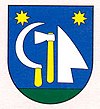
Kvetoslavov
| Kvetoslavov | ||
|---|---|---|
| coat of arms | map | |

|
|
|
| Basic data | ||
| State : | Slovakia | |
| Kraj : | Trnavský kraj | |
| Okres : | Dunajská Streda | |
| Region : | Podunajsko | |
| Area : | 8.100 km² | |
| Residents : | 1,631 (Dec. 31, 2019) | |
| Population density : | 201 inhabitants per km² | |
| Height : | 127 m nm | |
| Postal code : | 930 41 | |
| Telephone code : | 0 31 | |
| Geographic location : | 48 ° 3 ' N , 17 ° 21' E | |
| License plate : | DS | |
| Kód obce : | 501727 | |
| structure | ||
| Community type : | local community | |
| Administration (as of November 2018) | ||
| Mayor : | Zoltán Sojka | |
| Address: | Obecný úrad Kvetoslavov Hlavná 833/57 930 41 Kvetoslavov |
|
| Website: | www.obeckvetoslavov.sk | |
| Statistics information on statistics.sk | ||
Kvetoslavov (up to 1948 Slovak "Úsor"; German oysters , Hungarian Úszor ) is a municipality in southwest Slovakia with 1631 inhabitants (as of December 31, 2019). Administratively, it is located in Okres Dunajská Streda , which in turn belongs to the Trnavský kraj district.
geography

The municipality is located on the upper part of the Danube river island Große Schüttinsel , which belongs to the Slovakian Danube lowlands . There is fertile soil ( black earth ) around the community . Kvetoslavov is five kilometers from Šamorín and about 25 kilometers from the capital Bratislava .
history
A Roman barbarian settlement was discovered in the municipality. The place appears for the first time in 1230 in a document as Uzor and probably refers to a family that settled down before the Christianization. In the Middle Ages this name was also used as a nobility predicate. The place was affected by the Hussites in the 15th century, as well as by the rebels against the Habsburgs and the Turks in the 17th and early 18th centuries. Until the 18th century, the place was settled by German immigrants, but over time they were absorbed into the Hungarian language group. Important owners of the place were the Farkas (in the 16th century), Forgách (in the 17th century), Bittóo , Nassvady (in the 18th century) and Pongrácz families in the 19th century.
The place in Pressburg County belonged to the Kingdom of Hungary until 1918 and then came to the newly formed Czechoslovakia. 1938-45 he was again in Hungary because of the First Vienna Arbitration . In 1948 the place name was renamed Kvetoslavov for national political reasons.
population
According to the 2001 census (822 inhabitants), the majority of the population is divided between Slovaks (46.6%) and Magyars (46%), with a small proportion of Czechs (4.1%). In terms of denominations, the Roman Catholic Church dominates with 60.6%, followed by atheists (17.3%) and Protestants (6.6%); 10.2% of the population gave no information.
