Ňárad
| Ňárad | ||
|---|---|---|
| coat of arms | map | |

|
|
|
| Basic data | ||
| State : | Slovakia | |
| Kraj : | Trnavský kraj | |
| Okres : | Dunajská Streda | |
| Region : | Podunajsko | |
| Area : | 10.447 km² | |
| Residents : | 625 (Dec. 31, 2019) | |
| Population density : | 60 inhabitants per km² | |
| Height : | 113 m nm | |
| Postal code : | 930 06 ( Sap post office ) | |
| Telephone code : | 0 31 | |
| Geographic location : | 47 ° 50 ' N , 17 ° 37' E | |
| License plate : | DS | |
| Kód obce : | 501930 | |
| structure | ||
| Community type : | local community | |
| Administration (as of November 2018) | ||
| Mayor : | Jozef Lukács | |
| Address: | Obecný úrad Ňárad č. 78 930 06 Sap |
|
| Website: | www.narad-csiliznyarad.sk | |
| Statistics information on statistics.sk | ||
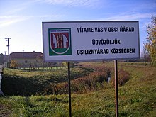
Ňárad (1948–1990 Slovak "Topoľovec" - until 1948 "Čilizský Ňárad"; Hungarian Csiliznyárad - until 1907 Nyárad ) is a municipality in southwest Slovakia with 625 inhabitants (as of December 31, 2019). It belongs to the Okres Dunajská Streda , part of the Trnavský kraj .
geography
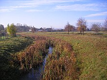
The municipality is located in the southern part of the Big Schüttinsel , part of the Slovak Danube lowlands , not far from the power station canal of the Danube - Gabčíkovo hydropower station . The Chotárny kanál also runs northwest of the village . The center of the village lies at an altitude of 113 m nm and is 14 kilometers from Veľký Meder and 19 kilometers from Dunajská Streda .
Neighboring communities are Gabčíkovo in the north, Baloň in the east, Medveďov in the southeast and Sap in the south and west.
history
The place was first mentioned in writing in 1468 as Nyarad and was owned by the Dóczy family , in the 16th century Czobor , Dersffy , Kamarjay and Illésházy ; the last landlords came from the Batthyány family . A record of the Raab County from 1646 shows that at that time Nyárad had no judge for over 50 years. In 1828 there were 67 houses and 430 inhabitants, whose main source of income was agriculture. In 1850 a flood caused severe damage to the village.
The place in Raab County belonged to the Kingdom of Hungary until 1919 and then came to Czechoslovakia or now Slovakia. 1938-45 he was again in Hungary due to the First Vienna Arbitration .
The place name is derived from the Hungarian name nyár (Sg.) For poplars ; the Csiliz came only in the 20th century to better distinguish the place from other places of the same name in the Kingdom of Hungary and indicates the landscape of Csilizköz (Slovak Medzičiližie ).
population
According to the 2011 census, Ňárad had 651 inhabitants, including 602 Magyars, 38 Slovaks and five Czechs. One resident indicated a different ethnic group and five residents gave no information about the ethnic group. 529 residents committed to the Roman Catholic Church, 57 residents to the Reformed Church, nine residents to the Greek Catholic Church and three residents to the Evangelical Church AB; three residents professed a different denomination. 28 residents had no denomination and the denomination of 22 residents was not determined.
Buildings
- Roman Catholic Church of the Nativity of Mary
Individual evidence
Web links
- Entry on e-obce.sk (Slovak)


