Dolný Štál
| Dolný Štál | ||
|---|---|---|
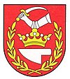
| coat of arms | map | |

|
|
|
| Basic data | ||
| State : | Slovakia | |
| Kraj : | Trnavský kraj | |
| Okres : | Dunajská Streda | |
| Region : | Podunajsko | |
| Area : | 29.997 km² | |
| Residents : | 1,896 (Dec. 31, 2019) | |
| Population density : | 63 inhabitants per km² | |
| Height : | 112 m nm | |
| Postal code : | 930 10 | |
| Telephone code : | 0 31 | |
| Geographic location : | 47 ° 56 ' N , 17 ° 43' E | |
| License plate : | DS | |
| Kód obce : | 501611 | |
| structure | ||
| Community type : | local community | |
| Administration (as of November 2018) | ||
| Mayor : | Tomáš Horváth | |
| Address: | Obecný úrad Dolný Štál Mateja Korvína 676/2 930 10 Dolný Štál |
|
| Website: | www.alistal.sk | |
| Statistics information on statistics.sk | ||
Dolný Štál (1948–1990 Slovak "Hroboňovo"; German Allish Valley , Hungarian Alistál ) is a municipality in southwestern Slovakia with 1896 inhabitants (as of December 31, 2019). It belongs to the Okres Dunajská Streda , part of the Trnavský kraj .
geography
The municipality is located in the Slovakian Danube lowlands on the river island Žitný ostrov . There are still a few ponds in the municipality. The center of the village is at an altitude of 112 m nm and is 11 kilometers from Dunajská Streda .
history
Dolný Štál was first mentioned in writing in 1113 as villa Staul (other sources only speak of 1255). It belonged to the Pressburg Castle as a royal property . The name is probably derived from the Hungarian word istálló (= stable), as royal stables were once located here. From the 14th century until the end of serfdom in the 19th century, the village was predominantly inhabited by members of the nobility.
Until 1919 all places in Pressburg County belonged to the Kingdom of Hungary and then came to Czechoslovakia. Through the First Vienna Arbitration , they came back to Hungary for the period from 1938 to 1945. 1940 the places Horný Štál (Hungarian Felistál ) and Tône (Hungarian Tőnye ) were incorporated.
From 1948 to 1990 the village was named Hroboňovo in honor of the Slovak poet Samo Bohdan Hroboň .
population
Results after the 2001 census (1962 inhabitants):
|
By ethnicity:
|
By denomination:
|
Attractions
- Roman Catholic Church of St. Martin from the 15th century
- Reformed Church from 1786
- Memorial to the fallen of the First and Second World Wars
- Regional studies house from 1848 with an exhibition
traffic
The main road 63 (Bratislava – Komárno – Štúrovo) runs through the village . There is a train station on the Bratislava – Komárno railway line three kilometers outside the town .

