Šamorín
| Šamorín | ||
|---|---|---|
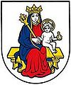
| coat of arms | map | |

|
|
|
| Basic data | ||
| State : | Slovakia | |
| Kraj : | Trnavský kraj | |
| Okres : | Dunajská Streda | |
| Region : | Podunajsko | |
| Area : | 44.348 km² | |
| Residents : | 13,350 (Dec. 31, 2019) | |
| Population density : | 301 inhabitants per km² | |
| Height : | 130 m nm | |
| Postal code : | 931 01 | |
| Telephone code : | 031 | |
| Geographic location : | 48 ° 2 ' N , 17 ° 19' E | |
| License plate : | DS | |
| Kód obce : | 501905 | |
| structure | ||
| Community type : | city | |
| Urban area structure: | 5 districts | |
| Administration (as of November 2018) | ||
| Mayor : | Csaba Orosz | |
| Address: | Mestský úrad Šamorín Hlavná 37 93101 Šamorín |
|
| Website: | www.samorin.sk | |
| Statistics information on statistics.sk | ||
Šamorín (until 1927 Slovak "Šamorýn"; German Sommerein , Hungarian Somorja , Latin. Sancta Maria ) is a small town in western Slovakia , southeast of Bratislava on the Danube .
history
The place was mentioned for the first time in 1238 as ecclesia Sancte Mariae and in the Middle Ages was a Danube port on an arm of the river that has long since been filled in. Due to the location and the soil, agriculture developed very well, and there was also a lot of craft activity. Numerous ship mills were built on the Danube . However, the city lost more and more of its importance due to the rise of Bratislava / Bratislava . The city soon lost a right to the status of a royal free city , granted by King Sigismund in 1405 . In the 17th century the city drew attention to itself again with some cruel judgments in witch trials .
Until 1918, Šamorín belonged to the Kingdom of Hungary and then came to the newly formed Czechoslovakia . Through the First Vienna Arbitration Award , the city briefly returned to Hungary from 1938 to 1945.
Attractions
- Reformed church, originally Catholic and late Romanesque from the 13th century
- Catholic church and former monastery from the 18th century in baroque style
- Evangelical Church from 1784
- Synagogue , built in 1912 in the Romanesque-historicizing style
- Renaissance style town hall
- In 2015 the new X-Bionic Sphere was completed, a gigantic sports center built according to plans by the German course designer Arno Gego directly on the Danube with an area of 90 hectares, including 38 hectares for three grass and two clay courts, an all-weather racecourse (1,650 m) and 600 fixed horse boxes and two multi-purpose halls for equestrian sports. With this, Šamorín justified the candidacy for hosting the World Equestrian Games in 2022.
- See also: List of listed objects in Šamorín
City structure
In addition to the actual city of Šamorín, Šamorín also includes the towns of Bučuháza , Čilistov ( Kledern ), Kráľovianky and Mliečno ( milk village ).
Incorporations
- 1808: Gančháza
- 1960: Čilistov
- 1976: Mliečno (in 1940 Bučuháza and Kráľovianky were incorporated into it)

See also
Web links
Individual evidence
- ↑ Dieter Ludwig: "Hippo Arena Samorin" is a candidate for the 2022 World Equestrian Games , on horseweb.de from September 4, 2016

