
Mainbernheim
| coat of arms | Germany map | |
|---|---|---|

|
Coordinates: 49 ° 43 ' N , 10 ° 13' E |
|
| Basic data | ||
| State : | Bavaria | |
| Administrative region : | Lower Franconia | |
| County : | Kitzingen | |
| Height : | 226 m above sea level NHN | |
| Area : | 12.21 km 2 | |
| Residents: | 2219 (Dec. 31, 2019) | |
| Population density : | 182 inhabitants per km 2 | |
| Postal code : | 97350 | |
| Area code : | 09323 | |
| License plate : | KT | |
| Community key : | 09 6 75 144 | |
| LOCODE : | DE MBM | |
| City structure: | 1 district | |
City administration address : |
Rathausplatz 1 97350 Mainbernheim |
|
| Website : | ||
| Mayor : | Peter Kraus ( FWG ) | |
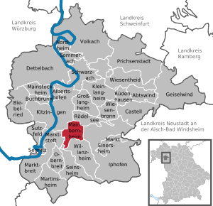
| Location of the city of Mainbernheim in the Kitzingen district | ||
  |
||


Mainbernheim is a country town with around 2200 inhabitants on the B 8 in the Lower Franconian district of Kitzingen .
The city was first mentioned in a document in the 9th century. An important east-west connection, the "Alte Reichsstraße" , ran through the city . This was a continuation of the "Golden Road" and shaped the development of the place. Mainbernheim remained an imperial city until 1803 and is a little-known tourist attraction with its historic town center and the listed arcade cemetery. During the regional reform in Bavaria, Mainbernheim received its administrative independence again after a short membership of the Iphofen administrative community.
The city is a community of commuters, mainly to the district town of Kitzingen and the centers of Würzburg and Nuremberg. The manufacturing industry and some craft businesses only play a very subordinate role.
geography
Geographical location
The city lies between Kitzingen and Iphofen on the western foothills of the Steigerwald . South of the center runs the Sickersbach , the southwest of the urban area of Busch ditch flows to the west rises the Franzosengraben , in Sickershausen also flow to the Sickersbach that there in the Main empties.
Neighboring communities
Neighboring communities are (starting from the north clockwise): Rödelsee , Iphofen , Willanzheim , Marktsteft with OT Michelfeld and Kitzingen .
Natural location
In terms of its natural surroundings, Mainbernheim is in the Mainbernheim plain , which the municipality gives its name to. It has gently rolling valleys from smaller main tributaries such as the Sickersbach. The soils of this subunit of the Steigerwald foreland are characterized by the easily malleable Lettenkeuper .
history
Place name
In 889, the place "Bernheim" appears in a document from King Arnulf of Carinthia . Later forms of the name were:
- 1000 Bernheim
- 1230 Bernheim
- 1303/1304 Bernhei (m) prope Kitzingen
- 1312 Menbernheim
- 1320 Bernheim prope Mogum
- 1321 Meunberghei (m)
- 1322/23 Bernheim prope Ipfhouen
- 1340 Moinbernheim
- 1399 Meinbernheim
- 1404 Meyn – Berenheim
- 1508 Mainbernheim
The basic word home means apartment, dwelling, home or place to stay. The determinative word Bero indicates the personal name. The localization was done with the addition Main.
Local history

The origin of the settlement as a home of Bero can be dated from the name to the time of the Franconian conquest . Bero probably had the task of securing an important base on Heerstraße and later Reichsstraße as a royal interest. In the list of goods that had to deliver the tithing of the harvests, the place was first mentioned in 889 as "Bernheim" in a document from King Arnulf of Carinthia , who gave the bishop the gift of his predecessors, Karlmann, Pippin and Ludwig the Pious confirmed by Würzburg.
1172 Place of received Barbarossa the privilege of outdoor Reich village after the Main Bernheimer himself had assumed unanimously the immediate imperial power. For the annual delivery of 25 Malter wheat, "those who bought and sold in the village were exempt from ... duty and change ..." In 1367, Charles IV confirmed the protection of the Reich and allowed a fortification to be built with a hedge and a moat to secure it. The place then passed into the possession of his son King Wenceslaus of Bohemia and received city rights from him in 1382 . Associated with this was a market right . The city was only able to generate income through market law, as it was linked to customs law . This formed the prerequisite for the construction of the fortifications. In the beginning there were only a few market days a year, in spring and autumn and on religious festivals. The weekly market later became the norm. The farmers in the area brought their produce for sale. For this they bought from merchants or craftsmen what they could not produce themselves. In 1414, Emperor Sigismund allowed a weekly market and three annual markets in Mainbernheim as well as the admission of Jews. 1442 awarded Emperor Friedrich III. the blood spell of the city , d. H. the city fathers had the right to pass death sentences and to enforce them in the “court” area. In 1457, Count Wilhelm II von Castell gave Mainbernheim's citizens the privilege of choosing pastors and school teachers themselves. In 1494 the knights Anton von Bibra and Neithart von Thüngen zum Sodenberg plundered and plundered the city in a feud with Christoph von Guttenstein. In 1525 the city came under the rule of the Margraves of Ansbach . With Ansbach, Mainbernheim fell to Prussia in 1792 . After the turmoil of the Napoleonic Wars and the brief affiliation to the Grand Duchy of Würzburg , the place finally came to the Kingdom of Bavaria in 1814 .

Jewish families had lived in the village since at least the 15th century , and they later built a synagogue in Untere Brunnengasse. During the November pogrom of 1938 the church was devastated; since then it has been used as an apartment building. A memorial plaque from the town hall was placed on the site of the former synagogue to commemorate this event and the persecution and murder of the Jewish residents in the Shoah .
At the beginning of the 20th century, several major fires destroyed parts of the city center. After the Second World War there was brisk construction activity.
When the municipalities were reorganized in the Free State of Bavaria with the municipal reform , Mainbernheim belonged to the Iphofen administrative community for three years. The residents resisted successfully and Mainbernheim was spun off again on January 1, 1981 and regained its independence.
Population development
| year | 1732 | 1840 | 1866 | 1868 | 1871 | 1900 | 1925 | 1939 | 1950 | 1961 | 1970 | 1987 | 1991 | 1995 |
|---|---|---|---|---|---|---|---|---|---|---|---|---|---|---|
| Residents | 1267 | 1592 | 1389 | 1389 | 1381 | 1330 | 1346 | 1394 | 2055 | 1775 | 1780 | 2190 | 2311 | 2297 |
| year | 2002 | 2003 | 2004 | 2005 | 2006 | 2007 | 2008 | 2009 | 2010 | 2011 | 2012 | 2013 | 2014 | 2015 | 2016 |
|---|---|---|---|---|---|---|---|---|---|---|---|---|---|---|---|
| Residents | 2314 | 2304 | 2304 | 2311 | 2318 | 2297 | 2330 | 2343 | 2292 | 2245 | 2230 | 2208 | 2223 | 2202 | 2157 |
Source of the figures without individual reference: Bavarian State Office for Statistics and Data Processing
politics
mayor
After three election periods in which Karl Wolf of the Free Voters as mayor directed the fortunes of the city, Peter Kraus (Free Voters) was elected as the new First Mayor of the city of Mainbernheim in the 2014 local elections. Kraus was elected for a further six years on March 15, 2020 with 93.7% of the vote.
City council
The city council currently has 14 members (excluding the mayor) (as of the local elections on March 16, 2014 ). Of these, 3 are from the CSU , 6 from the SPD and 5 from the FWG .
coat of arms
|
|
Blazon : "In gold an upright, red armored bear." |
| Founding of the coat of arms: Mainbernheim received city rights from King Wenzel (1378–1419). The oldest seal probably comes from the time of the town elevation: there is evidence of an impression from the year 1470. The seal is probably with the confirmation of Mainbernheim's privileges as an imperial village by King Friedrich III. originated in 1443. The city was pledged several times and came to the Margraves of Ansbach in 1525, who ruled until 1792. The sealing always show for the place name speaking bear (bear for bern). He is depicted walking in seals from the 16th century. Later he stands upright, but then strides again with a collar and chain. This representation probably stands for the subjugation of the city by the Margraves of Ansbach. The colors silver and gold are the colors of the empire and have been used since 1818. They are a historical reference to the city's previous relationship with the Empire. In the 19th century the bear was also depicted with brown tinging and in seals walking to the left. |
Culture and sights
Buildings
City fortifications


Fortified cities emerged in the Middle Ages mainly in places that were particularly convenient for the exchange of goods. Some of them gradually emerged from the markets where the merchants did their trade. From the 12th century onwards, kings and high nobility purposefully founded new markets.
An important east-west connection, the Alte Reichsstraße , ran through Mainbernheim. It was a long-distance trade and military route from Nuremberg to Frankfurt and the continuation of the Golden Road from Prague to Nuremberg. Two large gate towers protected the entrances. At sunrise the city servants opened the city gates. They kept watch at the gates and on the defense towers all day. Every carriage, every pedestrian, every rider had to pass the lower or the upper gate. The foreign merchant who wanted to go into town with his goods was stopped there and searched for weapons. These had to be handed in. The city was at peace and disputes were resolved by a court. After the merchant paid duty on his goods, he was allowed to stay in the city. Thick, high walls offered residents and travelers protection and security for their goods and trade. Night watchmen walked the streets with lanterns to deter thieves. The device for the drawbridge at the Upper Gate and the mounts for the heavy wooden gates that were closed in the evening can still be seen. Those who came too late had to spend the night in a hostel in front of the gate. Even on the way, the travelers received protection. B. Mainbernheimer took over the escort of the traders from the citizens of Kitzingen on behalf of the king at the highest point of today's B 8 . The escorts were paid for the safe conduct.
The medieval townscape with the largely intact city wall , recognizable 18 towers and two gates has been preserved . The lower gate, pointing towards Kitzingen, with an ogival passage, was built around 1400. At the beginning of 1600 it was given a further storey in half-timbered construction. During the renewed renovation, the Mainbernheimers replaced the former drawbridge with a permanent bridge and in 1787 added the two-storey half-timbered building with a hipped roof to the gatehouse . The royal gatekeeper lived there. The upper gate points towards Nuremberg. It was built at the same time as the lower one with an ogival passage. The rolling slots for the drawbridge, the brackets for the heavy gates and the bars for locking, as well as a machicolation can still be clearly seen. The renovation with an eight-sided tower and a mansard roof by Johann David Steingruber ended in 1765. From the tower's apartment you can see the city and the surrounding area.
The entire wall rests on stone arches. In this way, material could be saved. There are only a few pedestrian breakthroughs and a subsequent larger opening of the wall behind the Protestant church. When the church forecourt was redesigned in 2011, the course of the wall and the location of the tower were marked in the ground.
Fountain
In Mainbernheim, numerous fountains remind of the important supply of water for the medieval city for life, work and fire protection. Because of the way it was built, there was a constant risk of fire. The watchman had when somewhere broke out in the city a fire, blow the fire horn or the fire bell ringing. From the apartment in the upper gate one had an important view of the city and the surrounding area. The residents of each property were required to have a water supply ready for extinguishing. Violations were severely punished.
Fountains are located in the free spaces, the former marketplaces or have been newly built in the vicinity for traffic reasons. Old photos show former locations where well successors are still maintained today.
Pump wells and scoop wells got their water from springs, the tube wells from a water pipe made of wooden pipes. A well master was employed with an annual wage of 70 guilders to ensure the safe supply of the valuable water through cleaning and repairs .
- Original fountain: A fountain in its original state has been preserved on the Herrnstrasse on the left.
- Church square fountain: There is no longer a fountain on the town hall forecourt. With the redesign of the town hall and church square, the development of the city, which opens outwards, should be spatially and artistically visible in the sculpture development by the artist Kurt Grimm from Kleinrinderfeld through the new location of the modern fountain .
- Four-tube fountain: The center of the city is the four-tube fountain, built in 1683. It bears the city's heraldic animal, the bear. As the old photo shows, there was another well, which was probably the original one.
- Playing bears: the fountain on the edge of Scheuerleinsplatz was donated by the Schmidt brothers on the occasion of its 125th anniversary. With Playing Bears , the artist Theo Steinbrenner recalls the heraldic animal and a legend about the city's name.
- Home: After the Obere Tor there is a new fountain on the left, reminiscent of the old one that stood across from the Gasthaus zum Goldenen Löwen and bears the barely legible inscription "TREU DER HEIMAT GESTIFTET IRMA ZEHNER 1996". The Mainbernheimerin donated it for her 80th birthday.
Although Mainbernheim had wells and water pipes, the threat of disease was very high because the city had no sewer system. The household garbage was simply thrown on the street and all sewage found its way downhill. There were openings for this in the wall.
Protestant church

The responsible persons state the reason for the new construction of the church St. Johannis in the certificate of the laying of the foundation stone: “... A church which was previously filled with darkness is now in full light. About two hundred years ago it was freed from the darkness of the Pope and illuminated with the light of Heavenly Truth ... “This is the reference to the Protestant creed, which is also expressed in the architecture of this Margrave Church .
Churchyard
Before the Reformation, in the Middle Ages, in the immediate vicinity of the holy of holies with the relics, an expectation for the redemption of the deceased at the resurrection was seen. This also applied to the consecrated area around the church . Outside the walls of the churchyard and the city, outcasts found their place in unconsecrated earth.
In Mainbernheim, too, the cemetery was originally located in the immediate vicinity of the church building before it was moved in 1546. 111 skeletons were found during the rescue excavation in 2010. They lay in several layers on top of each other. Because of the burials in the narrow space around the church building, only fragments remained for posterity.
As a rule, in the Middle Ages, the deceased were wrapped in a shroud and not buried in a coffin. This way the decomposition went on faster and there was room for new burials again. The poor population could not afford a coffin burial. Only a few of the excavated skeletons in Mainbernheim were buried in coffins. Individual nails and brown discoloration of the floor from the rotten wood indicate this.
Finds such as hooks and eyes made of bronze were remains of clothing from the dead. Two skulls could also be discovered. Ceramic lids without associated vessels from the time around the turn of the 15th to the 16th century at six burials are still a mystery.
Catholic Church
The Catholic Church of St. John the Baptist was built on Steinberg in 1932 and is dedicated to John the Baptist. In the course of the expansion in 1982/83, the parish built a parish center. During the necessary renovation of the church in 2004, the modern artistic interior design was positively highlighted by the public.
synagogue
A Jewish community existed in Mainbernheim as early as the late Middle Ages, in the 15th century. In 1409 and 1414, several Jewish residents from Mainbernheim can be identified for the first time. The year 1748, which stood above the entrance of the synagogue, probably indicated the year it was built. There was also a religious school and a mikveh . A Torah mantle from 1720/21 was also kept there. The dead found their final resting place in the Jewish cemetery in Rödelsee . The parish had its heyday in the first half of the 19th century with 125 Jewish inhabitants in 1814 and the maximum of 140 in 1837. In 1933, only 25 Jews lived in the city. During the November pogrom of 1938 , the synagogue was mechanically destroyed due to the risk of fire in the narrow city and the facility burned in a safe place. Most of the Jewish residents had left Mainbernheim in 1940. In March 1942 the few remaining were deported to the Izbica ghetto and in September 1942 to the Theresienstadt ghetto .
The city of Mainbernheim installed a commemorative plaque at the location of the synagogue, Untere Brunnengasse 4, to prevent forgetting.
Houses
Some remarkable old town houses stand along the Herrnstrasse from the Untere to the Upper Gate.
town hall
The three-storey renaissance building with stepped gables is impressive towards Herrnstrasse. The year of completion is in the cornice of an arched curtain window. The “superiors” wanted to communicate important things with proverbs: “Whoever recognizes the Word of God will not run dry in this world, neither here nor there” and “If you don't want to know who you are, don't tell anyone else who he is. 1548 ".
If you step inside through the arched portal, you stand in the former market hall , the original plank ceiling of which was revealed during the renovation in 1998. The old staircase, which was installed later (a bar had to be cut in half!), Leads to the conference room, whose arched curtain windows with leaded glazing provide a view of the street and the Golden Crown Inn. There is the former treasure chest with a complicated, still functioning locking system.
Golden crown
The so-called Paulshaus, built in the 16th century, named after a later owner and wine merchant, faces the town hall. The original name is a reference to the inn for crowned heads of the Middle Ages. On their journey along the Golden Road from Prague to Nuremberg and further on the Alte Reichsstraße to Frankfurt, which led through Mainbernheim, high-ranking personalities stopped there. It is said that the imperial crown and imperial insignia on the way to the imperial coronation in Frankfurt were housed in this inn in 1742 . This was repeated in 1790 for the coronation of Leopold II. The Prussian King Friedrich Wilhelm III. found accommodation there with his wife in 1799.
Headquarters of the gingerbread factory
One of the oldest houses in the old town next to the four-tube fountain dates from 1480. There was a customs post there, where the first cars had to pay their obolus to use the road . In this property, Johann Friedrich Schmidt from Nuremberg founded the first gingerbread bakery in Lower Franconia in 1863. The Gebrüder Schmidt family made gingerbread there until 1902. When there was no longer enough space, the new factory was built next to the train station, which today produces Haribo products.
House Berggasse 6
The house is not far from the four-tube fountain in Berggasse. The property, which is used for agriculture today, has half-timbered buildings from 1483 on the upper floor. While the ground floor was used for sales and trade, the first floor was reserved for living. The goods could be brought into the store from the outside via two additional levels with doors. A two-storey extension in the courtyard from 1591 has a wooden alcove , the upper storey is made of half-timbering and bears the Ansbach coat of arms dated 1593.
Monastery courtyard
An imposing entrance with a coat of arms leads into the monastery courtyard. The commissioner lived there, the abbot of the Cistercian monastery Ebrach , who could claim fiefdoms in the place.
The property at Herrnstrasse 41, today's Turmschänke, has a particularly beautifully decorated courtyard entrance. The stone consoles stand out at the entrance. There is a stair tower in the inner courtyard. The owner has old photographs showing an imposing, covered arcade that was no longer produced after a fire in 1917. Perhaps this property belonged to the monastery and was probably a winery. This assumption is based on the large, evenly tempered, cool cellar with oak beams for placing large barrels and a stone vat .
Scheuerleinsplatz
A two-story house on Scheuerleinsplatz with a Franconian pointed gable and half-timbered construction above the ground floor bears the year 1696 and is the birthplace of the writer Johann Georg Scheuerlin , who was born there on February 25, 1802.
Right next to it is a two-storey hipped roof building with plaster structure, the caste office , from the 15th century. There resided the Ansbach Kastner, an official of the Margraves of Ansbach, who monitored and administered the interests and income of his masters in the city.
Fire station

The old fire station from 1721 with half-timbering stands at the large parking lot at the Schützenhaus outside the city wall on the road to Rödelsee. It serves as a clubhouse for the Mainbernheim volunteer fire brigade.
Further
- Gasthof zum Falken
- The two guard houses at the gates of the city have been preserved. A single-storey mansard-roofed house was built at Kitzinger Strasse 2 , while a two-storey house with a beamed cellar was built at Nürnberger Strasse 2.
graveyard

A special feature that Mainbernheim has in common with Prichsenstadt , Repperndorf , Marktsteft , Wiesenbronn and Abtswind is the old cemetery outside the city wall, an arcade cemetery with a free-standing cemetery pulpit.
As in the surrounding communities, people in Mainbernheim were first buried around the church. The relocation in front of the city fortifications took place in 1546. This number and that of the expansion in 1618 are on two panels in the renaissance portal of the main entrance.
The spirit of the Reformation found its structural expression in the relocation. The believers now relied on the saving suffering and death of Christ.
Memorials

Stumbling blocks
To commemorate the Jewish fellow citizens, stumbling blocks were laid in Untere Brunnengasse, Herrnstrasse, Schützenstrasse and Klostergasse .
Monuments
In 1927 Richard Rother created the war memorial for those who fell in the First World War. It was moved from its original location on the town hall forecourt behind the town church.
Another monument is located in the area of the former village of Rügerrieth in the southwest of the village. The place was abandoned in the 15th century because the hall no longer fed the people. The residents moved to the surrounding towns, but continued to cultivate their fields and formed a separate body within Mainbernheim into the 21st century. The memorial is reminiscent of the old church of the town, another, lying pillar calls for international understanding and condemns the war.
Architectural monuments
music
In Mainbernheim there is the men's choir 1871, a trombone choir and a church choir.
Museums
One of the largest historical shooting target collections in Germany can be found in the shooting range at the shooting range. A remarkable history picture book was created by depicting contemporary historical events on over 180 panes. This tradition is continued, because the lap master donates a target every year for the traditional shooting Wednesday. The new Schützenkönig can keep this disc all year round. Then it comes into the shooting target collection. The beginnings of the association go back to the city elevation, which brought with it a kind of conscription. The vigilante's task was to protect the city. When the defense contract was dropped, the shooting club developed. He has a target shooting regulation from 1731, which replaced the previous one. The old flag and the oldest shooting target are from 1783.
Regular events
- The highlight of the year is the traditional shooting Wednesday, which follows the last Sunday in August, the church fair Sunday.
- At the wine presentation in front of the historic town hall in June, the "Bernemer", a Silvaner wine, is presented. It is the result of the previous year's harvest from the urban vineyard, the only one in Mainbernheim today.
- In June, the Göttemann family's court concerts take place in Haus Klostergasse 2.
- Every two years the city festival "Echt Berna" is a magnet for numerous visitors.
Sports
At TSV Mainbernheim, sports in the disciplines handball , football , gymnastics and tennis are practiced . There is a soccer field with a sports restaurant, a tennis hall and a multi-purpose hall.
Economy and Infrastructure
Economic trends
The Mainbernheimer lived from viticulture and agriculture. There were some artisans and trading companies.
The number of main and part-time farms decreased sharply. In 1999 there were still 18 farms cultivating land, in 2010 there were only 14 farms with agricultural land. In 2013 only 7 farms were still farming as their main occupation. Much land owned by farmers of retirement age was also leased to farmers in neighboring towns. From 2013 the place is a pure residential community with the exception of 5 farmers and a few tradespeople. The number of people employed at the place of residence increased from 815 in 2008 to 920 in 2011. The commuter rate in the years mentioned almost doubled from 340 to 604. The majority of those in employment work locally, in Iphofen or Kitzingen. Some commuters also travel to the metropolitan areas of Nuremberg, Würzburg and Schweinfurt.
Viticulture
Mainbernheim is today a wine-growing area in the Franconian wine-growing region . There is a wine location around the city, the wine has been marketed under the name Mainbernheimer Dornberg since the 2000s, and the “Bernemer” brand can also be found on the labels. Mainbernheim is part of the Schwanberger Land area, until 2017 the winemakers were grouped together in the Steigerwald area. The limestone soils around Mainbernheim are just as suitable for growing wine as the location in the Maingau climate zone, which is one of the warmest in Germany.
The people around Mainbernheim have been growing wine since the early Middle Ages . The Franconian settlers probably brought the vine to the Main in the 7th century. In the Middle Ages, the region was part of the largest contiguous wine-growing region in the Holy Roman Empire. The people mostly operated part-time viticulture for self-sufficiency , while export centers were already emerging, especially along the Main. The part-time winemaker remained predominant in Mainbernheim.
Viticulture experienced a major decline after secularization at the beginning of the 19th century. Above all, locations with less favorable climatic conditions were completely abandoned. In addition, the emergence of pests such as phylloxera made cultivation difficult . Mainbernheim lost all of its vineyards and became a pure arable farming area. The Franconian wine-growing region was not able to consolidate again until the second half of the 20th century. The use of fertilizer and improved cultivation methods had contributed to this, as had the organization in cooperatives and the land consolidation of the 1970s. Only since 2004 have the people of Mainbernheim been back in viticulture to a limited extent. There is a wine trail.
| Vineyard | Size 2004 | Size 2017 | Compass direction | Slope | Main grape varieties | Great location |
|---|---|---|---|---|---|---|
| Dornberg | 0.4 ha | 5.6 ha | south | not clear | Silvaner | Rödelsee Castle Hill |
Established businesses
The largest and best-known employer in Mainbernheim was the Bären-Schmidt company founded in 1863. It became well known for its gingerbread hearts, among other things. From 1971 to 2009 the company belonged to Haribo and since January 2010 it has been part of the Lambertz Group .
traffic
Federal road 8 runs through the city as a bypass road past the old town . Via port Marktbreit or Kitzingen-Biebelried Mainbernheim is connected to the highways A 3 and A 7 connected.
education
In the primary school Mainbernheim-Rödelsee the elementary and secondary school students are taught up to the 6th grade. At the end of the 2005/2006 school year, the partial secondary school was dissolved on the basis of a resolution by the Bavarian State Parliament. The number of pupils for fifth and sixth grades is insufficient. These classes are now taught in the Iphofen Middle School .
Public utilities
Mainbernheim is one of the smallest cities that has had its own power station since 1908 . Elektrizitätswerke Mainbernheim GmbH is responsible for the municipal energy supply . The electricity generated in Mainbernheim from a solar and combined heat and power plant covers around 50% of the city's needs and is fed directly into the grid.
Personalities
sons and daughters of the town

- Georg Meder († 1599), rector of the Kitzingen Latin School, crowned poet, mathematician
- Michael Schober (1580–1657) from Crailsheim, 52 years pastor in Mainbernheim
- Johann Friedrich Schober (1648–1731), imperial councilor, court and count palatine, specialist writer
- Simon Friedrich Wolfhardt (also Wolffarth, Wolffhard, 1650–1709), Prussian councilor, abbot of the Berge monastery , writer
- Johann Christoph Prechtel (1704–1757), Protestant clergyman, philological writer
- Johann Ludwig Uhl (born July 10, 1714 - † November 10, 1790 in Frankfurt a. D. Oder), lawyer. Career: Father pastor, studies in philosophy, law Univ. Jena, Halle, Heinneccius' employee, Hofmeister, 1743 law teacher at Hamm high school, 1744 Doz. Univ. Frankfurt an der Oder, university archive, doctorate Univ. Königsberg (in absentia), 1751 Hofrat Ansbach, 1752–1790 Prof. Univ. Frankfurt Oder. Publications: Academic Handbook on the Use of the Right Conservative , 1778, Sylloge nova epistolarum varii argumenti (5 volumes), 1760–1769
- Johann Georg Stintzing (1740–1832), wine merchant in Hamburg
- Johann Georg Jakob Bernhold (1762–1836), medical writer
- Georg Scheurlin (1802–1872), poet and writer
- Johann Christoph Frank (* 1851 in Mainbernheim; † 1927), estate inspector in South Tyrol, professor of agriculture, Golden Order of Merit with crown from Emperor Franz Josef
- August Ludwig (1863–), professor of church history in Freising
- Johann Dürr (1880–1952), politician, member of the Baden state parliament
- Rudi Neuwirth (* 1959), comedy artist and jazz musician
- Karl Röder (* 1881 in Mainbernheim; † 1965), important designer of steam turbine construction, professor in Hanover, honorary citizen of the city of Mainbernheim, burial site in the historic cemetery of Mainbernheim
Connected to Mainbernheim
- Christian Rasp (* 1989 in Ochsenfurt), track and field athlete and bobsledder, Rasp grew up in Mainbernheim
literature
- Hans Ambrosi, Bernhard Breuer: German Vinothek: Franconia. Guide to the vineyards, winegrowers and their kitchens . Herford 2 1993.
- Johann Ludwig Klarmann: The Steigerwald in the past. A contribution to Franconian cultural studies . Gerolzhofen 2 1909.
- Johann Kaspar Bundschuh : Maynbernheim . In: Geographical Statistical-Topographical Lexicon of Franconia . tape 3 : I-Ne . Verlag der Stettinische Buchhandlung, Ulm 1801, DNB 790364301 , OCLC 833753092 , Sp. 471-472 ( digitized version ).
- Günter Garenfeld: The city of Mainbernheim. In: Art and culture guide through the district of Kitzingen. 1986, 2nd expanded edition 1993 pp. 103-106.
- District administrator & district council of the district Kitzingen (Hrsg.): Yearbook of the district of Kitzingen - In the spell of the Schwanberg . 1980, 1981, 1982. Vier-Türme-Verlag, Münsterschwarzach.
- Robert Neussner: Pictures from the history of Mainbernheim . Ed .: City of Mainbernheim. Mainbernheim 1982.
- František Spurný (Ed.): Sometimes Bavarian - sometimes Bohemian, stories that build bridges . 1st edition. Support group of German-Czech schools between Nuremberg and Prague e. V., FöDTSCH, Altenstadt / WN - Pilsen 2007, ISBN 978-80-903560-3-0 , p. 239 .
- Gottfried Stieber: Mainbernheim . In: Historical and topographical news from the Principality of Brandenburg-Onolzbach . Johann Jacob Enderes, Schwabach 1761, p. 574-577 ( digitized version ).
Web links
- Website of the city of Mainbernheim
- Entry on the coat of arms of Mainbernheim in the database of the House of Bavarian History
Individual evidence
- ↑ "Data 2" sheet, Statistical Report A1200C 202041 Population of the municipalities, districts and administrative districts 1st quarter 2020 (population based on the 2011 census) ( help ).
- ↑ Wolf-Armin Frhr. v. Reitzenstein : LEXICON FRÄNKISCHER LOCAL NAME . CH Beck oHG, Munich 2009, ISBN 978-3-406-59131-0 , p. 137 .
- ↑ Erhard Nietzschmann: The free in the country. Former German imperial villages and their coats of arms. Melchior, Wolfenbüttel 2013, ISBN 978-3-944289-16-8 , p. 52.
- ↑ NN: Memorials for the Victims of National Socialism. A documentation , Volume 1, Federal Agency for Civic Education , Bonn 1995, ISBN 3-89331-208-0 , p. 162
- ^ Günter Garenfeld: City of Mainbernheim . In: District Administrator and District Council of the District of Kitzingen (Hrsg.): District of Kitzingen . Benedict Press, Münsterschwarzach 1984.
- ↑ a b Certificate of laying the foundation stone of the Johanneskirche in Mainbernheim in the archives of the Mainbernheim rectory
- ^ Eugen Hartmann: Statistics of the Kingdom of Bavaria . Ed .: Eugen Hartman. Self-published, Munich 1866, p. 105 , urn : nbn: de: bvb: 12-bsb10374251-0 (signature: Bavar. 1198 o).
- ↑ Joseph Heyberger, Arthur von Ramberg, Michael Friedrich Heil (eds.): Topographical-statistical manual of the Kingdom of Bavaria . Cotta, Munich 1868, p. 1176 , urn : nbn: de: bvb: 12-bsb10385642-0 (signature: Bavar. 4343-5,1).
- ↑ a b c Bavarian State Office for Statistics and Data Processing (ed.): Statistics communal 2012 . A selection of important statistical data for the city of Mainbernheim. Bavarian State Office for Statistics and Data Processing, Munich 2012 ( statistik.bayern.de [PDF; accessed on September 25, 2013]).
- ^ Bavarian State Office for Statistics
- ^ House of Bavarian History: Mainbernheim coat of arms , accessed on July 5, 2019.
- ^ Kurt Kraus, Collection of Old Recordings, Mainbernheim, 2012
- ↑ Fritz Mägerlein, district home nurse a. D., Archive 863/3 from April 18, 1810, Mainbernheim
- ^ RPZ Heilsbronn: Churches - Expressions of Faith. In: Booklets on regional church history. IV, exploration of a margrave church, 1996.
- ^ A b c Office for Excavations & Documentation Heyse: Press release on the Mainbernheim excavation – church square renovation . Ed .: Evangelical Parish Office Mainbernheim. 2010.
- ^ Mainbernheim (Kitzingen district) Jewish history. Alemannia Judaica, November 15, 2010, accessed September 3, 2012 .
- ↑ Inscriptions on the town hall windows on Herrnstrasse
- ↑ Royally privileged shooting society Mainbernheim: Disc collection . Hügelschäffer printing works, Mainbernheim.
- ^ Ambrosi, Hans (among others): German Vinothek: Franconia . Pp. 50-52.
- ↑ Government of Lower Franconia: Vineyards in Bavaria broken down by area ( Memento of the original from July 28, 2018 in the Internet Archive ) Info: The archive link was automatically inserted and not yet checked. Please check the original and archive link according to the instructions and then remove this notice. , PDF file, accessed May 16, 2019.
- ↑ E-Werk Mainbernheim (accessed on June 24, 2015)
- ↑ Klarmann, Johann Ludwig: The Steigerwald in the past . P. 201 f.

Cities: Dettelbach | Iphofen | Kitzingen | Mainbernheim | Market wide | Marktsteft | Prichsenstadt | Volkach
Markets: Abtswind | Hostage wind | Großlangheim | Kleinlangheim | Einersheim Market | Obernbreit | Rüdenhausen | Schwarzach am Main | Home of being | Wiesentheid | Willanzheim
Municipalities: Albertshofen | Biebelried | Buchbrunn | Castell | Mainstockheim | Martinsheim | Nordheim am Main | Rödelsee | Segnitz | Sommerach | Sulzfeld am Main | Wiesenbronn