Maurs
| Maurs | ||
|---|---|---|

|
|
|
| region | Auvergne-Rhône-Alpes | |
| Department | Cantal | |
| Arrondissement | Aurillac | |
| Canton | Maurs | |
| Community association | Châtaigneraie Cantalienne | |
| Coordinates | 44 ° 43 ′ N , 2 ° 12 ′ E | |
| height | 237-551 m | |
| surface | 30.84 km 2 | |
| Residents | 2,144 (January 1, 2017) | |
| Population density | 70 inhabitants / km 2 | |
| Post Code | 15600 | |
| INSEE code | 15122 | |
| Website | www.ville-maurs.fr/ | |
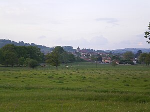
 Look at Maurs |
||
Maurs (Occitan: Maurç; the place itself is also known as Maurs-la-Jolie ) is a municipality in the French region of Auvergne-Rhône-Alpes with 2144 inhabitants (as of January 1, 2017). The municipality belongs to the Cantal department , to the Aurillac arrondissement .
location
Maurs is located in the Massif Central on the Rance , about 30 kilometers southwest of Aurillac . In terms of traffic, the community is developed through Route nationale 122 and the Figeac – Arvant railway with a train station. The river Rance runs southeast of the village , into which several streams in the municipality flow.
history
The place was first mentioned in a document in 941.
Population development
| year | 1962 | 1968 | 1975 | 1982 | 1990 | 1999 | 2009 | 2016 |
| Residents | 2485 | 2535 | 2566 | 2426 | 2350 | 2253 | 2213 | 2164 |
| Sources: Cassini and INSEE | ||||||||
Attractions
- Church of St. Sulpice (also known as Church of St. Césaire, Monument historique )
Personalities
- Fleur d'Issendolus (1300 / 1309–1347), Catholic saint, Knight of Malta
Community partnerships
- Los Arcos in the northern Spanish province of Navarre
Sports
Maurs was a stage stop on the Paris – Nice 2007 and Paris – Nice 2010 tours, as well as on the Tour de France 2011 .

