Raulhac
| Raulhac | ||
|---|---|---|

|
|
|
| region | Auvergne-Rhône-Alpes | |
| Department | Cantal | |
| Arrondissement | Aurillac | |
| Canton | Vic-sur-Cère | |
| Community association | Cère et Goul en Carladès | |
| Coordinates | 44 ° 54 ' N , 2 ° 39' E | |
| height | 539-995 m | |
| surface | 16.98 km 2 | |
| Residents | 272 (January 1, 2017) | |
| Population density | 16 inhabitants / km 2 | |
| Post Code | 15800 | |
| INSEE code | 15159 | |
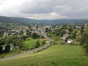
 Raulhac - town view |
||
Raulhac ( Occitan : identical) is a French city and a municipality with 272 inhabitants (at January 1, 2017) in the Cantal in the region of Auvergne Rhône-Alpes . Raulhac belongs to the historic region of Carladès .
location
The place Raulhac lies on the river Goul at an altitude of about 740 m above sea level. d. M. The distance to Aurillac is approx. 30 km (driving distance) in a westerly direction.
Population development
| year | 1800 | 1851 | 1901 | 1954 | 1999 | 2016 |
| Residents | 910 | 1,017 | 953 | 602 | 332 | 276 |
The population decline in the 20th century is largely due to the loss of jobs as a result of the mechanization of agriculture .
economy
For centuries, the place Raulhac served the exclusively agriculturally oriented and self- sufficient hamlets ( hameaux ) and individual farms in the area as a center of handicrafts, trade and services. Since the middle of the 20th century tourism has played a not insignificant role for the economic life of the place in the form of the rental of holiday apartments ( gîtes ).
history
In the Middle Ages Raulhac belonged to the Vice-County Carlat ; the manorial power was successively in the hands of the Armagnaks (1414–1477), the Bourbons (1495–1505) and the French crown (1531–1643). In 1643, the French King Louis XIII. the Carladès to the county and gave it to the Monaco-based Grimaldi family as a fief; it retained this until the outbreak of the French Revolution .
Attractions
- In the village there are several houses from the 15th to 18th centuries covered with stone shingles ( lauzes ).
- The originally Romanesque parish church of Saint-Pierre, which was Gothicized in the 15th century, was possibly a priory church of the Abbey of Saint-Géraud of Aurillac. While parts of the nave still show quarry stone masonry , the multi-storey western tower, accompanied by an octagonal stair tower, and the eastern parts of the church with a polygonal apse are made of precisely hewn stones. The nave , lined with side chapels , is ribbed ; two keystones show the coats of arms of Bonne de Berry and her son Bernard de Pardiac . The church has been recognized as a monument historique since 1927 .
- outside
- Which is in the south of the community Château de Messilhac ( 44 ° 52 '27 " N , 2 ° 38' 0" O ) from the 13th century; The three-story building with its two side towers was not built until the 16th century. The privately owned country palace has been classified as a Monument historique since 1921 .
- Another country estate is the Château de Cropières in the north of the municipality ( 44 ° 55 ′ 23 ″ N , 2 ° 39 ′ 38 ″ E ). It dates from the 13th century, but was repeatedly rebuilt and expanded by its respective owners until the 18th century. The upper floor contains a room with paintings (hunting scenes, etc.). It was recognized as a Monument historique in 1986.
- Other buildings include the Château du Mas de Raulhac , the Manoir de Valduchez and the Château de Courbelimagne, which has been converted into a charming country hotel .
Personalities
- Marie Angélique de Scoraille de Roussille (1661–1681), mistress of King Louis XIV , was probably born in the Château de Cropières .
literature
- Bernard Poulhès: L'Ancien Raulhac depuis ses origines jusqu'à la Révolution. 2 volumes, Le Livre d'histoire.
Web links
- Raulhac, history etc. - photos + brief information (French)
- Raulhac - Photos + Info (French)
Individual evidence
- ↑ Église Saint-Pierre, Raulhac in the Base Mérimée of the French Ministry of Culture (French)
- ↑ Château de Messilhac, Raulhac in the Base Mérimée of the French Ministry of Culture (French)
- ↑ Château de Cropières, Raulhac in the Base Mérimée of the French Ministry of Culture (French)


