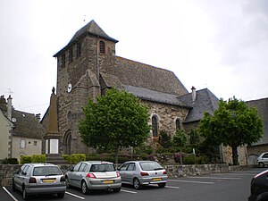
Saint-Mamet-la-Salvetat
| Saint-Mamet-la-Salvetat | ||
|---|---|---|
|
|
||
| region | Auvergne-Rhône-Alpes | |
| Department | Cantal | |
| Arrondissement | Aurillac | |
| Canton | Maurs | |
| Community association | Châtaigneraie Cantalienne | |
| Coordinates | 44 ° 52 ′ N , 2 ° 18 ′ E | |
| height | 499-790 m | |
| surface | 51.49 km 2 | |
| Residents | 1,550 (January 1, 2017) | |
| Population density | 30 inhabitants / km 2 | |
| Post Code | 15220 | |
| INSEE code | 15196 | |
| Website | www.stmamet-lasalvetat.com/ | |
 Saint-Mamet Church |
||
Saint-Mamet-la-Salvetat is a French commune in the department of Cantal and the region Auvergne Rhône-Alpes with 1,550 inhabitants (at January 1, 2017). The municipality belongs to the arrondissement of Aurillac and the canton of Maurs .
location
Saint-Mamet-la-Salvetat is located in the Massif Central , in the Châtaigneraie , the region between the Lot department and the Chaîne des Puys , about 13.5 kilometers southwest of Aurillac . In terms of traffic, the municipality is accessible via Route nationale 122 . The Cère delimits the municipality in the northeast.
Population development
- 1962: 1062
- 1968: 1153
- 1975: 1200
- 1982: 1236
- 1990: 1327
- 1999: 1321
- 2006: 1394
- 2016: 1548
Community partnerships
Web links
Commons : Saint-Mamet-la-Salvetat - Collection of images, videos and audio files
