Brakel district
| Location (1818) | |
|---|---|

|
|
| Basic data (1831) | |
| Existing period: | 1816-1831 |
| State : | Prussia |
| Province : | Westphalia |
| Administrative region : | Minden |
| Administrative headquarters : | Brakel |
| Surface: | 397 km² |
| Residents: | 22,197 |
| Population density : | 56 inhabitants per km² |
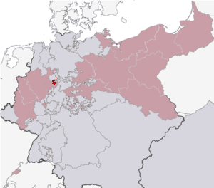
| Location of the Brakel district in the province of Westphalia | |

|
|
The Brakel district was a Prussian district in southern East Westphalia that existed from 1816 to 1831. The administrative seat was Brakel . It was part of the administrative district of Minden and was incorporated into the Höxter district on January 1, 1832 . Before that, the similarly delimited Oberwaldische Kreis existed from 1803 to 1807 in the Prussian Principality of Paderborn .
location

The Brakel district was essentially east of the Egge Mountains , west but not directly on the Weser and south of Lippe . The area was largely in the Oberwälder Land . The Lippe exclave Grevenhagen was almost completely enclosed by the district . On the other hand, the district with the Lügde office also had an exclave north of the core area. Today the former areas of the district are located in the north-western part of the Höxter district in the east of North Rhine-Westphalia and in the south-east of East Westphalia-Lippe . Lügde belongs to the Lippe district .
history
In 1802 Prussian troops occupied the prince-bishopric of Paderborn and annexed it in 1803 in accordance with the resolutions of the Reichsdeputationshauptschluss . Formally, it remained an area in the Lower Rhine-Westphalian Empire and was not abolished until 1815. On April 10, 1803, the area of the former prince-bishopric was divided into three new districts, the Unterwald district , the Oberwald district and the Warburg district . With the formation of the districts, the reorganization of the administration in the new Prussian western provinces was initiated. The districts were at the same time municipal associations and state tax and police administrative districts. The head was a Prussian full-time district administrator . The Oberwaldische Kreis encompassed the north of the former Paderborn administrative area Oberwaldischer District , consisting of the Dringenberg Rent Office (excluding the Kleinenberg and Herbram judges), the Brakel judge, the Nieheim judge, the Driburg bailiwick, the parishes of Fölsen and Tietelsen, the offices of Steinheim and Lügde , the cities of Bredenborn and Vörden and the Paderborn part of the Oldenburg and Schwalenberg offices . The work of District Administrator Wilhelm Friedrich von Bocholtz began on December 1, 1803.
The first Prussian era lasted only four years. From October 1806 (after the double battle near Jena and Auerstedt ) to November 1813 (after the Battle of the Nations near Leipzig ) the area was under French rule. Until the founding of the Kingdom of Westphalia (1807-1813), the administration of the former Prussian and now provisionally still existing district was initially carried out by the French military government in Minden (or the Minden Chamber of War and Domains). After the founding of the Kingdom of Westphalia, new administrative structures were created based on the French model. The later district area now belonged to the Höxter district in the Fulda department and was divided into the five cantons of Brakel, Driburg, Lügde, Nieheim and Steinheim.
After the end of the French era , the district initially belonged to the Prussian civil government between the Weser and the Rhine and from 1815 to the new Prussian province of Westphalia . The administrative district of Minden , founded within the province of Westphalia , was divided into twelve districts on November 1, 1816, including the Brakel district. The Brakel district comprised the area of the cantons of Brakel, Driburg, Lügde, Nieheim and Steinheim, founded in 1807, which continued to exist as an administrative district, sometimes also referred to as the mayor's office .
The Brakel district was dissolved by a cabinet order with effect from January 1, 1832, and merged with the neighboring Höxter district. In the 1840s, the former district area was divided into the offices of Brakel , Driburg , Harzberg , Nieheim and Steinheim and the non-official cities of Brakel , Driburg , Lügde , Nieheim and Steinheim .
District Administrator
- 1816–1829 Adrian Alhard von der Borch
Population development
The following overview shows the population of the Brakel district. The numbers are census results that were determined using inconsistent survey methods.
| year | 1818 | 1822 | 1825 | 1831 |
| Residents | 20,802 | 21,223 | 21,395 | 22,197 |
Web links
Individual evidence
- ↑ Thomas Reich: Erbfürstentum Paderborn, circles. Finding aid G111. Landesarchiv NRW Westphalia department, 2013, accessed on November 1, 2017 .
- ↑ Theodor Kraayvanger: The organization of the Prussian judiciary and administration in the Principality of Paderborn . In: Münster contributions to historical research . Schöningh, Paderborn 1905, chap. The appointment of the district administrators , p. 44 ff . ( Digitized version ).
- ^ Regional Association Westphalia-Lippe (ed.); Westphalian history project: “Royal Decree, which orders the division of the kingdom into eight departments”, page 103
- ↑ Westfalenlexikon 1832-1835 . In: Landschaftsverband Westfalen-Lippe (Ed.): Reprints for the Westphalian archive maintenance . tape 3 . Münster 1978, p. 158 (reprint of the original from 1834).
- ^ Official Journal of the Minden Government 1831, p. 383: Change in the regional division of Westphalia
- ↑ Landgemeinde -ordnung for the Province of Westphalia from October 31, 1841 (PDF; 1.6 MB)
- ^ Official Journal of the Minden Government 1843. Accessed February 2, 2014 .
- ^ Official Journal of the Minden Government 1844. Retrieved February 2, 2014 .
- ↑ State Statistical Office of North Rhine-Westphalia: Municipal statistics of the State of North Rhine-Westphalia: population development 1816–1871 . Düsseldorf 1966, pp. 56-57.
Coordinates: 51 ° 43 ′ 3.8 " N , 9 ° 10 ′ 51.7" E

