Parabita
| Parabita | ||
|---|---|---|

|
|
|
| Country | Italy | |
| region | Apulia | |
| province | Lecce (LE) | |
| Coordinates | 40 ° 3 ′ N , 18 ° 7 ′ E | |
| height | 80 m slm | |
| surface | 20.84 km² | |
| Residents | 8,856 (Dec 31, 2019) | |
| Population density | 425 inhabitants / km² | |
| Post Code | 73052 | |
| prefix | 0833 | |
| ISTAT number | 075059 | |
| Popular name | Parabitani | |
| Patron saint | Mother of God | |
| Website | Parabita | |
Parabita is a south-east Italian municipality ( comune ).
geography
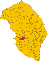
Parabita has 8856 inhabitants (as of December 31, 2019). It is located in the province of Lecce in Apulia , about 34 kilometers south of the city of Lecce and about 10.5 kilometers east of Gallipoli . Parabita is located in the center of southern Salento .
history
The Messapians settled in the area from 800 BC. The current settlement of Parabita was built after 927 after the Saracens destroyed the settlements in Salento. Numerous church buildings were built during the feudal period.
traffic
The municipality is located on the former Strade Statali 459 di Parabita and Strada Statale 475 di Casarano , which has been downgraded to a provincial road.
The train station of Parabita lies on the railway line Novoli-Gagliano Leuca .
Individual evidence
- ↑ Statistiche demografiche ISTAT. Monthly population statistics of the Istituto Nazionale di Statistica , as of December 31 of 2019.


