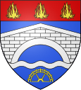
Pogny
| Pogny | ||
|---|---|---|

|
|
|
| region | Grand Est | |
| Department | Marne | |
| Arrondissement | Châlons-en-Champagne | |
| Canton | Châlons-en-Champagne-3 | |
| Community association | Moivre à la cool | |
| Coordinates | 48 ° 52 ' N , 4 ° 29' E | |
| height | 85-172 m | |
| surface | 14.05 km 2 | |
| Residents | 916 (January 1, 2017) | |
| Population density | 65 inhabitants / km 2 | |
| Post Code | 51240 | |
| INSEE code | 51436 | |
Pogny is a French commune with 916 inhabitants (as of January 1, 2017) in the Marne department in the Grand Est region (before 2016 Champagne-Ardenne ). It belongs to the Arrondissement of Châlons-en-Champagne and the canton of Châlons-en-Champagne-3 (until 2015 Marson ).
geography
Pogny is located about 14 kilometers south-southeast of Châlons-en-Champagne on the Moivre River , which flows into the Marne here . Neighboring municipalities are Vésigneul-sur-Marne in the north, Marson in the northeast, Francheville in the east and northeast, Omey and La Chaussée-sur-Marne in the south and southeast, Cheppes-la-Prairie in the south, Vitry-la-Ville in the southwest and Togny -aux-Bœufs to the west.
Population development
| year | 1962 | 1968 | 1975 | 1982 | 1990 | 1999 | 2006 | 2011 | 2017 |
|---|---|---|---|---|---|---|---|---|---|
| Residents | 560 | 574 | 654 | 681 | 718 | 635 | 800 | 890 | 916 |
| Sources: Cassini and INSEE | |||||||||
Attractions
- Celtic necropolis from the Laténe period
- La Nativité-de-la-Notre-Dame church, Monument historique since 1915
Personalities
- Hubert Henry (1846–1898), officer
Web links
Commons : Pogny - collection of images, videos and audio files

