
Lipno reservoir
| Lipno reservoir | |||||||||||
|---|---|---|---|---|---|---|---|---|---|---|---|
 |
|||||||||||
|
|||||||||||
|
|||||||||||
| Coordinates | 48 ° 37 '55 " N , 14 ° 14' 4" E | ||||||||||
| Data on the structure | |||||||||||
| Construction time: | 1952-1959 | ||||||||||
| Height of the barrier structure : | 25 m | ||||||||||
| Crown length: | 296 m | ||||||||||
| Power plant output: | 120 MW | ||||||||||
| Data on the reservoir | |||||||||||
| Altitude (at congestion destination ) | 725.6 m nm | ||||||||||
| Water surface | 46.5 km² | ||||||||||
| Reservoir length | 42 km | ||||||||||
| Reservoir width | 5 km | ||||||||||
| Storage space | 309.5 million m³ | ||||||||||
| Design flood : | 25 m³ / s | ||||||||||

| Lipno II compensation pool | |||||||
|---|---|---|---|---|---|---|---|
 |
|||||||
|
|||||||
|
|||||||
| Coordinates | 48 ° 37 ′ 32 " N , 14 ° 18 ′ 17" E | ||||||
| Data on the structure | |||||||
| Height of the barrier structure : | 11.5 m | ||||||
| Crown length: | 224 m | ||||||
| Power plant output: | 1.5 MW | ||||||
| Data on the reservoir | |||||||
| Altitude (at congestion destination ) | 558 m nm | ||||||
| Water surface | 12.4 km² | ||||||
| Reservoir length | 7 km | ||||||
| Storage space | 1.6 million m³ | ||||||
The Lipno Reservoir ( Vodní nádrž Lipno in Czech, Lipno Reservoir ) is a lake in the southwest of the Czech Republic , part of the Vltava Cascade ( Vltavská kaskáda in Czech ) and forms its fourth oldest and highest level . It is located on the border with Austria in the Bohemian Forest National Park and Protected Landscape Area ( Czech Národní park a chráněná krajinná oblast Šumava ) in Okres Český Krumlov ( Krumlov district), only a small foothill of the lake in the northwest is in Okres Prachatice (Prachatitz district) Southwest a very small part of the Austrian territory ( Rohrbach district , Upper Austria ).
The reservoir was created in 1959 after a dam wall with a power station had been built in the Vltava Valley between 1952 and 1959 . This measure was intended to protect the region, in particular the downstream towns of České Budějovice (Bohemian Budweis) and Prague, from flooding . Even then, the lake was nicknamed Jihočeské moře ( German South Bohemian Sea ) or Šumavské moře ( German Sea of the Bohemian Forest ).
Size and scope
Today the lake has a volume of 309.5 million m³ and a total area of about 4650 ha, making it the largest lake in the Czech Republic in terms of area. Its level is around 725.6 m nm when it is fully blocked. Its length is 42 km with a maximum width of 5 km at Černá v Pošumaví ( German Schwarzbach , hereinafter simply called Černá). The average depth is 6.5 m, the maximum 21 m. The storage space extends to the mouth of the Hajný potok in the Vltava at Vltava and Ovesná .
The dam has a length of 296 m, is 25 m high and is located at river kilometer 329,543. It is partly an earth embankment dam (right bank) and partly a gravity dam (left bank) made of concrete. The Lipno I storage power plant has an output of 120 megawatts. The power plant is a cavern power plant and is 160 meters below the dam. The tunnels for water drainage end a few kilometers downstream in the reservoir of the Lipno II run- of -river power plant ⊙ . This lake serves as a compensation basin for the irregular runoff of the Lipno I power plant. Originally, the Vltava river bed between the power plants fell dry for nine kilometers, only since 1996 has a rehabilitation flow of 1.5 m³s −1 been drained. More water is only drained for water sports events and during floods.
prehistory
In the Upper Vltava region there was a natural lake already in the Tertiary , which was about 44 km long and 7 to 22 km wide and which reached a depth of 80 to 100 m. Between the Devil's Wall ( Čertova stěna in Czech ) and Mount Luč, this lake broke through the rocks in the Tertiary, into which it had eaten for thousands of years, and when it broke through it created the Vltava river bed .
This area on the upper reaches of the Vltava was settled as early as the Mesolithic , as evidenced by a total of 15 finds from 1983 to 1985 on the northern shore of the lake between Frymburk nad Vltavou ( German Friedberg , hereinafter simply called Frymburk) and Horní Planá (Oberplan). Today's settlements have been German and Czech settlement areas for centuries; Places such as B. Frymburk were mentioned as early as 1277. Even then, the numerous lumberjacks were using the river's energy to wash wood. At that time, mills and hammer mills were widespread on the upper reaches of the Vltava (23 at that time), which also used the river as an energy source. Štěpánek Netolický , hydraulic engineer of the Rosenberg family , presented a draft in 1530 that provided for the rafting of the upper Vltava in order to simplify the transport of timber. This project was realized around 1552 under Albrecht von Guttstein between Vyšší Brod and České Budějovice . The extent of logging and rafting increased further in the following decades and reached its maximum around 1850. It was not until the outbreak of World War I in 1914 and the separation of markets through the proclamation of Czechoslovakia in 1918 that there was a slump in timber transport and sales.
First plans

The places on today's lake report in their chronicles from the 17th to the 19th century, especially in the years 1740 and 1890, of frequent floods and floods. Some preserved markings of the water level on walls and rocks bear witness to this. In 1890, when another major flood hit the region, the real story of the reservoir begins. A few years later, in 1892, the engineer Daniel published a brochure describing the construction of several small dams along the Upper Vltava and its tributaries, such as B. at Frymburk and at Želnava (Salnau). These should prevent future flooding. The idea prevailed so that the district administrator of the Kingdom of Bohemia advised on the construction. In 1899, building councilor Jan Jirsík suggested the construction of some reservoirs. Already after the first negotiations it became clear that the farmers who cultivated the fertile floodplains were not ready to sell their land - the project was forgotten again.
It was not until another flood in 1920 that one or more small reservoirs had to be planned again, which would be able to catch the meltwater in spring. In 1930 there were the first concrete plans from engineers of the State Office who placed the planned dam near Lipno nad Vltavou ( German lip , in the following simply called Lipno). This project could not be realized, the reason for this was the occupation of Bohemia and Moravia as a result of the Munich Agreement and the outbreak of the Second World War . The placement near Lipno, which was suggested in these plans, had enormous advantages, which would lead to the actual construction of the dam at this point a few years later: the river bed is at Lipno at an altitude of 705 m nm , at Vyšší Brod at 560 m nm and at Mělník at the mouth of the Elbe only at 155 m nm. This means that the first short section at a distance of 3.5 km as the crow flies and 10 river kilometers has a drop of 145 m. The remaining 322 kilometers of the river to the mouth of the Elbe fall only another 405 meters. Since the Vltava at Lipno itself had only a small waste, the site was well suited for damming. The composition of the subsoil ( gneiss and granite ) was an advantage.
Construction of the dam
planning
The idea of building a dam with an attached power station did not arise until after the Second World War, after the expulsion of the Sudeten Germans , who were the largest population group in the region, made it easier for the government to own the land, since the land fell to the state. A study from 1948 was the basis for future work. The main reason for the construction were energetic and water management considerations. For the communist government, the dam became a prestige object , for which workers were sought all over the country by leaflet with the motto Pomoz stavět Lipno, velikou stavbu socialismu v Čechách ( German: "Help Lipno to build, a large building of socialism in Bohemia" ). Preparatory construction work began in 1950 with the blasting and removal of granite rocks for the planned road from Frymburk to Lipno. From 1951 to 1959 the reservoir with the associated dam was built.

1951 - preparatory work
Work on the water basin began in the first few months of 1951, although the planning of the project was not quite finished at that time. Initially, bricklayers and construction workers from Pozemní stavby České Budějovice built wooden houses for the workers near the future dam, which would later become the basis of the Lipno settlement (after which the lake was named), as well as warehouses, garages and workshops. Now they began to cut down forests (about 550 hectares) and avenues that were in the flood zone, which in the densely forested region of the Bohemian Forest led to several thousand truckloads of wood. In addition, houses and other buildings were demolished, which would also be located under the future water surface. This affected, for example, the community Dolní Vltavice ( German Lower Moldau ), part of Horní Planá ( Oberplan ) and Frymburk ( Friedberg ) and almost all of Lipno, and two cemeteries were relocated. Numerous access roads and paths were created in order to be able to bring building materials. All of this made the Vltava Valley into a huge construction site, which partially changed the neighboring places beyond recognition. Furthermore, a geological investigation of the subsurface of the future dam was carried out.
1952 to 1956 - first expansion stage

In 1952, construction of the dam began at river kilometer 329,543. To this end, twelve shafts were first driven along the longitudinal axis of the dam to a depth of 20 meters; each of these shafts produced around 600 cubic meters of overburden . The hard rock there was strengthened in a further 20 meters by injecting cement milk so that the foundations could be securely anchored. To prevent the dam from being washed under, it was necessary to build a caisson . This caisson, with a mass of 60 t and the shape of a huge box, forms the basis of today's dam. Gradually, several hundred cubic meters of overburden were removed here until the caisson was at the desired depth. Then it was filled with concrete (total mass 230 t).
The Lipno I power plant is designed as a cavern power plant . 160 meters below the left end of the dam is the engine room, which is connected to the lake with two 160 m long pressure shafts with a diameter of 4.5 m and two 3.6 km long drainage tunnels with a cross section of 9 by 8 m to the equalization basin is.
From 13 May 1952, the two tailrace tunnel were Vyšší Brod propelled .
In 1954 construction was continued at a faster pace, which was possible because there were hardly any difficulties during construction. Despite a reduced number of employees and the high water level of the Vltava, construction progressed well. The unwanted floods of a flood could be diverted so that normal operation was guaranteed. The completion of the nearby concrete plant further benefited the work. Particularly intensive work was carried out on breaking through the two tunnels, which by mid-July had a total length of 1,300 m. In the autumn of that year, concreting of the new Vltava river bed began.
On December 30, 1955 at 2:30 a.m., the Vltava was diverted to its new river bed. In addition, excavation of the counter tunnels from Lipno started this year in order to speed up the work.
On January 10, 1956, shortly before midnight, the two tunnels, which were driven by Vyšší Brod and Lipno, broke through . The work went so precisely that, despite the total length of 3.6 km, there was no significant deviation between the two tunnels.
1957 to 1960 - final work as well as construction and commissioning of the power plant
Construction of the underground power plant began in mid-January 1957. The granite rock was broken and the resulting cave (internal dimensions 60 x 22 x 38 m) was then filled with concrete. Construction at Lipno II came to a standstill due to the floods in 1955, which filled the equalization basin with 800 cubic meters of sand and mud. Nonetheless, the basin weight block was completed at the beginning of October and filled with 25,000 cubic meters of concrete. Then the valley was closed with an 11.5 m high weir and the first turbine installed, which went into operation in the spring of 1957. The dam was completed in autumn of that year.

At the beginning of 1958, work began on installing the machine equipment for the two power plant blocks in the cavern. The builders expected that the dam would be able to absorb the spring floods this year, so the Vltava was expected to be dammed from March 1st. For this reason, the last objects that were still in the flood zone, such as B. some bridges over the Vltava. The intention to fill the reservoir slowly in order not to put the dam wall under full load could not be realized due to the early and strong onset of snowmelt. So it happened that on February 17th the water level was 715.15 m nm and 12.5 million cubic meters of water accumulated. The weirs were opened to relieve the dam, at least initially. By February 20, the water level rose to 716.35 m nm , when the end of the snowmelt in the catchment area was reached, the water level was 717.4 m nm , there were no notable problems despite the premature pollution. On June 26, 1958, the last block of the dam was concreted at street level. The summer of 1958 thus became the first holiday season at the Lipno reservoir.
Power plant unit 2 was handed over for assembly at the beginning of August. On September 1, the first part of the Francis turbine (weighing thirty tons) was moved into the cavern, and on October 24, Block 1 was set in concrete.
On July 15, 1959 at 5:55 p.m. the first test run of the electrical system took place. The other turbine went online on December 7th. After various test runs, turbine two went into regular operation on August 13, 1959 and turbine one on January 5, 1960. Since then, the two turbines from Lipno I and the turbine from Lipno II have generated a total of 6012 GWh of energy (as of 2000).
Repairs in 2004


From July to November 2004 the company Stavby silnic a železnic, as renewed the entire roadway on the dam. To do this, the street had to be completely closed and removed, including the sidewalk and railings. Special care had to be taken to ensure that no asphalt residues, etc. fall into the lake, as it is located in a nature reserve. During this full closure, there were considerable traffic disruptions, as bypass roads and ferries had to be used instead of this main traffic axis. The work was completed successfully and on schedule in November.
Biotope "Lipno Reservoir"
Tributaries
In addition to the Vltava, numerous small streams flow into the reservoir, some of which are only a few kilometers long. On the left side these are downstream u. a. the Želnavský potok, the Bělský potok, the Pernecký potok, the Slatinka, the Ostřice, the Olšina , the Černý potok (near Černá ), the Lukavický potok, the Lužní potok, the Černý potok or Liščí potok (near Vřesná), the Podhořský potok or Náhlovský potok and the Slupečný potok. From the right flow u. a. the Hajný potok, the Jezerní potok , the Rasovka or Novopecký potok, the Novopecký smyk, the Smrčinský potok, the Šešovec, the Hamerský potok, the Borkovský potok, the Pestřice / Rothbach, the Rothovský potok /ügelbach, the Černá stoka / Schwarze Runse, the Ježová / Iglbach, the Pašerácký potok, the Vítkův potok, the Zámecký potok, the Frýdavský potok, the Výtoňský potok and the Lipový potok into the lake. Fishing is prohibited all year round in these tributaries.
Water quality
The reservoir has an unstable temperature stratification , is eutrophic with a visibility depth of 1.3 to 1.8 m and has a recurring blue algae infestation . Characteristic are low NO₃-N values (see nitrate ) in summer of about 0.1 to 0.5 mg / l in the entire water column. The eutrophy of the water began after 1968 at the earliest, but at the latest in the 1980s. This can mainly be explained by sewage that contains excessive amounts of phosphorus , which in turn leads to excessive chlorophyll production . In the 1990s, numerous sewage treatment plants were built to reduce the supply of phosphorus into the lake, but this hardly improved the trophy. In order to better understand and improve the trophy of the lake, numerous studies (cf.) dealt with the topic. It turned out that in the 1990s agriculture was responsible for the high phosphorus content with 35 to 68 percent and municipal waste water with 21 to 42 percent. A stronger treatment of the wastewater is seen as the solution. More recent data indicate, after a sharp increase in 2001 and 2002, a decrease in the chlorophyll-a concentration. Despite these problems, drinking water can be obtained from the lake , both surface water and groundwater , which happens in several places.
Flora and fauna
.jpg)
The lake is surrounded by large spruce forests , numerous swamps and larger agricultural areas. These landscapes provide a home for numerous animals. These include numerous species of butterflies, such as B. the peacock butterfly , peacock owls and the little fox . Other insects are z. B. various ground beetles and longhorn beetles . Also to be found are corncracks , whinchat , red-backed killer , black grouse , peregrine falcon , partridge , woodpecker , owl , eagle owl and sea eagle . Mammals include field mice , birch mice , bats , deer , roe deer , wild boar , fox , marten , badger , lynx and, for some time now , the European elk in the woods near Svatý Tomáš ( German "St. Thomas" ). In the lake itself there are carp , pike , pikeperch , trout , brook trout , peled vendace , silver carp , perch and catfish , as well as crayfish and freshwater pearl mussels , which are, however, highly endangered.

The forests consist largely of spruce, but also beeches , which are the original vegetation. Furthermore, the Great Anemone , the Schopfige finial , precious germander , grapes germander , three types of Waldvöglein , sedge , grape Pippau , sage , hypericum , Heather (especially in the Devil's Wall and Mount Luč) and alyssum , Pale sheep's fescue and mountain leeks .
climate
The climatic conditions at the lake are slightly different from those in the Český Krumlov region. The short summer, which is also cool and humid, is characteristic here. The average annual temperatures here are around 5 to 5.5 ° C, around 2 ° C lower than in the surrounding area. The highest temperatures are reached in July, with an average of 15 ° C, in the surrounding area 17 ° C. Precipitation is around 25 percent higher than in Budweis. There are an average of 38 summer days (days on which the temperature reaches at least 25 ° C) in the warmer areas of the Český Krumlov region and 34 in the vicinity of the lake. Frost days (days when the temperature drops below 0 ° C) an average of 120, around 150 in the area around the lake.
The lake as a border area
The villages along the new border between Austria and ČSSR , which were largely depopulated after 1945 , were declared a restricted military area by the communist government shortly after the end of the war, and many villages fell into disrepair or were destroyed (see: Boletice military training area ). As a result, after the reservoir was built, the right bank could not be entered, with a few exceptions near Přední Výtoň . It was also forbidden to cross the middle of the lake towards Austria; The military and border police strictly controlled this. Nevertheless, several people managed to flee across the green border to Austria, including in the Rakovská Bay on the right bank of the lake, since the bank is already Austrian territory. In the event of an emergency, meaning war, there had been a plan since 1961 to empty the Lipno reservoir faster by two thirds in order to be able to bring troops to the other bank more quickly; there were similar plans for other reservoirs of the Vltava cascade . In addition, the military should control access to the Vltava River and all waters of the Vltava Cascade. According to the same plans, the dam should be destroyed before it falls into the hands of the enemy.
The Barry Meeker case in 1975 caused a particular stir. On behalf of Heinz Heidrich, who fled the GDR in 1973, the American pilot flew three times in a helicopter ( Bell 206 JetRanger ) at low altitude over the border of the ČSSR (on August 17, 1974 and on August 15 and 17, 1975 ). He landed at Dolní Vltavice, a district of Černá, and on these three flights brought nine GDR refugees, most of whom were Heidrich's relatives and friends, to West Germany. The third flight on August 17, 1975 did not go as planned, because border guards happened to be in the vicinity of the designated landing site during construction work. These soldiers shot at the helicopter and prevented two people from escaping. A little later, Meeker landed at the hospital in Traunstein , where he had been an ambulance pilot for a year and a half, injured by the gunfire and with a damaged helicopter . This spectacular incident made the international press. Among others, Der Spiegel , Time-Magazine and The Economist , as well as the KSČ party newspaper , Rudé právo reported about it. In 1976 ZDF published a 30-minute documentary entitled Barry Meeker or I was just the pilot, in 2008 Czech television published a 10-minute report with eyewitnesses.
After the fall of the Wall in 1989 , the restricted area was dissolved in 1991 and the area opened up for tourism. Seen in this way, the restricted area turned out to be a lucky factor for today's use, as the almost untouched nature is very well preserved there.
Use of the reservoir
The role of the reservoir during floods

The reservoir serves to regulate floods on the Vltava River above Prague. A particularly large amount of precipitation falls on their upper reaches, on the edge of the low mountain range (see section “Special climatic conditions”). Since the Vltava and Elbe have similar flow rates at the confluence, the regulation can be felt up to the upper reaches of the Elbe (see: Flood protection in Dresden ).
Like other reservoirs in the flood plain at that time, the Lipno reservoir was able to hold off part of the flooding in August 2002 and thus initially relieve cities such as Český Krumlov, České Budějovice and Prague. Various newspapers later accused the power plant operators of not having drained enough water when further rains were predicted for August 11 and 12. The main allegations were against Zdeněk Zídek, who is also the manager of the dam, manager of the port in Lipno (where numerous sailing boats were anchored) and mayor of Lipno. He was accused of having a conflict of interest. These claims were not tenable. An investigation by the Czech Ministry of the Environment in 2003 did not reveal any serious deficiencies in dealing with the flood.

Since this flood, the level of the lake has continuously decreased by one to two meters, so that there is more scope to absorb larger amounts of water. When water was additionally drained in 2004 in order to be able to hold a rafting championship on the Vltava, this resulted in some objects emerging from the water that had sunk there for almost 50 years, such as B. Rails and the former train station of Horní Planá or the Vltava heart, a striking, heart-shaped river bend. Because of this lowering, the lake had a reserve of 127.7 million m³ in 2006, which enabled it to regulate the water level of the Vltava during the floods of the same year so that the floods were not as bad as initially feared.
Electricity generation
The original economic use of the reservoir includes the generation of energy by means of the dammed water. The Lipno I storage power plant has an output of 120 megawatts and can be started up within three minutes if necessary. Increased water runoff can influence the electricity production of other power plants downstream, including the Lipno II run-of-river power plant, which delivers up to 1.5 megawatts. These two power plants operated by the Czech energy operator ČEZ supply the Lipno area with electricity.
Drinking and industrial water treatment
The lake water is obtained in several places as groundwater and surface water, treated and used as drinking or service water. This happens in Hůrka (district of Černa), Lipno, Loučovice and Plískov, among others. The places around the lake and the farms are supplied with water from here. However, there is no pipeline system for the entire region, so numerous households and entire towns are supplied with water from private wells.
Fish farming
Fish farming in the Lipno reservoir is almost exclusively limited to the release of several thousand fish a year (details in the tourism section). In the 1990s there were attempts to breed fish. For this purpose, fish traps were created at the mouth of the Černý potok in the lake, in which trout were bred from 1991 to 1995. This breeding contributed two to six percent to the phosphorus pollution of the water body (see section on water quality).
tourism

| Water temperature (° C) | ||||
|---|---|---|---|---|
| Jan | 2 | |||
| Feb | 2 | |||
| Mar | 3 | |||
| Apr | 10 | |||
| May | 15th | |||
| Jun | 19th | |||
| Jul | 21st | |||
| Aug | 20th | |||
| Sep | 18th | |||
| Oct | 12 | |||
| Nov | 5 | |||
| Dec | 3 | |||
The lake, one of the most popular travel destinations in Bohemia from the 1960s until the turn of 1989 , is today an important economic factor in the region with its numerous tourist offers and is not only a destination for Czech holidaymakers, but also for German, Austrian and Dutch tourists. This may be due to the nature, which is still very well preserved, especially on the right bank, but also to the fact that the region is very well developed for tourism. So here z. B. hiking, cycling (there is a bike path around the lake), camping, rowing, bathing, swimming, sailing or surfing. Due to the good conditions, international kayak and sailing competitions have been held here since the 1960s. Motor boating is forbidden on the lake, with the exception of fewer than ten ships, including a police ship, which since June 2020 has three round trips and motor boats of the Rosenberger Lipno Line (liner shipping) and three ferries in Frymburk, Dolní Vltavice and Horní Planá. The uninhabited island of Tajvan, 2 km from the shore and 150 x 200 m in size (rare Czech spelling for Taiwan ; located near Černá) is popular. The wooded island has no sights, but is used by anglers and geocachers and can be easily reached by boat. One of the newest attractions are rabbits that have been abandoned on the small island about 400 m from the dam.
The abundance of fish in the lake is important for tourism as it attracts numerous tourists who often only come to fish. Therefore, fish to the value of around 4-4.5 million Czech crowns , including around 60,000 one-kilogram carp , as well as pikeperch, pike and trout are released here every year , which is exclusively through the sale of fishing licenses, which are available in every larger town is funded. These were in particular:
| fish | carp | tench | pike | Pikeperch | catfish | Rainbow trout | Perch | burbot |
|---|---|---|---|---|---|---|---|---|
| Number (2007) | 67,396 | 10,300 | 107,765 | 142,000 | 0 | 11,150 | 0 | 405,000 |
| Total weight (kg) (2007) | 91,670 | 1,217 | k. A. | k. A. | 0 | 4,500 | 0 | k. A. |
| Number (2006) | 62.996 | 5,400 | 93,260 | 44,000 | 0 | 5,200 | 1,300 | 0 |
| Total weight (kg) (2006) | 82,690 | 925 | 570 | k. A. | 0 | 3,700 | 130 | 0 |
| Number (2005) | 75,475 | 2,200 | 475 | 102,000 | 800 | k. A. | 0 | 0 |
| Total weight (kg) (2005) | 91,280 | 300 | 95 | k. A. | 135 | k. A. | 0 | 0 |
Other attractions are the historic town centers of Frymburk and Horní Planá ( Adalbert Stifter's birth house), the summer fair in Černá and the numerous marinas such as B. in Černá as well as the 2003 newly built marina in Lipno with an attached swimming pool. In winter there are numerous cross-country skiing opportunities around the lake, as well as downhill slopes in Lipno and Frymburk, as well as an annual ice skating marathon and ice surfing events. Above the Olšina Bay near Černá there is the Olšina Pond at the tributary of the same name , which is one of the highest artificial ponds in Bohemia.
There has been an information center about the dam and the power plant since 2003, which is located in the former premises of the power plant.
Today, three ferries run across the lake (Horní Planá – Bližší Lhota, Dolní Vltavice – Kyselov, Frymburk – Frýdava), there are two bridges (one of which spans the small Rakovská Bay, as the shore here already belongs to Austria) and a railway bridge . It can be reached from Germany via the Philippsreut border crossing , from Austria via the B 126 Leonfeldener Straße and the Weigetschlag border crossing (municipality of Bad Leonfelden ), from Prague via the E 55 or by train via the stops in Černá or Lipno .
Sports
Various national and international water sports championships have already taken place on the lake, for example in sailing. National and international championships are held directly behind the weirs of the dam, which drain more water for this purpose, such as rafting (last world championship in 2003) and canoe slalom (last world championship in 1967, the GDR won four gold medals).
In 2007 Prague considered competing for the 2016 or 2020 Summer Olympics , but this project was dropped due to the financial crisis . As it itself is in Prague no ability to fight Olympic sailing events, including the Lipno dam was proposed as the venue and (by the President of the International Sailing Federation English International Sailing Federation ) Paul Henderson found suitable. This was discussed critically in the press and among the population, among other things because of the new motorway construction , which would have been necessary in this case.

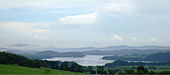
Northern part of the Lipno reservoir near Horní Planá
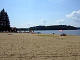
Horní Planá beach

Ferry to Dolní Vltavice

Evening at the lake
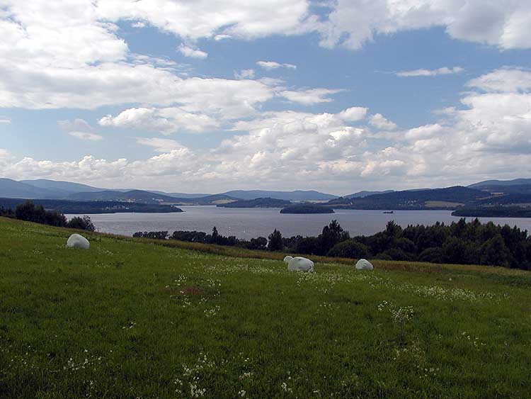
View over the lake from Pihlov (Pichlern)


literature
- Ivan Beneš: Lipenská přehrada. Cartography Praha, 1982 (Czech).
- Ivan Beneš: Lipenská přehrada. Cartography Praha, third edition 1992, ISBN 80-7011-208-5 (Czech).
- Reinhold Fink: Destroyed Bohemian Forest locations. BoD, Norderstedt 2006, ISBN 3-8334-6429-1 .
Web links
- The Lipno reservoir . In: Online encyclopedia encyklopedie.ckrumlov.cz about Krummau .
- historical photos from Frymburk with pictures of the flooding of the place by the reservoir on frymburk.info.
- Photo of the dam on ckrumlov.cz.
- Webcam in Frymburk with a view of the lake and weather diagram for the last few days (Czech)
- detailed map of the lake (PDF; 836 kB) on lipnoinfo.cz.
- Photo of the island of Tajvan on sumavanet.cz.
- sensitive map of the Lipno I hydropower plant on ckrumlov.cz.
- Photo archive of the Czech Geological Service (Česká geologická služba) with numerous photos of the construction of the dam and the reservoir from the years 1958–1960 on geology.cz.
Individual evidence
- ↑ a b c Lipno hydropower plant (official information system of the Český Krumlov Region) ckrumlov.cz
- ↑ Jan Michálek: Comments on prehistoric and early historical settlement on this side of the Bohemian Forest. In: Archaeological Working Group East Bavaria / West and South Bohemia. 6th meeting, Espelkamp, pp. 130–153.
- ^ Mesolithic settlement of Lipno (official information system of the Český Krumlov region) ckrumlov.cz
- ↑ Construction of the Lipno Dam (official information system of the Český Krumlov Region) ckrumlov.cz
- ↑ Pomoz stavět Lipno, velikou stavbu socialismu v Čechách (pamphlet) ckrumlov.cz
- ↑ Antonín Chlum, Ředitelství vodohospodářského rozvoje, Praha: Úpravy ve zdrži vodního díla Lipno, special print from the magazine Vodní hospodářství, No. 9 (1960) (Czech), here quoted from lipen.banda.cz
- ↑ a b c Rybářství - Příloha pro předplatitele (XXIII. 50 let ÚN Lipno) (Supplement to the Rybářství magazine on the 50th anniversary of the reservoir) crscb.cz ( Memento of the original from February 21, 2014 in the Internet Archive ) Info: The archive link was used automatically and not yet checked. Please check the original and archive link according to the instructions and then remove this notice. (PDF; 7.9 MB).
- ↑ Vodní dílo Lipno I, oprava koruny hráze (Construction work on the dam in 2004 by SSŽ) eurovia.cz ( Memento of the original from June 14, 2009 in the Internet Archive ) Info: The archive link was inserted automatically and has not yet been checked. Please check the original and archive link according to the instructions and then remove this notice.
- ↑ Vodstvo ( German "waters" ).
- ↑ Rybaření (website of the town of Černá).
- ↑ a b Odborná podpora k přípravě prováděcích předpisů zákona 254/2001 Sb. (Study commissioned by the Czech Ministry of the Environment, 2006; PDF, 3.8 MB; Czech)
- ↑ a b 12th Magdeburg water protection seminar (report of the seminar in Český Krumlov, 2006; PDF, 4.9 MB; ( page no longer available , search in web archives ) Info: The link was automatically marked as defective. Please check the link according to the instructions and then remove this notice. Czech, English)
- ↑ a b c d e Scénářová study per snížení eutrofizace nádrže Lipno (journal articles: Hejzlar J et al: Scénářová study per snížení eutrofizace nádrže Lipno; Aktuality Šumavského výzkumu, 2006 87-90; PDF, 70 KB; Czech) npsumava.cz ( PDF; 69 kB)
- ↑ Hodnocení koncepce regionální operační program NUTS II Jihozápad na období 2007–2013 (Announcement of the Czech Environmental Information Agency 2006; Czech) ( DOC file ( page no longer available , search in web archives ) Info: The link was automatically marked as defective. Please check Link according to instructions and then remove this note. )
- ↑ Characteristic krajů (Ireas, Institute for Structural Policy; PDF, 1.8 MB; Czech) ireas.cz ( Memento of the original from September 28, 2007 in the Internet Archive ) Info: The archive link was inserted automatically and has not yet been checked. Please check the original and archive link according to the instructions and then remove this notice. (PDF; 1.8 MB)
- ↑ www.lipnoweb.cz (water quality, PDF; 400 kB)
- ↑ Sources in Jihočeský kraj (search engine estudanky.cz)
- ^ Fauna in the Český Krumlov Region (official information system of the Český Krumlov Region) ckrumlov.cz
- ^ Flora in the Český Krumlov Region (official information system of the Český Krumlov Region) ckrumlov.cz
- ↑ a b c www.idnes.cz (interviews with meteorologists, lifeguards and the fishing association) sport.idnes.cz
- ↑ a b c d Climatic conditions in the Český Krumlov Region (official information system of the Český Krumlov Region) ckrumlov.cz
- ↑ Politické byro ústředního výboru KSČ: Možnost výroby 9 těžkých mostových souprav v r. 1961 (Czech)
- ↑ Petr Luňák: Plánování nemyslitelného: československé válečné plány 1950–1990; Ústav pro Soudobé Dějiny AV ČR, 2007 ("Planning the unthinkable: Czechoslovak war plans 1950–1990") (Czech)
- ↑ a b Český a slovenský zahraniční časopis: Střelba na hranici (2004) - (Czech)
- ↑ Rosenheimer Nachrichten: Barry Meeker brought the Cold War to Traunstein ( memento of the original from December 15, 2007 in the Internet Archive ) Info: The archive link was automatically inserted and not yet checked. Please check the original and archive link according to the instructions and then remove this notice. (from August 24, 2005)
- ↑ Time Magazine: The Copter Caper (September 1, 1975)
- ↑ www.zdf.de: 30 years ago - Barry Meeker
- ^ ČT1: Lipno 1975 - Barry Meeker
- ↑ Vojtěch Vyhnálek: Přírodní památka Pestřice - Biologický průzkum, 2005 (Czech) (DOC file; 53 kB)
- ↑ Zpráva ČHMÚ, 2002: Vyhodnocení katastrofální povodně v srpnu 2002. 1. Etapa, Meteorologické příčiny katastrofální povodně v srpnu 2002 a vyhodnocení extremity of the Czech Republic.
- ↑ Tratě, které "utopilo" lipenské přehradní jezero (article of the Czech railways, with photo and map of the region before the lake existed (Czech))
- ↑ https://www.schwarzaufweiss.de/tschechien/moldau.htm
- ↑ Zpráva o aktuálním vývoji povodňové sitauce na území ČR (report of the Ministry of the Environment of the Czech Republic from 2006)
- ↑ Počasí na Lipně: "Average water temperature of the reservoir at the dam at a depth of 2 meters" ( memento of the original from October 16, 2011 in the Internet Archive ) Info: The archive link was inserted automatically and has not yet been checked. Please check the original and archive link according to the instructions and then remove this notice. (Czech)
- ↑ Václav Janouš: Po Lipně už třetí pluje velká loď, za týden začnou Vyhlídkové plavby. www.idnes.cz, accessed June 26, 2020 (Czech).
- ↑ idnes.cz ( page no longer available , search in web archives ) Info: The link was automatically marked as defective. Please check the link according to the instructions and then remove this notice. Přehrada Lipno má novou atrakci, ostrov plný králíků - article in the newspaper iDnes (Czech).
- ↑ Jihočeský územní svaz Českého rybářského svazu: Nasazení údolní nádrže Lipno v roce 2005 ( Memento of the original from February 21, 2014 in the Internet Archive ) Info: The archive link was automatically inserted and has not yet been checked. Please check the original and archive link according to the instructions and then remove this notice. - South Bohemian Anglers Association: stocking of the Lipno reservoir in 2005 (Czech).
- ↑ Jihočeský územní svaz Českého rybářského svazu: Nasazení ÚN Lipno v roce 2006 ( Memento of the original from February 21, 2014 in the Internet Archive ) Info: The archive link was automatically inserted and has not yet been checked. Please check the original and archive link according to the instructions and then remove this notice. - South Bohemian Anglers Association: stocking of the Lipno reservoir in 2006 (Czech).
- ↑ Jihočeský územní svaz Českého rybářského svazu: Komentář k nasazení ÚN Lipno v roce 2007 v porovnání na rok 2006 ( Memento of the original from February 21, 2014 in the Internet Archive ) Info: The archive link was inserted automatically and has not yet been checked. Please check the original and archive link according to the instructions and then remove this notice. - South Bohemian Anglers Association: Commentary on the stocking of the Lipno Reservoir in 2007 compared to 2006 (Czech).
- ↑ Informační centrum vodní elektrárny Lipno ("Information Center of the ČEZ Energy Supply", Czech)
- ↑ Uni Magdeburg: Chronicle - Magdeburg and its University, 1967
- ^ Radio Praha (Prague plans to run for the Summer Olympics from 2016) radio.cz
- ↑ iDnes: Praha ustoupila od olympijské kandidatury na hry v roce 2020 - Article from iDnes (Czech)
- ↑ www.idnes.cz: Areály pro olympiádu: Račice, Lipno, Lobzy? (Czech)
- ↑ oh.idnes.cz ( page no longer available , search in web archives ) Info: The link was automatically marked as defective. Please check the link according to the instructions and then remove this notice. Praha olympijská? Za 135 miliard - article in the newspaper iDnes (Czech)

Lipno | Lipno II | Hněvkovice | Kořensko | Orlík | Kamýk | Slapy | Štěchovice | Vrané | Štvanice