
Waltersdorf (Thuringia)
| coat of arms | Germany map | |
|---|---|---|
 Help on coat of arms |
Coordinates: 50 ° 50 ′ N , 11 ° 45 ′ E |
|
| Basic data | ||
| State : | Thuringia | |
| County : | Saale-Holzland district | |
| Management Community : | Hills / valleys | |
| Height : | 215 m above sea level NHN | |
| Area : | 4.58 km 2 | |
| Residents: | 160 (Dec. 31, 2019) | |
| Population density : | 35 inhabitants per km 2 | |
| Postal code : | 07646 | |
| Area code : | 036428 | |
| License plate : | SHK, EIS, SRO | |
| Community key : | 16 0 74 107 | |
| Address of the municipal administration: |
Dorfstrasse 16 07646 Waltersdorf |
|
| Website : | ||
| Mayor : | Ralf Mueller | |
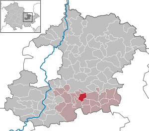
| Location of the municipality of Waltersdorf in the Saale-Holzland district | ||
  |
||

Waltersdorf is a municipality in the south of the Saale-Holzland district in Thuringia and part of the Hügelland / Täler administrative community .
geography
location
The place is located in a wooded area around three kilometers south of the city of Stadtroda and around 20 kilometers (as the crow flies) southwest of the district town of Eisenberg .

Neighboring communities
Tröbnitz , Tissa , Lippersdorf-Erdmannsdorf , Rattelsdorf , Meusebach and Geisenhain border the town clockwise .
Waters
Waltersdorf is located in the Roda valley .
mountains
The highest elevation is the Sommerberg, one kilometer south of the village ( 359.5 m above sea level ).
history
The first documentary mention of 1288 has yet to be clarified. The date of September 7, 1358 is official.
Individual evidence
- ^ Population of the municipalities from the Thuringian State Office for Statistics ( help on this ).
- ↑ Thuringian Land Survey Office TK25 - sheet 5136 Stadtroda
- ^ Wolfgang Kahl : First mention of Thuringian towns and villages. A manual. 5th, improved and considerably enlarged edition. Rockstuhl, Bad Langensalza 2010, ISBN 978-3-86777-202-0 , p. 303.
Web links
Albersdorf | Altenberga | Bad Klosterlausnitz | Bibra | Bobeck | Bremsnitz | Bucha | Bürgel | Crossing the Elster | Dornburg-Camburg | Eichenberg | Eineborn | Eisenberg | Frauenprießnitz | Outdoor orla | Geisenhain | Gneus | Golmsdorf | Gosen | Graitschen at Bürgel | Greater buckedra | Grosseutersdorf | Großlöbichau | Großpürschütz | Gumperda | Hainichen | Hainspitz | Hartmannsdorf | Heathland | Hermsdorf | Hummelshain | Jenalöbnitz | Kahla | Karlsdorf | Little buckedra | Kleinebersdorf | Kleineutersdorf | Laasdorf | Lehesten | Lindig | Lippersdorf-Erdmannsdorf | Löberschütz | Mertendorf | Meusebach | Milda | Möckern | Mörsdorf | Nausnitz | Neuengönna | Oberbodnitz | Orlamünde | Ottendorf | Petersberg | Poxdorf | Rattelsdorf | Rauda | Rauschwitz | Rausdorf | Reichenbach | Reinstädt | Renthendorf | Rothenstein | Ruttersdorf-Lotschen | Scheiditz | Schkölen | Grinding trips | Schlöben | Schöngleina | Schöps | Side rod | Serba | Silbitz | Stadtroda | St. Gangloff | Sulza | Tautenburg | Tautendorf | Tautenhain | Animal snail | Tissa | Trobnitz | Trockenborn-Wolfersdorf | Unterbodnitz | Waldeck | Walpernhain | Waltersdorf | Weissbach | Weißenborn | Wichmar | Rooms | Zollnitz