Atlantic hurricane season 2005
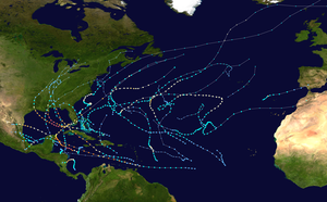 All the storms of the season | |
| Formation of the first storm |
June 8, 2005 |
|---|---|
| Dissolution of the last storm |
January 6, 2006 (record) |
| Strongest storm | Wilma (record) - 882 hPa ( mbar ), 160 kn (295 km / h ) |
| Tropical lows | 31 (record) |
| Storms | 28 (record) |
| Hurricanes | 15 (record) |
| Severe hurricanes ( Cat. 3+ ) | 7th |
| Total number of victims | 3937 total |
| Total damage | $ 159.2 billion (2005) |
|
Atlantic hurricane seasons 2003 , 2004 , 2005 , 2006 , 2007 | |
| Saffir Simpson hurricane wind scale | |
|---|---|
| category | Wind speed. |
| km / h ( mph ) | |
| 5 | > = 252 (> = 157) |
| 4th | 209-251 (130-156) |
| 3 | 178-208 (111-129) |
| 2 | 154-177 (96-110) |
| 1 | 119-153 (74-95) |
| Tropical storm | 63-118 (39-73) |
| Tropical low | 0-62 (0-38) |
| Subtropical storm | 63-117 (39-73) |
| Subtropical low | 0-62 (0-38) |
| Extra tropical storm | > = 63 (> = 39) |
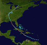
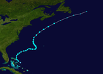
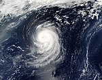
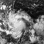
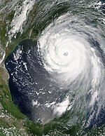
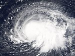
The Atlantic hurricane season of 2005 began, as every year, officially on June 1 and ended on 30 November. Almost all tropical cyclones form during this period , as only then is the ocean warm enough to create favorable conditions for hurricane formation. Early signs, such as the high water temperature, indicated an extremely active season . So a total of over 28 tropical storms formed. This is the most active season since regular records began in the Atlantic Basin. In addition, 15 hurricanes formed in just this one storm season. Of these 15, seven developed into severe hurricanes, one even surpassing the record for the lowest central pressure since records began in 1950. In addition, 2005 was the first hurricane season in which the supply of hurricane names was exhausted and Greek letters had to be used. After all, the season was the third of six hurricane seasons to date in which two or more Category 5 hurricanes formed (the others were 1960 , 1961 , 2007 , 2017 and 2019 ).
This hurricane season brought much damage, death and destruction. In total , there was property damage of over 100 billion US dollars (most of it caused by Hurricane Katrina ), at least 3937 people were killed (1833 of them by Katrina alone).
Summary of the storm season
The season started very turbulent with seven tropical storms and two strong hurricanes that had formed before the end of August. This early activity, manifested in the number and intensity of the storms, indicated a record season. The trend quickly proved to be true. So many storms formed in October; more than any other month. Usually the hurricane season peaks in September. There were a total of 27 named storms, which is a new record for the Atlantic Basin. There were also two tropical low pressure systems and one subtropical low pressure system. A total of 16 records were broken in the 2005 season.
| Storm | dead |
|---|---|
| Arlene | 1 |
| Bret | 1 |
| Cindy | 5 |
| Dennis | 88 |
| Emily | 17th |
| Device | 1 |
| Irene | 1 |
| Jose | 8th |
| Katrina | 1836 |
| Maria | 4th |
| Nate | 2 |
| Ophelia | 3 |
| Rita | 125 |
| Stan | 1668 |
| Tammy | 10 |
| Twenty-two | 10 |
| Wilma | 87 |
| alpha | 26th |
| beta | 9 |
| gamma | 39 |
| delta | 19th |
| total | 3960 |
There were several strong storms during the season. But Hurricane Wilma, with a minimum air pressure of 882 hPa, put everyone in the shade. This also undercut the 17-year-old record set by Hurricane Gilbert (888 hPa). It was also the only season in which four Category 5 hurricanes formed on the Saffir-Simpson hurricane wind scale .
This season's storms were exceptionally devastating and wrought a great deal of destruction. At the beginning of the season, hurricanes Dennis and Emily caused billions in damage. In late August, Hurricane Katrina caused minor damage in southern Florida before moving to the Gulf of Mexico, where it wreaked havoc in Alabama, Mississippi and Louisiana, but especially in the city of New Orleans . It was the costliest hurricane in US history, even more expensive than Hurricane Andrew in 1992. Katrina was followed by Rita, which in turn hit land near the Katrinas landing area and flooded the city of New Orleans again and caused further damage in Louisiana and Texas served. Later, what was left of Tropical Storm Tammy and Sub-Tropical Depression Twenty-two moved across the northeastern United States, causing severe flooding.
A particularly rare storm was Hurricane Vince, which, of all storms observed so far, had formed the furthest northeast over the Atlantic, attained the strength of a hurricane and also reached mainland in the south of the Iberian Peninsula on Europe . Subsequently, the tropical storm Delta caused severe damage to the Canary Islands and killed seven people.
Another obscurium of the 2005 season was that the initial letters used for the names of the storms were soon used up. So in the end the Greek alphabet also had to be used for the names. This happened in 2005 for the first time since 1970. But then only subtropical and tropical low pressure areas were given names with Greek letters.
| Systems | average | 2005 |
|---|---|---|
| Storms | 10 | 28 |
| Hurricanes | 6th | 15th |
| Category 3+ hurricanes | 2 | 7th |
| Category 5 hurricanes | 0.3 | 4th |
The intense activity of this season had significant economic consequences. Because of the added expense of producing fuels and the problem of limited oil production and refining capacity in the Gulf of Mexico , the storms drove up the price of crude oil. The obstruction to refining capacity in the United States caused refiners to raise fuel prices to record levels. This increase in the price of fuel was only achieved in the USA by the inflationary highs in the years 1918–1920 and 1979–1982. The governments in Europe and the USA therefore had to tap into strategic oil reserves. In addition, there were further bottlenecks in the oil supply in the days after Katrina. Even weeks after this hurricane event, prices remained at a record high, although the total output was increased to over a million barrels per day. Rita damaged other production facilities in the western Gulf of Mexico, which were primarily used for research, but this meant that oil production was inhibited for some time.
Storms
Tropical storm Arlene
| Tropical storm | |||
|---|---|---|---|
|
|||
| Duration | June 8, 2005 - June 13, 2005 | ||
| intensity | 60 kn (110 km / h ) (1 minute) , 989 hPa | ||
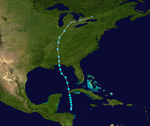
Already at the beginning of the hurricane season a low pressure area formed and established itself north of Honduras . Despite the strong wind shear , the low was able to organize itself and was finally recognized on June 8, 2005 as a tropical low pressure system. The next day it turned into a tropical storm.
Arlene brought gale force winds and heavy rainfall to the Cayman Islands and Cuba . When Arlene crossed Cuba towards morning on June 10 and moved into the Gulf of Mexico , the storm continued to weaken.
Arlene reached land west of Pensacola on June 11th . Arlene was the strongest June storm to hit the mainland since Hurricane Allison crossed eastern Florida in 1995 . After the storm moved inland towards Indiana and Michigan , it existed for two days as a low pressure area, and then moved as an extratropical low pressure area towards Europe.
The only fatality was a woman who was on Miami Beach at the time of the passage of the storm .
Tropical storm Bret
| Tropical storm | |||
|---|---|---|---|
|
|||
| Duration | June 28, 2005 - June 30, 2005 | ||
| intensity | 35 kn (65 km / h ) (1 minute) , 1002 hPa | ||
End of June, a disturbance formed in the Bay of Campeche . The system quickly organized itself and was finally named Tropical Depression Two Two in the evening on June 28th. Two hours later, measurements by a weather plane showed that the system had intensified into a tropical storm, which from then on was named Bret. It marked the first time two tropical storms had formed in June since the 1986 season - the fifteenth time since 1851.
The storm moved west-northwest, where it hit land as a weak tropical storm near Tuxpan , Mexico at around 7 a.m. on June 29 . It moved inland, with heavy rainfall over the state of Veracruz , until the storm eased sharply over the mountains of San Luis Potosí on the late evening of June 29th.
Hundreds of houses and apartments were damaged, and some cities, particularly Naranjos and Chinampa (over 95 km south of Tampico ), were largely flooded. Probably the only person who died was an occupant of a car, which was swept away by floods in Naranjos.
Hurricane Cindy
| Category 1 hurricane | |||
|---|---|---|---|
|
|||
| Duration | July 3, 2005 - July 7, 2005 | ||
| intensity | 65 kn (120 km / h ) (1 minute) , 991 hPa | ||
On July 3, a tropical wave intensified to tropical depression three in the northwest of the Caribbean Sea. It met the Yucatán Peninsula on July 4th and moved on to the Gulf of Mexico . Late in the evening a new circulation had formed further north of the former center. On the morning of the next day, the system intensified further into a tropical storm. The storm continued north across the Gulf of Mexico and landed near Grand Isle, Louisiana on July 5. As it moved inland, it continued to weaken and turned into an extratropical storm on July 7th.
As Cindy wandered further inland, an F2 tornado occurred that damaged the Atlanta Motor Speedway and Tara Field Airport in Hampton, Georgia . Large, sometimes record-breaking amounts of precipitation fell over parts of Louisiana, Mississippi , Alabama and Maryland . More than 127 mm of rain fell in numerous places .
In total there were 5 deaths from Cindy.
Cindy was subsequently upgraded to a hurricane. A precise evaluation of the data thus confirmed an assumption that had already existed. Cindy had reached hurricane strength shortly before her shore leave. This is reported by the National Hurricane Center (NHC) in the updated January 26, 2006 Tropical Storm Report for Cindy.
Hurricane Dennis
| Category 4 hurricane | |||
|---|---|---|---|
|
|||
| Duration | July 4, 2005 - July 13, 2005 | ||
| intensity | 130 kn (240 km / h ) (1 minute) , 929 hPa | ||
Tropical low pressure area Four formed on the evening of July 4th in the southeastern Caribbean Sea. The next day, the system intensified into tropical storm Dennis. The storm began moving rapidly west-northwest, eventually reaching hurricane strength by the afternoon of July 6, while reaching the southern coast of Hispaniola . The next day it intensified very quickly into a Category 4 hurricane. Dennis was the strongest Atlantic storm observed prior to August at the time of his peak activity, but was surpassed by Emily just a few days later. On July 8th, Dennis crossed the island of Cuba with a course for the capital Havana . A second episode of severe intensification occurred on July 9th, where he migrated north towards the Gulf Coast of the United States and was re-classified in Category 4. Dennis hit land as a Category 3 storm southeast of Pensacola , Florida.
Dennis killed 89 people. In addition, more than 100 people were reported missing in Haiti. It was possibly the worst hurricane for Cuba since Hurricane Flora in 1963. The total damage amounts to 4 billion US dollars, most of it in the Caribbean .
Hurricane Emily
| Category 5 hurricane | |||
|---|---|---|---|
|
|||
| Duration | July 11, 2005 - July 21, 2005 | ||
| intensity | 140 kn (260 km / h ) (1 minute) , 929 hPa | ||
Emily formed on July 11th as Tropical Depression Five, east of the Lesser Antilles . It was moving westward and reached Grenada on July 14th as a Category 1 hurricane. Eventually it reached the Caribbean Sea and quickly began to intensify. On July 15, it was upgraded to a Category 5 hurricane on the Saffir-Simpson Hurricane Wind Scale. Emily broke Hurricane Dennis’s eight-day record as the most intense storm before August. The storm reached a minimum air pressure of 929 hPa with wind peaks of over 260 km / h on July 16. After passing southern Jamaica and the Cayman Islands , Emily landed off the Yucatán Peninsula on the morning of July 17th. Emily also surfaced over the coast of Campeche and made it to land near a rural area northeast of Mexico near Boca Madre, Tamaulipas for the second time as a Category 3 storm.
Emily is likely responsible for 17 deaths.
Tropical Storm Franklin
| Tropical storm | |||
|---|---|---|---|
|
|||
| Duration | July 21, 2005 - July 29, 2005 | ||
| intensity | 60 kn (110 km / h ) (1 minute) , 997 hPa | ||
Tropical Depression Six formed on the evening of July 21 near the Bahamas . Just 2 hours later, it was promoted to the sixth named storm of the season. Before that, there had never been a storm with the letter F this early in a season. Initially, tropical storm Franklin moved north, away from the Bahamas, then moved northeast out into the open Atlantic , where it finally lost its organization on July 24th under the effects of wind shear and dry air.
Tropical storm device
| Tropical storm | |||
|---|---|---|---|
|
|||
| Duration | July 23, 2005 - July 25, 2005 | ||
| intensity | 40 kn (75 km / h ) (1 minute) , 1005 hPa | ||
The tropical depression seven emerged on the evening of July 23 in the Bahía de Campeche . It was upgraded to Tropical Storm Gert by early morning the next day - the fastest development of a seventh named storm to date. Gert got a bit stronger before going ashore south of Tampico along the coast of Mexico late on July 24th . The minimum core pressure at this point was 1005 hPa and the wind speed was around 75 km / h. He moved inland via central Mexico and disappeared on July 25th.
Since Gert hit the same area as Hurricane Emily, which raged just four days earlier, about 1,000 people were taken to safety as a precautionary measure against fears of flooding .
Tropical Storm Harvey
| Tropical storm | |||
|---|---|---|---|
|
|||
| Duration | August 2, 2005 - August 8, 2005 | ||
| intensity | 55 kn (100 km / h ) (1 minute) , 994 hPa | ||
The low pressure area eight formed on August 2nd southwest of Bermuda . The next day it was upgraded to a tropical storm. Harvey wasn't a really well organized storm at first. It had a few subtropical characteristics, but over time it became more tropical in nature. Harvey passed just south of Bermuda on August 4th, just as he was at the peak of his activity. At that time it had wind speeds of 105 km / h and a minimum central pressure of 994 hPa. Since Harvey's Bermuda was only grazed, no damage was reported. After that, Harvey moved east and eventually drifted northeast, where it became extratropical over the open Atlantic on August 8th.
Hurricane Irene
| Category 2 hurricane | |||
|---|---|---|---|
|
|||
| Duration | August 4, 2005 - August 18, 2005 | ||
| intensity | 90 kn (165 km / h ) (1 minute) , 970 hPa | ||
The tropical depression Nine formed west of Cape Verde on the evening of August 4th. It was the second Cape Verde type storm of the season. As the system spun northwest, it encountered dry air and wind shear and broke under its impact. Despite poor organization and shear winds, it was upgraded to Tropical Storm Irene on August 7th. Further shear and dry air destroyed the structure of the cyclone and Irene was again downgraded to a tropical depression on August 8th. Irene alternated between apparent resurgence and considerable weakening, eventually becoming so disorganized that NHC forecasters even considered declaring the storm resolved on Aug. 10. But the low continued to move west and found better conditions there. Irene eventually regained tropical storm status and quickly intensified to a Category 1 hurricane on August 14th. Later it intensified even more - in low shear conditions under a high pressure area . Irene eventually became a Category 2 hurricane on Aug. 16, but weakened over cooler waters shortly thereafter. On August 18, Irene became extra-tropical off Newfoundland . She never posed a threat to the mainland.
Tropical Depression Ten
| Tropical depression | |||
|---|---|---|---|
|
|||
| Duration | August 13, 2005 - August 14, 2005 | ||
| intensity | 30 kn (55 km / h ) (1 minute) , 1008 hPa | ||
The tropical low pressure area Ten developed on August 13, 1770 km east of the Lower Antilles . However, unfavorable conditions such as vertical shear prevented development of the system. Remnants of the deep moved northwest and collided with another system north of the Leeward Islands. The resulting tropical wave later became Tropical Depression Twelve, Hurricane Katrina .
Tropical storm Jose
| Tropical storm | |||
|---|---|---|---|
|
|||
| Duration | August 22, 2005 - August 23, 2005 | ||
| intensity | 50 kn (95 km / h ) (1 minute) , 998 hPa | ||
The tropical depression Elf formed on August 22nd in the Bay of Campeche . It later intensified over the warm waters of the Gulf of Mexico to Tropical Storm Jose, where it blew with a maximum wind speed of 80 km / h. On August 23, it went ashore near Veracruz , Mexico , where it quickly weakened and soon disintegrated inland. But while it hit the Gulf Coast of Mexico, it made 25,000 people homeless. Eight people died in the state of Oaxaca due to the heavy rain, and two more are still missing. It was later found that Jose, two hours before it hit the coast of Mexico, was more organized and was in the process of training an eye. Even so, its wind speed remained well below hurricane strength.
Hurricane Katrina
| Category 5 hurricane | |||
|---|---|---|---|
|
|||
| Duration | August 23, 2005 - August 30, 2005 | ||
| intensity | 150 kn (280 km / h ) (1 minute) , 902 hPa | ||
Tropical depression Twelve formed near the Bahamas on August 23, became a tropical storm the next day and a Category 1 hurricane on August 25. On the same day, it went ashore in southern Florida and then reached the Gulf of Mexico. Due to the ideal conditions that prevailed there, Katrina rapidly intensified on August 28 to become a Category 5 hurricane, the fourth strongest in the Atlantic to date. Katrina weakened slightly to Category 4 as she turned toward Louisiana. Hours later, it crossed Breton Sound , near New Orleans, and finally came ashore for the last time as a Category 3 hurricane near Pearlington, Mississippi.
The coasts of Mississippi and Alabama suffered catastrophic damage from 30-foot storm surges . New Orleans escaped the worst damage from the storm, but several dams were damaged by the waves. The penetrating water flooded 80% of the city. 1,836 people in five states of the United States were killed. Katrina is also the most damaging hurricane. The damage is estimated at $ 100 billion.
Tropical Storm Lee
| Tropical storm | |||
|---|---|---|---|
|
|||
| Duration | August 28, 2005 - September 2, 2005 | ||
| intensity | 35 kn (65 km / h ) (1 minute) , 1006 hPa | ||
The tropical depression Thirteen developed on August 28, 1550 km east of the Lower Antilles. However, on August 29th it degenerated into a wide depression. However, it recovered on August 31 and later that day intensified to become the twelfth storm of the year. But in the evening Lee was again downgraded to a tropical low due to poor altitude conditions: Lee dissolved on September 1st. He never posed a threat to the mainland.
Hurricane Maria
| Category 3 hurricane | |||
|---|---|---|---|
|
|||
| Duration | September 1, 2005 - September 10, 2005 | ||
| intensity | 100 kn (185 km / h ) (1 minute) , 962 hPa | ||
Tropical Depression Fourteen formed 1770 km east of the Leeward Islands on September 1 and was upgraded to Tropical Storm the next day. Early on September 4, Maria intensified into a hurricane, the fifth of the season. On September 5, it was promoted to Category 3 hurricane, making it the fourth major (above Category 3) hurricane of the season. But then Maria steadily weakened and was graded as a Tropical Storm on September 8th.
Maria became extratropical on September 10 between Cape Race and the Azores . Maria never posed a threat to the country as a hurricane, but Maria became a powerful extratropical storm and, as such, once again reached hurricane wind speeds as she pulled on her way towards Iceland. The remnants of the system hit Norway , killing one person there.
Hurricane Nate
| Category 1 hurricane | |||
|---|---|---|---|
|
|||
| Duration | September 5, 2005 - September 10, 2005 | ||
| intensity | 80 kn (150 km / h ) (1 minute) , 979 hPa | ||
On September 5, a very pronounced low pressure area, 560 km south-southwest of Bermuda, organized into tropical low pressure area Fifteen. It intensified that evening after tropical storm Nate and increased in intensity afterwards. On September 7, it became the sixth hurricane of the season.
As Nate headed toward Bermuda, a hurricane warning was issued. Nate spared the island, however, and so Bermuda was only streaked by the storm. On September 8th, Hurricane Nate passed Bermuda just 200 km south. After moving north, it became an extratropical storm in the middle of the Atlantic Ocean on September 10th.
Hurricane Ophelia
| Category 1 hurricane | |||
|---|---|---|---|
|
|||
| Duration | September 6, 2005 - September 17, 2005 | ||
| intensity | 75 kn (140 km / h ) (1 minute) , 976 hPa | ||
Tropical Depression Sixteen formed over the northern Bahamas on September 6th. On the morning of September 7th, the system organized into tropical storm Ophelia, and the following day into hurricane Ophelia. The system stayed in the same location off the Florida coast for almost two days. On September 12, the storm slowly moved towards North Carolina , with the intensity alternating between tropical storms and hurricanes. The hurricane did not approach the land even though the western storm center had reached the coastal areas of North Carolina, causing great damage in the Outer Banks around Cape Fear. Ophelia was moving north and became an extratropical storm on the evening of September 17th, near Nova Scotia. However, it moved further northeast across the Atlantic coast of Canada and brought strong winds and heavy rainfall with it.
It is assumed that a total of three deaths. The damage amounts to around $ 1.6 billion.
Hurricane Philippe
| Category 1 hurricane | |||
|---|---|---|---|
|
|||
| Duration | September 17, 2005 - September 23, 2005 | ||
| intensity | 70 kn (130 km / h ) (1 minute) , 985 hPa | ||
A powerful tropical wave organized on September 17th, a few hundred kilometers east of the Leeward Islands, into Tropical Depression Seventeen. In the late evening it intensified into a tropical storm. On September 18, Philippe had intensified into a hurricane. This made it the eighth hurricane of the Atlantic storm season. It was downgraded to a tropical storm on the afternoon of September 20 and broke up south of Bermuda three days later. It was only the third time since 1950 that an Atlantic storm had carried the letter P.
Hurricane Rita
| Category 5 hurricane | |||
|---|---|---|---|
|
|||
| Duration | September 18, 2005 - September 26, 2005 | ||
| intensity | 155 kn (285 km / h ) (1 minute) , 895 hPa | ||
The eighteenth tropical depression formed over the Turks and Caicos Islands on September 18 . Later that day, it became the seventeenth tropical storm of the season. Rita slowly began to strengthen and became a hurricane on September 20th. Rita first became a Category 1 hurricane, eventually a Category 2 hurricane, as it passed south of the Florida Keys . When Rita reached the waters of the warm Gulf of Mexico, it rapidly strengthened and became a Category 5 hurricane on September 21 - at the time the third strongest hurricane ever recorded (now the fourth strongest) in the Atlantic. The landfall on September 24 took place near the border between the states of Texas and Louisiana.
Major floods have been reported; in Louisiana two districts were devastated. Numerous oil rigs in the Rita storm stretch were badly damaged and seven people died directly from Rita's. Another 113 people died indirectly as a result of the tropical storm.
Tropical Depression Nineteen
| Tropical depression | |||
|---|---|---|---|
|
|||
| Duration | September 30, 2005 - October 2, 2005 | ||
| intensity | 30 kn (55 km / h ) (1 minute) , 1006 hPa | ||
A low pressure area was formed by a tropical wave 1075 km west of the southwest Cape Verde Islands and developed into a tropical low pressure area on September 30th. There were strong wind shears and the system broke up on October 2nd without intensifying into a tropical storm.
Hurricane Stan
| Category 1 hurricane | |||
|---|---|---|---|
|
|||
| Duration | October 1, 2005 - October 5, 2005 | ||
| intensity | 70 kn (130 km / h ) (1 minute) , 977 hPa | ||
A tropical wave in the West Caribbean Sea organized itself into a tropical depression on October 1st. Off the coasts of the Yucatán Peninsula, it intensified into tropical storm Stan on October 2. Stan reached land in the Yucatán and quickly weakened to a tropical low, but quickly regained energy in Campeche Bay and intensified into a hurricane on October 4th. Later that day, Hurricane Stan moved across Mexico's east coast south of Veracruz as a Category 1 hurricane.
Stan was accompanied by a large area of poorly organized but heavy rains that stayed over Mexico and Central America during this time. Central America is quite mountainous and therefore extremely susceptible to severe flooding and mudslides, including from non-cyclonic systems. Torrential rains in the area, causing catastrophic flooding and mudslides, are responsible for at least 1153 deaths in six countries; 1036 of them in Guatemala alone . At first, over a thousand deaths were linked to Stan, but the National Hurricane Center believes that only around 100 deaths can be linked to the major weather phenomena around Stan, according to the Stan report.
In addition to the many fatalities, over 100,000 people had to be evacuated. The eruption of the Santa Ana volcano on October 1st caused damage in Central America in addition to the severe floods and mudslides.
Unnamed subtropical storm
| Tropical storm | |||
|---|---|---|---|
|
|||
| Duration | October 4, 2005 - October 5, 2005 | ||
| intensity | 45 kn (85 km / h ) (1 minute) , 997 hPa | ||
Upon re-analysis, the NHC determined that a short-lived subtropical storm existed. This had formed on October 4th and became extratropical over the Azores the next day . The extratropical storm was absorbed by a depression on October 5th that would later develop into Hurricane Vince .
Tropical Storm Tammy
| Tropical storm | |||
|---|---|---|---|
|
|||
| Duration | October 5, 2005 - October 6, 2005 | ||
| intensity | 45 kn (85 km / h ) (1 minute) , 1001 hPa | ||
A tropical fault north of the Bahamas showed signs of well-defined surface circulation and sufficient wind speed and was upgraded to a tropical storm east of Florida on October 5 without reaching tropical depression status. Only for the second time, after Tanya in 1995, was the letter T used. Tammy went ashore near Jacksonville, Florida - that evening that same day. After that, Tammy moved quickly inland via Georgia and Alabama before breaking up into few remains that drifted south into the Gulf of Mexico. The rains that accompanied Tammy were detached from the circulation and affected large parts of Georgia as well as South Carolina and parts of North Carolina. The front system with which it joined was blamed for the flooding in the northeast of the country. Tammy killed 7 people.
Subtropical depression twenty-two
| Tropical depression | |||
|---|---|---|---|
|
|||
| Duration | October 8, 2005 - October 10, 2005 | ||
| intensity | 30 kn (55 km / h ) (1 minute) , 1008 hPa | ||
The subtropical low pressure area Twenty-Two formed on October 8th from a non-tropical low 725 km southeast of Bermuda. The system encountered difficult conditions and the National Hurricane Center (NHC )’s precautionary measures were suspended when it disintegrated on October 9. The NHC watched the debris as they moved on toward the US east coast. The system continued to push tropical moisture northwards and, along with tropical storm Tammy, triggered floods in New York, New Jersey and New England from early to mid-October. It was partly responsible for the wettest month ever in the northeastern United States.
Hurricane Vince
| Category 1 hurricane | |||
|---|---|---|---|
|
|||
| Duration | October 8, 2005 - October 11, 2005 | ||
| intensity | 65 kn (120 km / h ) (1 minute) , 988 hPa | ||
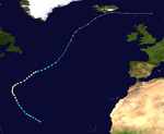
The tropical storm Vince was christened on October 9 in the east Atlantic near Madeira (east-southeast of the Azores). At the end of the day it intensified into a hurricane. Some NHC analysis indicated that Vince would only turn into a subtropical storm on October 8th. Even though Vince was very small and a very short-lived storm, it had briefly reached hurricane strength. It was noteworthy that this storm had developed in the eastern Atlantic, far from the areas where cyclones normally develop. It was the furthest north and east of the tropical cyclone that had ever formed in the Atlantic. Vince reached Spain on October 11 in the south of the Iberian Peninsula (near Huelva ) after weakening into a tropical depression. Vince was the first cyclone to hit the Spanish coast in over 160 years. The last time a Category 2 hurricane hit the Iberian Peninsula was in October 1842. No damage or injuries were reported.
Hurricane Wilma
| Category 5 hurricane | |||
|---|---|---|---|
|
|||
| Duration | October 15, 2005 - October 26, 2005 | ||
| intensity | 160 kn (295 km / h ) (1 minute) , 882 hPa | ||
Tropical Depression Twenty-four formed on October 15, southwest of Jamaica, and intensified into a tropical storm on October 17. On October 18, the storm developed a tiny, well-trained eye. The system quickly began to strengthen. When it reached category 5, it had a record-breaking air pressure level of just 882 hPa on October 19th.
Wilma weakened slightly to Category 4 before reaching the Yucatán coast on October 22nd. The system moved across the peninsula bringing heavy precipitation and wind in the process. This region was hit by Hurricane Emily three months ago. The Category 3 storm moved rapidly over southern Florida on October 24, before moving northeastward and becoming an extratropical storm.
64 people were killed by Wilma (28 directly and 36 indirectly). Billions of dollars in damage along the Caribbean, Mexico and Florida are making themselves felt. Evacuations along the hurricane route prevented higher casualties.
Tropical Storm Alpha
| Tropical storm | |||
|---|---|---|---|
|
|||
| Duration | October 22, 2005 - October 24, 2005 | ||
| intensity | 45 kn (85 km / h ) (1 minute) , 998 hPa | ||
A tropical wave organized into tropical depression twenty-five in the eastern Caribbean Sea on October 22nd. At the end of the day, the system intensified into a tropical storm moving west-northwest.
On the morning of October 23, the tropical storm reached land with winds of 95 km / h near the city of Barahona in the Dominican Republic. He later moved on to Haiti. Alpha reached the Atlantic Ocean again, where it was absorbed by Hurricane Wilma.
Tropical Storm Alpha was the 22nd named system in the 2005 hurricane season, surpassing the previous record for the storm season of 1933. In addition, Alpha was the first tropical storm to be named using a letter from the Greek alphabet. Alpha brought death to 26 people.
Hurricane Beta
| Category 3 hurricane | |||
|---|---|---|---|
|
|||
| Duration | October 26, 2005 - October 31, 2005 | ||
| intensity | 100 kn (185 km / h ) (1 minute) , 962 hPa | ||
On the evening of October 26th, an extensive low pressure area southwest of the Caribbean Sea developed into the tropical low pressure area Twenty-Six. Six hours later it had evolved into tropical storm Beta. Beta turned into a hurricane on October 29th. On October 30th, Beta became a powerful hurricane with steady winds in excess of 185 km / h. This increased the number of strong hurricanes in the 2005 storm season to a total of seven - one more than in the 1950 hurricane season and as many as in the 1961 Atlantic hurricane season .
The Colombian island of Providencia, over 140 miles off the coast of Nicaragua, had been exposed to the winds of the storm for hours as the storm center moved very slowly near the island. Initial reports included reports of extensive house demolitions and loss of communication with islanders.
Beta broadened the record of tropical storms in a season to 23, and it was the first time the name Beta was used to refer to a tropical system. Beta was the 13th hurricane of the 2005 season, breaking the record of 12 hurricanes in 1969. It was also the first hurricane to have a Greek letter as its name.
Tropical storm gamma
| Tropical storm | |||
|---|---|---|---|
|
|||
| Duration | November 14, 2005 - November 22, 2005 | ||
| intensity | 45 kn (85 km / h ) (1 minute) , 1002 hPa | ||
On the evening of November 13, after two weeks of storm inactivity, Tropical Depression Twenty-seven was formed from a tropical wave 115 miles west-southwest of St. Lucia . As the system passed through the Lesser Antilles , heavy rains caused mudslides that buried two people. The wind shear prevented further development of the system and further precautionary measures were suspended on November 16 when the storm lost its closed circulation 205 miles southeast of Kingston, Jamaica.
The remnants of the low pressure system moved further west, but were not, as expected, absorbed by a major low pressure area over the Caribbean. The remnants stayed over the Caribbean Sea and moved along the northern coast of Honduras, where it merged with parts of the larger depression (which was just about to disintegrate). The storm grew stronger and a closed circulation formed on November 18th. This is how the tropical storm Gamma came about.
After the storm regenerated, 32 people were killed by floods in Honduras. In addition, 13 people were missing in Honduras and three people were killed in Belize . After wind currents hit the system, it intensified slightly. Gamma moved back and forth in the Caribbean Sea for some time before it weakened. The storm finally resolved on November 20th, except for a small remnant. Gamma had killed a total of 41 people to date, two during the tropical depression period and 39 or more during the tropical storm.
Tropical storm delta
| Tropical storm | |||
|---|---|---|---|
|
|||
| Duration | November 22, 2005 - November 28, 2005 | ||
| intensity | 60 kn (110 km / h ) (1 minute) , 980 hPa | ||
Tropical Storm Delta, the 26th of the 2005 season, formed unusually far east in the Atlantic and moved eastward, crossing the Canary Islands and causing massive damage and killing seven people. 12 people were missing. Eventually it crossed the coast of Morocco as a simple low pressure system .
Hurricane Epsilon
| Category 1 hurricane | |||
|---|---|---|---|
|
|||
| Duration | November 29, 2005 - December 8, 2005 | ||
| intensity | 75 kn (140 km / h ) (1 minute) , 981 hPa | ||
On November 29, tropical storm Epsilon originated in a similar mechanism that gave rise to tropical storm Delta. A non-tropical depression acquired tropical properties. Epsilon increased the number of storms in the 2005 Atlantic season to 26. It is also one of five storms in eight years that were still active after the official end of the season. On December 2, it intensified into a hurricane, the 14th of the season. This only happened the second time. Only in 1984 did Hurricane Lili turn into a hurricane after the official end of the season.
Tropical storm Zeta
| Tropical storm | |||
|---|---|---|---|
|
|||
| Duration | December 29, 2005 - January 6, 2006 | ||
| intensity | 55 kn (100 km / h ) (1 minute) , 994 hPa | ||
The tropical storm Zeta formed on December 29th from a front trough about 1720 km south-southwest of the Azores . After Hurricane Alice (1954–1955), Zeta was only the second tropical cyclone recorded in the North Atlantic to extend from a calendar year through the turn of the year into a new calendar year. On January 6, 2006, due to strong wind shear and dry air , Zeta broke up into a few remains.
Accumulated Cyclone Energy (ACE)
| ACE (10 4 kt 2 ) - storm | ||||||||
|---|---|---|---|---|---|---|---|---|
| 1 | 38.9 | Wilma | 10 | 7.17 | Nate | 19th | 1.66 | Vince |
| 2 | 32.9 | Emily | 11 | 6.72 | Franklin | 20th | 1.52 | Cindy |
| 3 | 25.1 | Rita | 12 | 6.47 | beta | 21st | 1.33 | gamma |
| 4th | 20.0 | Katrina | 13 | 6.27 | Zeta | 22nd | 0.810 | Tammy |
| 5 | 18.8 | Dennis | 14th | 5.95 | Philippe | 23 | 0.650 | alpha |
| 6th | 15.7 | Ophelia | 15th | 5.41 | delta | 24 | 0.528 | Device |
| 7th | 14.3 | Maria | 16 | 5.39 | Harvey | 25th | 0.448 | Jose |
| 8th | 13.4 | epsilon | 17th | 2.56 | Arlene | 26th | 0.368 | Bret |
| 9 | 13.1 | Irene | 18th | 2.36 | Stan | 27 | 0.245 | lee |
| Total = 248 (248,059) | ||||||||
The table opposite shows the ACE for every storm this year. The ACE describes the energy of a tropical storm by multiplying the strength of a storm with its duration, i.e. long-lasting storms and strong storms have a high ACE value. Traditionally, the NOAA only records storms with wind speeds of over 34 knots (63 km / h). When calculating the ACE value, subtropical storms are not taken into account.
Annual overview 2005

Storm names
As every year, the storm names are assigned from a predetermined list , which is repeated every six years . If the 21 predetermined names are not sufficient, letters of the Greek alphabet are used, as was the case for the first time in 2005. Particularly strong storms will be removed from the list after a WMO meeting in the spring of next year. In 2005 there were five names namely Dennis, Katrina , Rita , Stan and Wilma . They will be replaced by the names Don, Katia, Rina, Sean and Whitney in the 2011 season. That surpasses the previous record of four names from the seasons 1955, 1995 and 2004.
Individual evidence
- ↑ Vaquero, JM; García-Herrera, R .; Wheeler, D .; Chenoweth, M .; Mock, CJ (2008): A Historical Analog of 2005 Hurricane Vince . In: Bulletin of the American Meteorological Society 89 (2), pp. 191-201. doi: 10.1175 / BAMS-89-2-191
- ↑ 2007 Atlantic Ocean Tropical Cyclones. (No longer available online.) NOAA June 1, 2007, archived from the original on December 25, 2007 ; accessed on June 3, 2007 . Info: The archive link was inserted automatically and has not yet been checked. Please check the original and archive link according to the instructions and then remove this notice.
Web links
- NRL Monterey Marine Meteorology Division : Good overview of hurricane events and documentation
- National Hurricane Center : Official site of the National Oceanic and Atmospheric Administration (NOAA)
- NASA Hurricane Tracking : Animation of all hurricanes up to Hurricane Epsilon
- 2005 hurricane season
- 2005 - a year with extreme hurricanes? ( Memento from December 23, 2010 in the Internet Archive )
- ZDF.de - Vince: a European hurricane
- “Vince” reached Spain in October 2005 - exception or harbinger?
- Hurricane Wilma

