Kothen (Wuppertal)
|
Kothen (57) district of Wuppertal |
|
|---|---|
| Coordinates | 51 ° 15 '34 " N , 7 ° 10' 51" E |
| height | 275 m above sea level NHN |
| surface | 1.85 km² |
| Residents | 8819 (December 31, 2016) |
| Population density | 4767 inhabitants / km² |
| Proportion of foreigners | 14.5% (Dec. 31, 2016) |
| Post Code | 42287 |
| prefix | 02 02 |
| Borough | Barmen |
| Transport links | |
| railroad | RE 4 RE 13 |
| Train | S 7 S 8 |
| bus | 628 640 NE5 |
| Source: Wuppertal statistics - spatial data | |
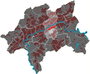
The Kothen residential area in Wuppertal is one of ten quarters in the Barmen district . The quarter emerged from one of the medieval courtyards of Barmen .
geography
The 1.85 km² residential area is located at the foot of the Wuppertaler Südhöhen . In the north it is bounded by the Elberfeld – Dortmund railway line , in the east by the streets Fischertal and Obere Lichtenplatzer Straße and in the west by Oberbergische Straße . In the south, in the Kothener Busch forest area, the district borders the Lichtenplatz residential area without a natural boundary line . The waters include the Fischertaler , the Springer , the Kothener and the Auer Bach . The north of the residential area is densely populated, while the south stretching up the slopes is largely forested.
Verkehrsgeografisch is the residential district four railway crossings (Fischer Viaduct, Victory Bridge, Fing Scheid bridge Unionstr.) From the north, on the Zeughausstraße from the west, the Upper Lichtenplatzer road and Oberbergische road from the south and the Knights street and the street On the lower Barmer cemetery to the surrounding quarters. The bus line 628 crosses the central east-west axis and thus takes over the development of the district in the direction of Barmer and Elberfeld center. Public transport is provided via the Wuppertal-Barmen train stations (RE and S-Bahn lines in the direction of Dortmund and Düsseldorf) and Wuppertal-Unterbarmen (S-Bahn), as well as the bus lines CE61 and 640 on the edge of the district.
Infrastructure
The infrastructure includes:
- Barmer Bahnhof and Wuppertal Opera House with the historic center on the border with the residential area Friedrich-Engels-Allee
- District sports facility Oberbergische Strasse
- Wuppertal Youth Hostel
- Barmer systems on the border to the residential district Heidt (district)
- Petruskirche parish center (see list of sacred buildings in Wuppertal )
- six schools:
- All-day high school Johannes Rau
- High School Am Kothen
- Vocational school on the Kothen
- Waldorf School Rudolf Steiner School
- Community elementary school Peterstraße
- Secondary school, community school Emilienstraße
Etymology and history

Kothen is a derivative of Kotten , a smaller courtyard or living space. The living space on the Kothener Bach was in the area of today's Schloßstraße at the corner of Fingscheid and is now part of a small park.
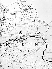
In 1715, Kothen is recorded on the Topographia Ducatus Montani by Erich Philipp Ploennies as a.Koten . With the other farms in the Barmen farming community , Kothen was part of the Bergisches Amt Beyenburg until 1806.
The residents of the Kothener Hof belonged to the Barmer Garnbleicher guild. The “Kothener Garnkasten ” on the Kothener Bach, which was removed around 1920, was one of the historically significant buildings in Kothen .
In 1815/16 there are 97 inhabitants. Which according to the statistics and topography of the district of Dusseldorf in 1832 as Ackergut categorized place was as encouraging Kothen called and had at that time seven houses and two farm buildings. At that time, 67 residents lived in the village, five of them Catholic and 62 Protestant.
The oldest surviving buildings include Böckmannsbusch 31-33 (approx. 1750-1800), Villa Dahl (1834) in Schlossstrasse 3 and Irmgardstrasse 47 (approx. 1840). Before the construction of the railway, the property of the Engels family extended to Springer Strasse (today the Emilienstraße bridge ). In the quarter there are a total of 70 buildings under monument protection, ranging from classical to art nouveau to cooperative buildings from the 1930s. With a total of 35 monuments, the streets Emilienstraße , Im Springen and Siegesstraße show a focus of the historically valuable buildings in the quarter.
For a long time, the Elberfeld-Dortmund railway line ensured only sparse development on the Unterbarmer Südhöhen due to its barrier function. It was not until the 1880s that the settlement structure began to densify. Today's Fischertal was one of the first dense streets.
During the Barmer attack on May 30, 1943, the eastern streets of Fischertal , Borkumer Strasse , Ehrenstrasse and Fischerstrasse were particularly hard hit. Today, there are no more buildings reminding of the time before 1943.
From the 1960s onwards, more streets were built with mostly single-family houses and vacant lots in the existing structures were closed. Old industrial wastelands such as the Budde dye works on Springer Bach (Edith-Stein retirement home) and the factory on Schluchtstraße ( Marie-Curie-Straße settlement ) were demolished and re-used. In addition, factory buildings were converted into high-quality lofts (e.g. Winkelsträterfabrik Oberbergische Straße 63 and Bandfuchsfabrik Emilienstraße 11 ).
The most famous residents of the quarter were Johannes Rau , who lived in Im Springen when he was a child , and Pina Bausch , who lived in a house on Siegesstrasse .
Today the upper Hinsberg in particular is a popular residential area and, after the Toelleturm, has one of the highest standard land values in Barmen.
See also
Web links
Individual evidence
- ↑ a b Johann Georg von Viebahn : Statistics and Topography of the Administrative District of Düsseldorf , 1836
- ↑ Land value map Wuppertal


