List of architectural monuments in Bergisch Gladbach
The list of architectural monuments in Bergisch Gladbach contains the listed buildings in the area of the city of Bergisch Gladbach in the Rheinisch-Bergisches Kreis in North Rhine-Westphalia (status: October 2016). These architectural monuments are entered in the list of monuments of the city of Bergisch Gladbach; The basis for the admission is the Monument Protection Act North Rhine-Westphalia (DSchG NRW).
Existing architectural monuments
| image | designation | location | description | construction time | Registered since |
Monument number |
|---|---|---|---|---|---|---|
|
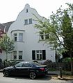
Residential building |
Stadtmitte Am Mühlenberg 24 map |
02/24/1982 | 1
|
||

|
Residential building |
Stadtmitte Am Mühlenberg 26 map |
1907 | 02/24/1982 | 2
|
|
|
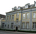
Residential building / office building on the left (267) Zanders Foundation on the right (269) Altenberger Domverein |
City center Hauptstr. 267/269 card |
former city villa Hans Zanders | 1875 | 02/24/1982 | 3
|

|
Residence Altes Pastorat in Alt Refrath |
Alt Refrath Kirchfeld 18 map |
former pastorate, half-timbered house | 02/24/1989 | 4th
|
|

|
Residential building |
Hebborn Unterhebborn 3 map |
Unterhebborn location | 1546 | 02/24/1982 | 5
|

|
former Asselborn mill , now a residential building |
Herkenrath Asselborner Weg 11, 11a map |
Residential house, restaurant | 19th century | 02/24/1982 | 6th
|

|
Residential building |
Alt Refrath Stachelsgut 38 map |
Location of Stachelsgut | Mid 19th century | 02/24/1982 | 7th
|
 more pictures |
Maltese Commandery |
Herrenstrunden Herrenstrunden 23 card |
Hotel, restaurant | 2nd half 17th century | 02/24/1982 | 8th
|
 more pictures |
Catholic parish church of St. Nicholas |
Bensberg Nikolausstr. 9 card |
Faith house | 1877 | 02/24/1982 | 9
|

|
Crossroads in front of the house |
City center Hauptstr. 315 card |
End of 18th century | 02/24/1982 | 10
|
|

|
Former way cross Rommerscheider Höhe, today altar cross Rommerscheid |
Rommerscheid Catholic Church Rommerscheid Map |
see discussion monument 11, altar cross | Body 17./18. Century | 02/24/1982 | 11
|

|
Weyerburg Villa and park |
Bensberg Overather Str. 8 map |
Mid 19th century | 05/17/1982 | 12
|
|

|
Residential building |
Bensberg Jan-Wellem-Str. 12 / Zur Hardt 13 card |
18th century | 06/23/1982 | 13
|
|

|
Residential building |
Bensberg Milchborntalweg 43 map |
1st half of the 18th century | 06/23/1982 | 14th
|
|

|
Residential building |
Bensberg Burggraben 35 map |
Early 18th century | 06/23/1982 | 15th
|
|

|
Residential building |
Kaule Kaule 50 card |
18th century | 06/23/1982 | 16
|
|
 more pictures |
St. Antonius Abbas (Herkenrath) |
Herkenrath Im Fronhof 24 / Im Wiedenhof card |
Faith house | 06/23/1982 | 17th
|
|
 more pictures |
Town Hall (Bergisch Gladbach) |
Stadtmitte Konrad-Adenauer-Platz 1 map |
town hall | 1905/1906 | 06/23/1982 | 18th
|
 more pictures |
Old Bensberg Castle |
Bensberg Wilhelm-Wagener-Platz 1 map |
town hall | 1964-1969 | 06/23/1982 | 19th
|
 more pictures |
City Gallery Villa Zanders |
Stadtmitte Konrad-Adenauer-Platz 8 map |
gallery | 19th century | 06/23/1982 | 20th
|

|
Bergisches Museum for Mining, Crafts and Commerce Main building |
Bensberg Burggraben 17-21 map |
museum | 15th century | 06/24/1982 | 21st
|

|
Half-timbered house Bergisches Museum for Mining, Crafts and Trades School class and ribbon weaving |
Bensberg moat 9-13 map |
museum | 17th century | 06/24/1982 | 22nd
|

|
former market fountain Bergisch Gladbach |
City center pedestrian zone in front of Villa Zanders map |
1901 | 06/24/1982 | 23
|
|

|
Residential house / company building |
Schildgen Altenberger-Dom-Str. 275 card |
1st half of the 19th century | 07/15/1982 | 24
|
|
|
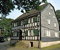
Hoverhof half-timbered house |
Schildgen Hoverhof 2 map |
1880 | 07/15/1982 | 25th
|
|
 more pictures |
Catholic parish church of St. Clement |
Paffrath Kempener Strasse o.Nr. map |
Faith house | 12th century | 07/15/1982 | 26th
|
 more pictures |
Evangelical Church of Grace |
Stadtmitte Hauptstraße 256/258 map |
Faith house | 1775/76 | 07.10.1982 | 27
|

|
Half-timbered house partially slated Gut Aufm Graben |
Bensberg Burggraben 37 map |
early 19th century | 07.10.1982 | 28
|
|
 more pictures |
St. Johann Baptist (Herrenstrunden) |
Men's rounds Men's rounds or no card |
Faith house | 14th century | 07.10.1982 | 29
|

|
Buchmühle half-timbered ensemble |
City center Buchmühlenstr. 17-21 card |
Office, restaurant, event venue | 07.10.1982 | 30th
|
|

|
French churchyard memorial cross on the franz. graveyard |
Bensberg In der Hardt card |
Memorial cross | 11/24/1982 | 31
|
|

|
Old Catholic Parish Church in Refrath |
Alt Refrath Alt Refrath / Stachelsgut map |
Faith house | 01/04/1983 | 32
|
|

|
Old rectory |
Sand Ommerbornstrasse 45 card |
Residential building | October 18, 1983 | 33
|
|
 more pictures |
Crossroads with trees |
Refrath at the corner of Bernard-Eyberg-Strasse / in front of Beningsfeld 35 map |
1765 | 01/06/1983 | 34
|
|
 more pictures |
Catholic parish church St. Laurentius |
Stadtmitte Konrad-Adenauer-Platz 3 map |
Faith house | 06/21/1983 | 35
|
|
 more pictures |
former Maltese mill |
Herrenstrunden Malteserweg 1 map |
06/21/1983 | 36
|
||

|
Steinbreche House |
Alt Refrath Dolmanstr. 17b card |
08/17/1983 | 38
|
||

|
Half-timbered building |
Bensberg Burggraben 4/6 map |
hotel | 08/17/1983 | 39
|
|

|
preserved part of the Bergischer Löwe community center |
City center Konrad-Adenauer-Platz / Hauptstraße 202 map |
08/17/1983 | 40
|
||

|
Residential building |
Heidkamp Bensberger Str. 188 map |
08/17/1983 | 41
|
||
 more pictures |
Zweiffel Castle |
Herrenstrunden Herrenstrunden 1 card |
08/17/1983 | 42
|
||

|
Wayside cross |
Herkenrath Kierdorf, opposite No. 22/26 map |
08/17/1983 | 43
|
||

|
Wayside cross |
Hebborn Odenthaler Str. 261 map |
08/17/1983 | 44
|
||

|
Residential building |
City center Richard-Zanders-Str. 47 card |
08/17/1983 | 45
|
||

|
Paffrath Mill |
Paffrath Paffrather Mühle 1 card |
08/17/1983 | 46
|
||

|
Hochkreuz in the St. Laurentius cemetery |
Stadtmitte Dr.-Robert-Koch-Strasse map |
October 18, 1983 | 47
|
||

|
Wayside cross |
Herkenrath Ball 15/17 card |
October 18, 1983 | 48
|
||

|
Wayside cross |
Kaule in front of the house Kaule 55 card |
October 18, 1983 | 49
|
||

|
Half-timbered building |
Bensberg Fischbachstr. 3 card |
Today reception of the Hotel Malerwinkel | First documented mention in 1780 | October 18, 1983 | 50
|

|
Residential building |
City center Richard-Zanders-Str. 29 card |
October 18, 1983 | 51
|
||

|
Gasthaus Paas Restaurant building with a wooden cross |
City center Maria-Zanders-Anlage 1 map |
October 18, 1983 | 52
|
||
 more pictures |
Half-timbered building complex, Alte Dombach paper museum |
Sand Alte Dombach map |
museum | 1614 | October 18, 1983 | 53
|
|
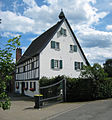
Hebborner Hof residential building |
Hebborn Hebborner Hof 1 map |
October 18, 1983 | 54
|
||

|
Reception building of the former train station in Gronau |
City center Gronauer Mühlenweg 2b map |
School, college | October 18, 1983 | 55
|
|

|
Quarry stone building Neues Herwegshaus |
Bensberg Burggraben 1 map |
04/01/1984 | 56
|
||

|
Half-timbered building in the coffee house |
Bensberg Burggraben 8-10 map |
04/01/1984 | 57
|
||

|
Wayside cross |
Herrenstrunden Unterhombach map |
04/01/1984 | 58
|
||

|
Half-timbered building |
Kaule Kaule 44 / 44a card |
04/01/1984 | 59
|
||
 more pictures |
Bensberg war memorial |
Bensberg Kadettenstrasse map |
03/27/1984 | 60
|
||

|
Crossroads on the property |
Herkenrath Im Fronhof 20 card |
03/27/1984 | 61
|
||

|
Half-timbered building |
Herkenrath Im Fronhof 21 card |
restaurant | 03/27/1984 | 62
|
|

|
Driescher Kreuz wayside cross |
City center at the corner of Hauptstrasse / Kalkstrasse map |
1799 | 03/27/1983 | 63
|
|

|
Wayside cross |
Hebborn Hebborner Strasse / Am Steinernen Kreuz map |
12/11/1984 | 65
|
||

|
Wayside cross |
Sand Kaltenbroich card |
January 24, 1985 | 66
|
||
 more pictures |
Wayside cross |
Lustheide Lustheide 44 map |
1897 | January 24, 1985 | 67
|
|

|
former parsonage Herkenrath |
Herkenrath Im Fronhof 30 card |
01/30/1985 | 68
|
||

|
Half-timbered building Rommerscheider Hof |
Rommerscheid Rommerscheider Str.153d map |
January 25, 1985 | 69
|
||
 more pictures |
Half-timbered building |
Rommerscheid Rommerscheider Höhe 60, 62 map |
01/28/1985 | 70
|
||
 more pictures |
Cardinal Schulte House |
Bockenberg Overather Str. 53 map |
Conference house | 02/05/1985 | 71
|
|
 more pictures |
House Blegge |
Paffrath Paffrather Str. 265 map |
Rehabilitation clinic for addicts | 03/14/1985 | 72
|
|

|
Wayside cross |
City center Gronauer Mühlenweg map |
1875 | 03/14/1985 | 74
|
|

|
Half-timbered building |
Halfen Dombach in the district of Sand Dombach 1 map |
March 27, 1985 | 75
|
||

|
Quarry stone building Rittergut Dombach |
Halfen Dombach in the Sand Dombach district 2 map |
Called "the castle" , it is to be restored |
March 27, 1985 | 76
|
|

|
Hardtknippen half-timbered building |
Herkenrath Hardtknippen 1 card |
March 27, 1985 | 77
|
||
 more pictures |
Lerbach Castle |
Heidkamp Lerbacher Weg 1 map |
Hotel Restaurant | 07/01/1987 | 78
|
|

|
Wayside cross |
Heidkamp Lerbacher Weg map |
March 27, 1985 | 79
|
||

|
Half-timbered building (formerly Oberlerbacher Mühle ) |
Sand Oberlerbach 1 card |
1804 and later | March 27, 1985 | 80
|
|

|
Half-timbered yard |
Sand Oberlerbach 2 card |
March 27, 1985 | 81
|
||

|
Half-timbered building |
Sand Ommerbornstrasse 41a card |
March 27, 1985 | 82
|
||

|
Forsthaus Steinhaus |
Bockenberg Steinhaus 1 map |
04/22/1985 | 84
|
||

|
Wayside cross |
Herkenrath Im Fronhof, between 12 and 14 card |
04/25/1985 | 85
|
||

|
Wayside cross |
Herkenrath streets 80 map |
04/25/1985 | 86
|
||

|
House from 1769 with cattle disease cross from 1797 "Gut aufm Pütz" |
Bensberg Gartenstr. 31 card |
1769 | 04/25/1985 | 87
|
|
|
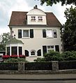
Residential buildings |
Heidkamp Gronauer Waldweg 28 map |
05/08/1985 | 88
|
||

|
Half-timbered building |
Herkenrath Im Fronhof 20 card |
05/08/1985 | 89
|
||

|
Half-timbered building |
Schildgen Unterscheider Weg 53/55 map |
05/09/1985 | 92
|
||

|
Imperial churchyard, Austrian cemetery and memorial |
Bensberg In der Hardt card |
05/31/1985 | 93
|
||

|
Wayside cross |
Herkenrath Bärbroicher Straße, opposite No. 8/10 map |
05/31/1985 | 94
|
||

|
Wayside cross |
Bärbroich in front of Bärbroich 52 card |
05/31/1985 | 95
|
||
 more pictures |
Wayside cross |
Refrath Vürels 76 card |
19th century | 05/31/1985 | 96
|
|

|
Wayside cross |
Moitzfeld Moitzfeld 46 map |
05/31/1985 | 97
|
||
 more pictures |
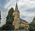
St. Severin (Sand) Catholic parish church St. Severin |
Sand Ommerbornstrasse / Herkenrather Strasse map |
Faith house | 05/31/1985 | 98
|
|

|
Rochus chapel sand |
Sand Herkenrather Strasse map |
Faith house | 05/31/1985 | 99
|
|

|
former cemetery Alter Kirchhof Sand |
Sand Ommerbornstrasse map |
05/31/1985 | 100
|
||

|
Büchelterhof half-timbered building |
Asselborn Am Büchelter Hof 1 card |
05/31/1985 | 101
|
||

|
Gierather Mill |
Gronau Gierather Mühlenweg 14 map |
05/31/1985 | 102
|
||

|
At the Waatsack restaurant building |
City center Hauptstr. 273 card |
Historic restaurant | 05/31/1985 | 103
|
|

|
Half-timbered building part of the Kesselshof |
Bensberg moat 23 map |
October 15, 1985 | 104
|
||

|
Half-timbered building |
Bensberg Burggraben 25a map |
October 16, 1985 | 105
|
||

|
Half-timbered building |
Herrenstrunden Oberhombach 1, 1a card |
October 16, 1985 | 106
|
||

|
Half-timbered building |
Herrenstrunden Oberhombach 5 card |
October 16, 1985 | 107
|
||

|
Half-timbered building |
City center Rommerscheider Höhe 60b / c map |
October 16, 1985 | 108
|
||
 more pictures |
Gut Schiff courtyard |
Herrenstrunden ship 1, 2 card |
10/22/1985 | 109
|
||

|
Wayside cross |
Bärbroich Vor Am Branderhof 1b card |
01/31/1986 | 110
|
||

|
7 footfalls |
Herkenrath Kath. Parish Church St. Antonius Abbas Map |
01/31/1986 | 111
|
||

|
12 grave crosses |
Herkenrath Kath. Parish Church St. Antonius Abbas Map |
01/31/1986 | 112
|
||

|
Kauler Hof restaurant building |
Kaule Kaule 55 card |
01/31/1986 | 113
|
||

|
Half-timbered building garden settlement Gronauerwald |
Heidkamp An der Eiche 1 card |
01/31/1986 | 114
|
||

|
Half-timbered building garden settlement Gronauerwald |
Heidkamp An der Eiche 2 card |
on the photo on the left | 01/31/1986 | 115
|
|

|
Half-timbered building garden settlement Gronauerwald |
Heidkamp An der Eiche 3 card |
on the photo on the right | 01/31/1986 | 116
|
|

|
Half-timbered building garden settlement Gronauerwald |
Heidkamp An der Eiche 4 card |
on the photo on the left | 01/31/1986 | 117
|
|

|
Half-timbered building garden settlement Gronauerwald |
Heidkamp An der Eiche 5 card |
on the photo on the right | 01/31/1986 | 118
|
|

|
Half-timbered building garden settlement Gronauerwald |
Heidkamp An der Eiche 6 card |
on the photo on the left | 01/31/1986 | 119
|
|

|
Half-timbered building garden settlement Gronauerwald |
Heidkamp An der Eiche 7 card |
on the photo on the right | 01/31/1986 | 120
|
|

|
Half-timbered building |
Stadtmitte Odenthaler Str. 41 map |
03/18/1986 | 121
|
||

|
German house residential building |
City center Hauptstr. 17 card |
03/19/1986 | 122
|
||

|
Half-timbered building |
Stadtmitte Hammermühle 3–5 map |
03/18/1986 | 123
|
||

|
Half-timbered building |
Town center Hammermühle 2 map |
03/18/1986 | 124
|
||

|
Half-timbered yard |
Herrenstrunden Büchel 18 card |
07/07/1986 | 126
|
||

|
Half-timbered building |
Kaule Uhlweg 2 map |
08/05/1986 | 127
|
||

|
Half-timbered building |
Kaule Uhlweg 4 map |
08/05/1986 | 128
|
||

|
Catholic parish church Hebborn Catholic parish church Hl. Dreikönige |
Hebborn Odenthaler Strasse 261 map |
Faith house | 11/27/1986 | 130
|
|

|
Slated half-timbered building |
City center Hauptstr. 133 card |
11/27/1986 | 131
|
||

|
Gasthaus Am Bock Restaurant building Am Bock |
City center Konrad-Adenauer-Platz 2 map |
Hotel Restaurant | 11/27/1986 | 132
|
|
 more pictures |
Kalköfen Cox former lime kiln plant |
Stadtmitte Paffrather Strasse map |
1858 | 07/01/1987 | 133
|
|

|
Half-timbered building |
Sand Ommerbornstrasse 64 card |
02/11/1987 | 134
|
||

|
House Offermann |
Bensberg Hundsiefen 5 card |
1920 | 02/11/1987 | 135
|
|
 more pictures |
New Bensberg Castle Extension of the entry; Takeover of the monument Kr. 83 |
Bensberg Kadettenstrasse 2 / Schloßstrasse map |
Hotel Restaurant | 1703 | 06/30/1988 | 136
|

|
Restaurant building |
City center Hauptstr. 316 card |
10/03/1988 | 137
|
||

|
Herrenstrunden outdoor pool, entrance building and subsequently single-storey tracts |
Herrenstrunden Kürtener Str. 339 map |
today beer garden and event location | 1930s | 12/02/1988 | 138
|

|
Wayside cross |
Herrenstrunden Gut Schiff Card |
1760 | December 6, 1988 | 139
|
|

|
Villa building |
Frankenforst Eichenhainallee 24 map |
11/24/1989 | 140
|
||

|
(Double) residential building |
Frankenforst forest belt 5 map |
11/24/1989 | 141
|
||

|
(Double) residential building |
Frankenforst forest belt 7 map |
11/24/1989 | 142
|
||

|
Residential building |
Stadtmitte Bensberger Str. 66 map |
The so-called Fritz Westphal House was built by Friedrich Westphal | 11/24/1989 | 143
|
|

|
Residential building |
Frankenforst Eichenhainallee 57 map |
05/15/1990 | 144
|
||

|
Villa building |
Frankenforst Parkstr. 18 card |
1910 | 05/15/1990 | 145
|
|

|
Villa building |
Frankenforst Parkstr. 6 card |
05/15/1990 | 146
|
||

|
former evgl. cemetery not far from evgl. Gnadenkirche |
Stadtmitte Quirlsberg 5 / Hauptstraße map |
memorial | 11/06/1990 | 147
|
|

|
Half-timbered building |
Paffrath Handstr. 272 card |
02/20/1991 | 148
|
||
![Lime kiln plant in the Zillertal quarry [1]](https://upload.wikimedia.org/wikipedia/commons/thumb/0/03/Kalkofen-Zillerstal.jpg/120px-Kalkofen-Zillerstal.jpg)
|
Lime kiln plant in the Zillertal quarry |
City center Hauptstr. 292 a map |
02/20/1991 | 149
|
||

|
Villa building |
Frankenforst Kastanienallee 9 map |
07/30/1991 | 150
|
||

|
Villa building |
Bensberg Kardinal-Schulte-Str. 26 card |
08/08/1991 | 151
|
||

|
Villa building |
Frankenforst Parkstr. 40 card |
07/30/1991 | 152
|
||

|
Mural "Joy of Life" in the town house |
Stadtmitte An der Gohrsmühle 18 map |
06/25/1992 | 153
|
||

|
Residential buildings |
Frankenforst Buchenallee 9 map |
06/25/1993 | 154
|
||

|
Residential building |
Frankenforst Eichenhainallee 29 map |
06/23/1993 | 155
|
||

|
Residential buildings |
Stadtmitte Paffrather Str. 42 map |
06/25/1993 | 156
|
||
|
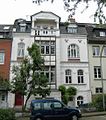
Residential buildings |
Stadtmitte Am Mühlenberg 15 map |
1903 | 06/23/1997 | 157
|
|

|
Warrior Memorial |
Lückerath Neuborn 2 map |
1859 | 03/25/1998 | 158
|
|

|
Max Bruch Memorial |
City center at the corner of Höhenweg / Margaretenhöhe map |
1935 | 08/25/2000 | 159
|
|

|
rose Garden |
City center at the corner of Odenthaler Straße / Am Broich map |
1930s | 09/19/2001 | 160
|
|

|
Residential building |
Herkenrath Alter Schulweg 13 map |
1827 | 11/19/2001 | 161
|
|

|
Belgian School Frankenforst |
Frankenforst Taubenstrasse 11/13 map |
1950 | 07/17/2003 | 162
|
|

|
Residential building |
City center Höhenweg 10 map |
1924 | 02/21/2005 | 163
|
|

|
Marienhof residential building "Marienhof" |
Gronau Mülheimer Str. 273 / Am Kuhlerbusch map |
1904 | 12/06/2005 | 164
|
|

|
Half-timbered building Gut an der Linde |
Moitzfeld Diakonissenweg 19 map |
19th century | 06/04/2007 | 165
|
|
 more pictures |
Sacred Heart Church |
Schildgen Altenberger Dom Strasse 140 map |
Faith house | 1959 | 10/19/2007 | 166
|

|
Half-timbered house |
Kaule Reiser 48 card |
19th century | 12/12/2007 | 167
|
|

|
Residential building |
Heidkamp Richard-Zanders-Straße 53 map |
1906/34 | 02/25/2011 | 168
|
|
 more pictures |
Bethanien Children's Village |
Lustheide Neufeldweg 26 map |
1964ff. | 05/13/2011 | 169
|
|

|
Herkenrath Gate |
Herrenstrunden Herrenstrunden 10 card |
Through gate | 17th century | 07/08/2011 | 170
|

|
Residential buildings |
Stadtmitte Hauptstrasse 303 map |
October 28, 2011 | 171
|
||

|
Tannenbergstrasse signal box |
City center Tannenbergstrasse map |
1868 | 04/01/2014 | 172
|
|

|
Service yard of Burg Zweiffel |
Herrenstrunden Herrenstrunden 4 card |
1660 | 04/01/2014 | 173
|
|

|
Tent church Kippekausen |
Kippekausen Am Rittersteeg 1 card |
Faith house | 12/10/2014 | 174
|
|

|
Memorial stone for the displaced |
Stadtmitte Forumpark map |
04/16/2015 | 175
|
||
|
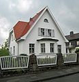
Residential building |
Kaule Broicher Strasse 40 map |
04/16/2015 | 176
|
||

|
Former rectory |
Herrenstrunden Herrenstrunden 28 card |
1873 | 06/09/2015 | 177
|
|

|
Former primary school in Heidkamp |
Heidkamp Bensberger Strasse 133 map |
social facilities, housing, commerce | 1892/1924 | 01/28/2016 | 179
|

|
former elementary school / former district court Bensberg |
Bensberg Schloßstraße 23 map |
office building | 1824 | December 15, 2015 | 180
|

|
Residential building |
Heidkamp Gronauer Waldweg 37 map |
1905/6 | 02.03.2016 | 181
|
|

|
Rectory |
Gronau Mülheimer Strasse 209 map |
Rectory | 1926 | 05/03/2016 | 182
|

|
Villa Offermann |
Bensberg Wipperfürther Straße 10-14 map |
1714 | 05/17/2016 | 183
|
|

|
Fachwerkkotten Oberdreispringen |
Bärbroich Oberdreispringen 29 card |
Half-timbered cottages | approx. 1880–90 | 06/28/2016 | 184
|

|
Residential building |
Heidkamp An der Tent 2 card |
1902/1903 | 08/29/2016 | 185
|
|

|
former Villa Bopp |
Heidkamp Richard-Zanders-Str. 49 card |
1899 | 05/10/2016 | 186
|
|

|
Villa Bopp |
Heidkamp Talweg 3 map |
Residential building (partly office use) | 1910 | 05/10/2016 | 187
|

|
House Alexi |
Bensberg Eichelstrasse 13-15 card |
Former estate on the Poelen, today a restaurant / bakery | Early 18th century | 06/08/2017 | 188
|

|
former civil servants' residence |
Heidkamp Bensberger Str. 92 map |
Residential building | 1904 | 08/17/2017 | 189
|

|
Old Weyerhof |
Bensberg Weyerhof 5–7 card |
Residential building | 16th Century | 05.10.2017 | 190
|

|
St. Maria Königin (Frankenforst) Church and parish buildings St. Maria Königin |
Frankenforst Im Hain 10 / Kiebitzstraße 22 map |
Pastoral use, previously monument no.A0178 (see under Discontinued architectural monuments) | 1954-1959 | October 19, 2017 | 191
|

|
Landhaus Offermann |
Bensberg Overather Str. 29 map |
Residential building | 1927 | 01/25/2018 | 192
|

|
former moth head estate |
Alt Refrath Alt Refrath 13 map |
restaurant | 18th century | 02/22/2018 | 193
|

|
former evangelical rectory |
City center Quirlsberg 2 map |
Rectory | 1899 | March 20, 2018 | 194
|
| Zanders paper mill , administration building |
Stadtmitte An der Gohrsmühle map |
1904 | 07/31/2018 | 195
|
||
| Zanders paper mill , gatehouse |
Stadtmitte An der Gohrsmühle map |
1898 | 07/31/2018 | 196
|
||
| Zanders paper factory , steam storage locomotive |
City center An der Gohrsmühle |
1898 | 07/31/2018 | 197
|
||
| Residential building |
Stadtmitte Hauptstraße 24 map |
The house, built from solid limestone, has a half-timbered roof area, a courtyard with a barn and is one of the oldest houses in town. At the time it was owned by Johann Wilhelm Guthair. In 1856 the landowner and lime manufacturer Franz Peter Siegen inherited the property. | circa 1800 | 08/28/2018 | 198
|
|
| Zanders paper mill , bust garden |
City center An der Gohrsmühle |
circa 1912 | 02.10.2018 | 199
|
||
| Zanders paper mill , power plant with chimneys |
Stadtmitte An der Gohrsmühle map |
1931 | 02.10.2018 | 200
|
||
| Zanders paper mill , machine house (museum) |
City center An der Gohrsmühle |
1898 | 02.10.2018 | 201
|
||
| Zanders paper mill , bleaching plant |
City center An der Gohrsmühle |
1880 | 02.10.2018 | 202
|
||
| Zanders paper factory , building with Dutch hall |
City center An der Gohrsmühle |
1880 | 02.10.2018 | 203
|
||
| Zanders paper factory , central workshop |
City center An der Gohrsmühle |
1880 | 02.10.2018 | 204
|
||
| Zanders paper mill , calender hall building |
City center An der Gohrsmühle |
1888 | 02.10.2018 | 205
|
||
| Zanders paper factory , sorting hall building |
City center An der Gohrsmühle |
1894 | 02.10.2018 | 206
|
||
| Zanders paper mill , high-rise warehouse |
City center An der Gohrsmühle |
1911/1912 | 02.10.2018 | 207
|
||
| Residential building |
Stadtmitte Hauptstrasse 68 map |
1924 | 10/11/2018 | 208
|
||
| Residential building |
Stadtmitte Odenthaler Str. 28 map |
1909 | 10/11/2018 | 209
|
||
| Residential building |
Frankenforst Nachtigallenstraße 2 map |
MAN steel house | 1952 | January 18, 2019 | 210
|
|
| Fallen memorial and Ferdinand Stucker -Denkmal |
Bensberg Deutscher Platz map |
1930/1931 | January 18, 2019 | 211
|
||
| Residential building |
Stadtmitte Feldstrasse 127 map |
1923 | 02/04/2020 | 212 |
Lost monuments
| image | designation | location | description | construction time | Registered since |
Monument number |
|---|---|---|---|---|---|---|

|
Wegekreuz (the now restored wayside cross by Breite is now in Sand on the corner of Ommerbornstrasse and Schulstrasse) |
Herkenrath Broad Map |
deleted on 06/27/2000 | 06/21/1983 | 37
|
|

|
Hammer mill |
Town center Hammermühle 1 card |
Half-timbered house (no longer exists), deleted on 09/30/1997 | 64
|
||

|
Half-timbered building (was rebuilt in the Bergisches Museum for Mining, Crafts and Commerce ) |
Bensberg Gartenstrasse 13 map |
deleted on 11/28/1989 | 73
|
||

|
former police station building today Trattoria Enoteca |
Bensberg Kadettenstrasse map |
deleted by taking over in monument no. 136 Schloss Bensberg | 04/10/1985 | 83
|
|

|
Half-timbered building (no longer exists), today this new building stands there. |
Romaney Kley 4 card |
deleted on 08/02/2000 | 05/08/1985 | 90
|
|
|
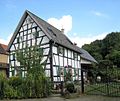
Half-timbered building (was rebuilt in 2011 in Sand 39) |
Hebborn Romaneyer Str. 34 map |
deleted on 10/12/2007 | originally 1697 | 05/09/1985 | 91
|

|
Half-timbered building (no longer exists) these two new houses are here today |
Romaney Unterholz 3 card |
deleted on 04/23/1987 | 125
|
||

|
Ore mining plant with headframe ( Julien pit ) (no longer exists) |
Kaule Broicher Strasse map |
deleted on 07/25/1989 | 129
|
||

|
St. Maria Königin (Frankenforst) Catholic Church St. Maria Königin |
Frankenforst Kiebitzstraße 22 map |
deleted on 09/29/2016; Newly registered as a monument A0191 | 178
|
Individual evidence
- ^ Article in the Bergische Landeszeitung on December 12, 2013, accessed on February 3, 2014
- ↑ Matthias Niewels: Despite monument: Owner wants to tear down in Bergisch Gladbach 200 year old house. February 27, 2019, accessed on February 28, 2019 (German).
literature
See also
Web links
Commons : Cultural heritage monuments in Bergisch Gladbach - Collection of images
- Monument descriptions on the website of the Bergisches Geschichtsverein, Rhein-Berg
