
Sainte-Geneviève (Manche)
| Sainte-Geneviève | ||
|---|---|---|
|
||
| region | Normandy | |
| Department | Some | |
| Arrondissement | Cherbourg | |
| Canton | Val-de-Saire | |
| Community association | Communauté d'agglomération du Cotentin | |
| Coordinates | 49 ° 39 ′ N , 1 ° 19 ′ W | |
| height | 9-60 m | |
| surface | 4.95 km 2 | |
| Residents | 318 (January 1, 2017) | |
| Population density | 64 inhabitants / km 2 | |
| Post Code | 50760 | |
| INSEE code | 50469 | |
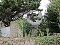
_-_Mairie.JPG) The Mairie |
||

Sainte-Geneviève is a French municipality with 318 inhabitants (as of January 1 2017) in the department of Manche in the region of Normandy . It belongs to the Arrondissement of Cherbourg and the Canton of Val-de-Saire .
location
The municipality is located in the Val de Saire countryside on the Cotentin peninsula . It is bordered to the northwest by Tocqueville , to the northeast by Gatteville-le-Phare , to the east by Montfarville and to the south and southwest by Valcanville .
Population development
| year | 1962 | 1968 | 1975 | 1982 | 1990 | 1999 | 2008 | 2015 |
|---|---|---|---|---|---|---|---|---|
| Residents | 296 | 281 | 286 | 296 | 256 | 293 | 316 | 322 |
Attractions
- Sainte-Geneviève church
- Manoir d'Arville (mansion), monument historique since 1982
Manoir d'Arville

Sainte-Geneviève church


Web links
Commons : Sainte-Geneviève - collection of images, videos and audio files