
Samut Prakan (Province)
| Samut Prakan | |
|---|---|
| สมุทรปราการ | |

|
|
| statistics | |
| Capital: | Samut Prakan |
| Telephone code: | 02 |
| Surface: |
1,004.1 km² 70. |
| Residents: |
2,089,200 (2017) 3. |
| Population density : | 2,081 E / km² 3. |
| ISO 3166-2 : | |
| Governor : | |
| map | |
  |
|
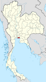
Samut Prakan ( Thai : สมุทรปราการ , [ sāmùt prāːkāːn ], something like "bulwark of the coast", ) is a province ( Changwat ) in central Thailand . It is located at the mouth of the Mae Nam Chao Phraya ( Chao Phraya River ) in the Gulf of Thailand , immediately south and southeast of the capital Bangkok, to whose metropolitan region it belongs. Samut Prakan is one of the most densely populated and one of the most economically important provinces. The capital of Samut Prakan Province is also called Samut Prakan .
geography
Samut Prakan is located at the mouth (Thai: Paknam ) of the Mae Nam Chao Phraya ( Chao Phraya River ) in the Gulf of Thailand and has a coastline of just over 47 kilometers. West of the Chao Phraya is predominantly agricultural land, mostly for rice cultivation . In the east is the urban center of the province with a large number of companies .
Samut Prakan belongs to the Bangkok metropolitan area , the transition between the two cities is fluid.
In terms of area, the province is somewhat larger than Berlin .
| Adjacent provinces and areas: | |
|---|---|
| north | Bangkok |
| east | Chachoengsao |
| south | Coast to the Gulf of Thailand |
| west | Bangkok |
climate
The climate is tropical - monsoonal . The number of annual rainy days is around 100 with a rainfall of 1064 mm.
Economy and Importance
Samut Prakan benefits from its proximity to the economic center of Thailand, the capital Bangkok. Many industrial companies have settled here that want to be close to the coast and avoid the capital's lack of space and constant traffic problems.
But agriculture , mostly rice , is also an important source of income for the province. After all, more than 36% of the area is designated as an agricultural area.
The "Gross Provincial Product" ( GDP ) of the province in 2009 amounted to 603.423 billion baht , the fourth highest value among Thailand's provinces. Manufacturing (289.266 billion baht), transportation, storage and communications (129.938 billion baht), and wholesale and retail (86.338 billion baht) contributed most of the province's economic output in 2011.
Land use
The following land use is documented for the province:
- Forest area: 6,995 Rai (7 km²), 1.1% of the total area
- Agricultural area: 131,296 rai (250.1 km²), 20.9% of the total area
- Unclassified area: 489,267 rai (756.6 km²), 78.0% of the total area
population
According to the 2000 census data, 99.8% of the population were Thai citizens. 97.7% were Buddhists, 1.5% Muslim. 0.5% said Chinese was their first language. 52.1% of the residents were not born in Samut Prakan, but moved from another province.
traffic
The Thanon Sukhumvit (National Road 3), which once served as the main connecting route between Bangkok and the eastern region, runs through the province of Samut Prakan . The Thang Phiset Burapha Withi ( Bang Na Expressway ) toll road and the Bangkok-Chonburi motorway (Autobahn 7), which is also subject to a fee , have now been created to relieve them and bypass them . In addition, the west of the province is intersected by Bangkok's outer ring road (Highway 9).
Suvarnabhumi Airport can be reached from Bangkok using the Airport Rail Link . So far, no other public mass transport systems serve the province. Since 2013, however, an extension of the light green line (Sukhumvit line) of the Bangkok Skytrain has been under construction. This should be completed by 2017.
Airport
Bangkok-Suvarnabhumi Airport , which opened in 2006 and is one of the busiest airports in Asia, is located in Bang Phli district , Samut Prakan province.
history

Samut Prakan was formed during the Ayutthaya period , but the center was initially in what is now the district ( Amphoe ) Phra Pradaeng . There were forts and city walls here . King Taksin had the fortifications razed after the fall of Ayutthaya.
In 1819, under King Rama II , the city was relocated to the municipality ( tambon ) Pak Nam, which lasted three years. Six new forts were built, of which only Phi Sua Samut and Phra Chulachomklao remain today.
Attractions

- Mueang Boran (also: Ancient City, Old City ) - skilfully laid open-air museum , one of the largest in the world; It shows objects, partly in their original size, partly as miniature versions of historical importance (e.g. the Sanphet Prasat audience hall from the royal palace of the former Kingdom of Ayutthaya , which was destroyed in 1767 ) on a surface that is roughly modeled on the outline of the national territory of Thailand .
- The Phra Samut Chedi was greeted 100 years ago, the first temple, which retracts into the Chao Phraya River sailors. The snow-white chedi was still in the middle of the river, it was called Phra Chedi Klang Nam (Chedi in the middle of the river). Today it lies on the west bank due to the formation of sediments .
- National parks:
- Bang Pu Nature Reserve - about 12 km east of Samut Prakan city, with many marine bird species; the reserve is operated by the Thai Army and WWF .
coat of arms
The coat of arms of Samut Prakan Province shows the Phra Samut Chedi temple , which is highly venerated in the province.
The local tree is Thespesia populnea .
The motto of Samut Prakan Province is:
- "Navy forts are here as a reminder,
- A pagoda in the middle of the mouth of the river
- And the largest crocodile farm in the world
- The old city with replicas of historical buildings,
- The Songkran Festival in Phra Pradaeng attracts many onlookers,
- Dried fish Pla Salit is delicious for those who try
- The city where the lotus festival is celebrated every year,
- And where different farms do their work. "
Administrative units
Provincial Administration
The province is divided into six districts ( Amphoe ) , which in turn are divided into 50 municipalities ( Tambon ) and further into 396 village communities ( Muban ) .
For the general elections, the province is divided into three constituencies, one of which sends three MPs and the other two two MPs each in the lower house.
|


Local administration
A provincial administrative organization ( บริหาร ส่วน จังหวัด , อบ จ for short , Ongkan Borihan suan Changwat ; English Provincial Administrative Organization , PAO) exists for the entire area of the province .
In the province there is one Thesaban Nakhon ( นคร นคร - "big city"): Samut Prakan ( เทศบาล นคร สมุทรปราการ ) and four Thesaban Mueang ( เทศบาล เมือง - "cities"): Paknam Samut Prakan ( เทศบาล เมือง ปากน้ำ สมุทรปราการ ) and Pu-Chao Ming Phraya ( เทศบาล เมือง ปู่เจ้าสมิงพราย ), Lat Luang ( เทศบาล เมือง ลัด หลวง ) and Phra Pradaeng ( เทศบาล เมือง พระประแดง ).
There are also eleven Thesaban Tambon ( เทศบาล ตำบล - "small towns").
Individual evidence
- ^ Gross Provincial Product at Current Market Prices: Bangkok and Vicinities, National Economic and Social Development Board, 2011.
- ↑ Status: 2009, based on Thailand in Figures . 13 ed. Nonthaburi 2011
- ↑ Key indicators of the population and households, Population and Housing Census 1990 and 2000: Samut Prakan
- ↑ Department of Provincial Administration : As of 2012 (in Thai)
Web links
- English page describing the history of Phra Samut Chedi. Made at the Sriwittayapaknam School.
- Overview map of Samut Prakan Province (names in Thai and English) [last accessed November 7, 2013]
North : Chiang Mai | Chiang Rai | Kamphaeng Phet | Lampang | Lamphun | Mae Hong Son | Nakhon Sawan | Nan | Phayao | Phetchabun | Phichit | Phitsanulok | Phrae | Sukhothai | Tak | Uthai Thani | Uttaradit
Northeast : Amnat Charoen | Bueng Kan | Buri Ram | Chaiyaphum | Kalasin | Khon Kaen | Loei | Maha Sarakham | Mukdahan | Nakhon Phanom | Nakhon Ratchasima | Nong Bua Lam Phu | Nong Khai | Roi Et | Sakon Nakhon | Si Sa Ket | Surin | Ubon Ratchathani | Udon Thani | Yasothon
Central : Ang Thong | Ayutthaya | Bangkok | Chachoengsao | Chai Nat | Chanthaburi | Chon Buri | Kanchanaburi | Lop Buri | Nakhon Nayok | Nakhon Pathom | Nonthaburi | Pathum Thani | Phetchaburi | Prachin Buri | Prachuap Khiri Khan | Ratchaburi | Rayong | Sa Kaeo | Samut Prakan | Samut Sakhon | Samut Songkhram | Saraburi | Sing Buri | Suphan Buri | Stepped
South : Chumphon | Krabi | Nakhon Si Thammarat | Narathiwat | Pattani | Phang-nga | Phatthalung | Phuket | Ranong | Satun | Songkhla | Surat Thani | Trang | Yala
Coordinates: 13 ° 36 ' N , 100 ° 36' E