
Herzogenburg
|
Borough Herzogenburg
|
||
|---|---|---|
| coat of arms | Austria map | |
 |
|
|
| Basic data | ||
| Country: | Austria | |
| State : | Lower Austria | |
| Political District : | Sankt Pölten-Land | |
| License plate : | PL | |
| Surface: | 46.16 km² | |
| Coordinates : | 48 ° 17 ' N , 15 ° 42' E | |
| Height : | 229 m above sea level A. | |
| Residents : | 7,844 (January 1, 2020) | |
| Postal code : | 3130 | |
| Area code : | 02782 | |
| Community code : | 3 19 12 | |
| NUTS region | AT123 | |
| UN / LOCODE | AT HER | |
| Address of the municipal administration: |
Rathausplatz 8 3130 Herzogenburg |
|
| Website: | ||
| politics | ||
| Mayor : | Christoph Artner ( SPÖ ) | |
|
Municipal Council : ( 2020 ) (33 members) |
||
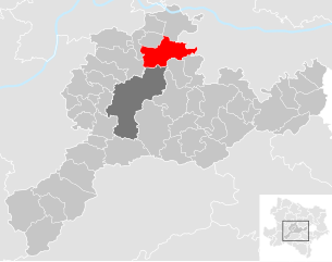
| Location of Herzogenburg in the Sankt Pölten-Land district | ||
  |
||
 Center of Herzogenburg |
||
| Source: Municipal data from Statistics Austria | ||

Herzogenburg is a municipality with 7844 inhabitants (as of January 1, 2020) in the district of Sankt Pölten-Land in the lower Traisental in Lower Austria .
geography
Geographical location
Herzogenburg is located in the lower Traisental in Lower Austria on the Krems expressway S 33 about 11 km north of St. Pölten ( provincial capital of Lower Austria) and about 20 km south of Krems (road kilometers in each case). The area of the municipality covers 46.16 square kilometers. 28.6 percent of the area is forested.
Community structure
The municipality includes the following 17 localities (population in brackets as of January 1, 2020):
- Adletzberg (79)
- Angern (113)
- Ederding (73)
- Desert (246)
- Gutenbrunn (142)
- Heiligenkreuz (21)
- Herzogenburg (3050) including Am Hainer Berg and Krenntal
- Oberhameten (30)
- Oberndorf in the plain (2114)
- Upper winches (221)
- Ossarn (813)
- Pottschall (6)
- St. Andrä an der Traisen (630)
- Lower hametes (32)
- Underwinding (160)
- Wielandsthal (108)
- Wiesing (6)
The community consists of the cadastral communities of Adletzberg, Angern, Ederding, Einöd, Gutenbrunn, Hameten, Herzogenburg, Oberndorf in the plain, upper winds, Ossarn, Pottschal, St. Andrä an der Traisen, Unter winds and Wielandsthal.
Incorporations
On January 1, 1968, the municipality of Ederding was merged with Herzogenburg, and on January 1, 1971, Gutenbrunn and Sankt Andrä an der Traisen.
history
Neolithic to the 19th century
The Herzogenburg area has been inhabited since the Neolithic Age and is therefore one of the oldest inhabited areas in Austria. In ancient times it was part of the Roman province of Noricum .
- Corridor lime kiln:
In the Herzogenburger Flur Kalkofen, a group of graves dating from the La Tène period was uncovered. It consists of three circular and one square grave complex with some grave goods. The most important objects are an animal head fibula, a fibula with profiled ornaments soldered onto it and a grip fishing sword with a human face as a grip knob. To the south of it, a late La Tène settlement was excavated with a pottery kiln . The furnace has two heating channels that are separated by stone slabs and a perforated plate for the items to be fired. The model of such a furnace can be seen in the Prehistory Museum Schloss Asparn . The pottery finds are also dated to the late Latène period.
- Oberndorf on the plain:
A Celtic burial ground was uncovered in 1982/83 in the lower Traisental during the construction work for the expressway feeder "Herzogenburg Süd" near Oberndorf on the plain. It contained 14 cremation graves from the Hallstatt and 4 cremation and 18 body burials from the early La Tène period . Some warriors' graves and a double burial of two women date from the Latène period (grave goods are chokers, a situla and a lens bottle), as well as a quadruple occupancy with square or round grave borders. A woman's grave contained bracelets and ankle bracelets, as well as a Weidach type fibula , which is one of the latest Hallstatt fibula types. In the immediate vicinity, in the cadastral municipality of Unterradlberg , an iron axle nail from the spring atène with a bronze mask decoration was found.
- Modern times:
The place was first mentioned in a document in 1014. The name is derived from Herzogenburg = castle of the dukes . In the 9th century, two brothers and border counts of the Bavarian Ostmark named Wilhelm II and Engelschalk I , who died in 871 in the battle against the Moravians , founded a border fortress. The rapid settlement in the protection of this complex underlines its special importance. For the use of the name Herzogenburg (traceable from 1014) it may have played a role that the fortress of the aforementioned border counts was subsequently subordinate to the Bavarian dukes.
The margraves of the Grenzmark, which was newly established after the Hungarian storm (907–955), remained wealthy in the Herzogenburg area long after the 1156 elevation to the Duchy of Austria . In the necrology of the Provostry St. Andrä an der Traisen under the date November 4, 1203, the entry: "Ruedegerus Marchio" (Margrave Rüdiger ). This was the historical model for the literary figure of Rüdiger von Bechelaren in the Nibelungenlied . The Herzogenburg area thus also has a considerable cultural tradition in the Middle Ages , which the name of the “ Nibelungen Pharmacy” still refers to today .
- The "Lower Market ":
It is the oldest part and was built in the area of today's Wiener Straße around the Duke's castle. The settlement received market rights as early as 1100 . The market square was on today's Rathausplatz . In 1192 was the holding of Babenberg , the Austrian sovereigns located "Lower Market" in-blown areas to Neunkirchen (Lower Austria) to the pin Formbach am Inn transmitted, the up 1803 manorial exercised, allowing citizens of the lower market manorial Were subjects of this Bavarian monastery.
- The "Upper Market":
In 1014, Emperor Heinrich II gave the Bishop of Passau a reason to build a church. Somewhat outside the existing village, raised on a gravel step, the Romanesque church of St. Stephen , a rectory, a cemetery with Karner and a small district "auf der Widem " (= dedicated to the church) were built in the area of today's church square .

In 1244 the Augustinian Canons and Choir Women Monastery of St. Georgen was relocated to Herzogenburg. Many servants and craftsmen came with the canons and the new district of Herzogenburg on the Widem was created . In 1548 he was granted market rights . It was called Oberer Markt because it was located higher up and was administered by the Canon Monastery.
At the beginning of the 14th century, the entire place was surrounded by a two-kilometer-long and four-meter deep moat, which was accompanied by an earth wall. However, multiple conquests and destruction of the monastery in the late Middle Ages could not be prevented.
Both markets were later also within a common wall, which was built in 1598 because Herzogenburg was a war zone from the first Turkish siege in 1529 to the second in 1683. The place was also fully affected by the turmoil of the Thirty Years War from 1618 to 1648. In contrast to Krems, which the Swedes conquered in 1645, and St. Andrä an der Traisen, which fell victim to a Turkish attack in 1683, Herzogenburg was never captured during this long war period, with the Herzogenburg Abbey playing the decisive role in the defense.
The two markets remained strictly separate from each other due to the different lordship relationships. Each had its own coat of arms , its own administration, its own jurisdiction and its own office building.
1421 was the year of the persecution, expulsion and exile of all Herzogenburg Jews due to the edict of the Habsburg Duke Albrecht V in the course of the so-called Viennese Gesera . (The persecution and extermination of Jews in seventeen Austrian towns took place in Austria because of an alleged host crime in Enns .)
From the 19th century to the Second World War
In 1808 the markets were united, the coat of arms of the lower market was taken over from the united market.
After the revolution of 1848 and the conversion of the manors into regional authorities, Herzogenburg became a market town with councilors and mayors elected for the first time.
In 1875, Carl Grundmann relocated the company he founded in Vienna in 1862 to Ossarn and in 1880 to Herzogenburg and built a new factory on the Traisen. In doing so, he laid the foundation for the creation of the Herzogenburg industrial center, which until then had a predominantly agricultural and commercial social structure. As early as 1914, the Gebrüder-Grundmann-Werke , which celebrated their 150th anniversary in 2012, were the largest manufacturer of locking goods in the Danube Monarchy with over four hundred employees . The urban census that was carried out in 1927, despite the fact that the population was actually far too small for this, of only 2700, was the result of this development.
From 1930 the Herzogenburg Aviation Club was headed by the well-known aircraft designer Erwin Musger . After the war he invented the steel frame for motorcycles, which helped the Puchwerke in Graz to a sales boom of over 300,000 pieces. Musger is thus one of the fathers of the Austrian economic miracle from 1949, as his invention was also used in the hundreds of thousands of Puch scooters and mopeds, which enabled many new jobs to be created in Graz. Like Carl Grundmann, Musger is a world-class technician from Herzogenburg, since his invention revolutionized the entire European motorcycle industry.
World War II and post-war period
In the Second World War to the pen was a north airbase of the German Luftwaffe , the physical infrastructure is still partially preserved. On the Hohen Kölbling, an elevation west of the city, there was a glider piloting school and an air monitoring station, the foundations of which can still be seen on the south side despite massive shelling. Erwin Musger developed his designs here from 1933 to 1937.
From 1944 onwards, the Grundmann works in Herzogenburg were the target of Allied air raids, which caused considerable damage but spared the structure of the monastery. A Russian military cemetery commemorates the final battles of World War II in the Herzogenburg area.
From 1945 to 1955, Herzogenburg was occupied by Soviet troops. In the first year of the occupation, Dr. Minna Nemec, the "Angel of Herzogenburg", together with her assistant Sister Anna Naschenweng, is the only doctor within a radius of 20 kilometers to provide medical care for the population and the Soviet soldiers. She had come to the Herzogenburg combat area from Vienna as a medical doctor for the Red Cross and remained as a general practitioner in Herzogenburg until her severe Parkinson's disease in 1955. As a social democratic member of the municipal council, she also completely rebuilt the urban health system from 1945 onwards.
Only after the State Treaty did the city begin to prosper.
As a result of the incorporation initiated by Mayor Erich Sulzer from 1967, the large community of Herzogenburg was created. It began in 1967 with Ederding, and the process was concluded with St. Andrä an der Traisen and Gutenbrunn, where in 1971 strangers even shot into the local council in protest at the decisive meeting.
In 2010 the complete redesign of the town hall square was completed.
Population development

According to the results of the 2011 census, there were 7,828 inhabitants, in 2001 there were 7,738, in 1991 the municipality had 7,461, in 1981 7,299 and in 1971 7,423 inhabitants.
Culture and sights
- Augustinian Canons Stift Herzogenburg : Herzogenburg is also known for the Herzogenburg Abbey of the Augustinian Canons. With the exception of the collegiate church, this was comprehensively renovated with the monastery’s own funds, but also with considerable funds from the municipality, the state of Lower Austria, and many donations in preparation for the 900th anniversary in 2012. This means that one of Austria's most valuable architectural monuments will be preserved for posterity in its original state.
- Pilgrimage church 'Maria Heil der Kranken': built 1755–1758 by Josef Ohmeyer. Side altar pictures and ceiling frescoes are by Franz Anton Maulbertsch . It is located in Gutenbrunn.
- Baroque - Museum : The village Gutenbrunn also has a castle that serves as Baroque Museum since 1964th In summer there are regular matinees on Sundays .
- The former Augustinian canons of St. Andrä an der Traisen is now used as a geriatric center for the municipality of Vienna.
Regular events
- NÖKISS : the NÖKISS, the Lower Austrian Children's Summer Games, take place every year around Herzogenburg Abbey. These are a special attraction for children on the two weekends before school starts.
Economy and Infrastructure
In 2001 there were 328 non-agricultural workplaces, the number of agricultural and forestry operations was 121 according to the official survey of 1999. A well-known wine-growing company is the Herzogenburg Abbey Winery .
According to the 2001 census, the number of people in employment at the place of residence was 3318, which is significantly more than a third of the total population. The employment rate in 2001 was 44 percent.
Established businesses
The city is an important regional center of the metalworking industry. The industrial enterprises of the city, especially the brothers Grundmann -Werke that today the Swiss Kaba Group and the Georg Fischer - Group include, play the most important role as the largest employer.
The works were initially founded in Vienna in 1862 by the locomotive driver Carl Grundmann , who came from Danzig , and moved to Ossarn in 1874. After moving from Ossarn to a new, large factory building in Herzogenburg in 1880, the Carl Grundmann company quickly developed into the largest lock goods manufacturer in the Habsburg monarchy before the First World War and established Herzogenburg's reputation as the most important location for Austrian locking technology production. They were also decisive for the city census that took place in 1927, despite the fact that the population was actually too small, as mentioned above, with which its founder Carl Grundmann also became the actual “father of the city”. In 2012 they celebrated their 150th anniversary.
The Erber Group ("Biomin") had its company headquarters in Herzogenburg until the move to the new corporate headquarters in Getzersdorf in mid-2015, but the mixing plant and delivery warehouse will remain at the Herzogenburg location.
traffic
_Bahnhof_Herzogenburg.jpg)

Street:
Herzogenburg is located on the Krems expressway S 33 and is connected to it by three entrances and exits ( Herzogenburg North, Herzogenburg City, Herzogenburg South ). In 2014, the construction work for the construction of the Herzogenburg Stadt approach and exit was completed.
Herzogenburg is on the Tullnerfelder Bahn , from here the railway line to Krems an der Donau branches off.
The Traisental cycle path leads along the Traisen directly past Herzogenburg.
Public facilities
- Anton-Rupp-Freizeithalle: event and sports center including tennis hall, mini golf course, sauna and solarium area, bowling alley and restaurants.
- Aquapark adventure pool: Adventure pool on three hectares with numerous bathing and relaxation areas.
politics
Mayor of the municipality was Government Councilor Franz Zwicker (SPÖ) until November 12, 2018, he was succeeded by Vice Mayor Christoph Artner (SPÖ), and Kurt Schirmer is the City Office Director.
In the city council , there are a total of 33 seats after the municipal elections of 26 January 2020 the following distribution of seats:
Personalities
Daughters and sons:
- Sigismund II. Braun , abbot of the Cistercian Abbey of Lilienfeld
- Eik Breit , musician and actor
- Anton Burger , violinist and composer
- Klemens Flossmann (1892–1951), architect
- Maximilian Fürnsinn , provost of the Herzogenburg monastery
- Carl Grundmann , locksmith, first Austrian train driver of the Danube Monarchy, escape helper to Emperor Ferdinand in 1848, train driver to Emperor Franz Joseph and Emperor Maximilians, founder of the largest locking technology works of the Habsburg monarchy in Herzogenburg.
- Erwin Musger , aircraft and vehicle designer, who lived in Herzogenburg from 1930 and was a member of the local glider pilot's club, inventor of the pressed steel frame for the Puch motorcycles and thus co-founder of the Austrian economic miracle
- Minna Nemec , Med. Univ. Dr .; Herzogenburg's only doctor in 1945, social democratic councilor
- Anton Rupp , long-term mayor a. D., member of the state parliament a. D.
- Johann Michael Sattler , landscape painter
- Simone Stelzer , singer, actress
- Othmar Toifl (1898–1934), police officer and one of the murdered in the so-called Röhm putsch
- Franz Zwicker , Mayor, Councilor
City literature
sorted alphabetically by author
- Chronicle of the city of Herzogenburg . Manuscript. City archive Herzogenburg.
- Thomas Ebendorfer : Chronica Austriae . In: Alphons Lhotsky (Ed.): Rerum Germanicorum Scriptores. Bern / Zurich 1967.
- Karl Glaubauf : The Augustinian Canons' Monastery and the "Gebrüder Grundmann" works reflected in the history of the Herzogenburg city . In: Austria Forum , Graz 2011.
- Karl Glaubauf: Dr. Med. Minna Nemec and sister Anna - The angels of Herzogenburg . In: Austria Forum. Graz 2012.
- Karl Glaubauf: Franz Zwicker . In: Austria Forum. Graz 2014
- Karl Glaubauf, Franz Mrskos: 125 years of the labor movement and social democracy for Herzogenburg . Herzogenburg 2013.
- Karl Gutkas : State Chronicle of Lower Austria . Vienna 1994.
- Andreas Meiller : Excerpts from previously unprinted necrologies of the monasteries St. Peter in Salzburg and Admont in Styria as well as the provost's office St. Andrä an der Traisen in Austria under the Enns , Vienna, Gerold-Verlag, 1858.
- Christine Oppitz, Huberta Weigl: '' Sources on the gardens of the Augustinian Canons ' Monastery in Herzogenburg in the 18th century. '' In: Die Gartenkunst 15 (1/2003), pp. 170–192.
- Anton Rupp, HP Schmidbauer: Herzogenburg , St. Pölten 1991.
- Joachim Splett: Rüdiger studies . Munster 1964.
- Günther Wintersberger, Ferdinand Zeller: Social Democracy in Herzogenburg - The First Hundred Years = Festschrift on the occasion of the hundredth anniversary of the Herzogenburg Social Democracy in 1988. Krems 1988. without ISBN.
Web links
- 31912 - Herzogenburg. Community data, Statistics Austria .
- Entry on Herzogenburg in the database of the state's memory for the history of the state of Lower Austria ( Museum Niederösterreich )
- City of Herzogenburg , website of the municipality
- Entry on Unter dem Erzherzogshut in the Austria Forum , author / editor: Karl Glaubauf
- Community data on the homepage of the state of Lower Austria
Individual evidence
- ↑ Statistics Austria: Population on January 1st, 2020 by locality (area status on January 1st, 2020) , ( CSV )
- ↑ Statistics Austria: dissolutions or associations of municipalities from 1945
- ^ Susanne Sievers / Otto Helmut Urban / Peter C. Ramsl: Lexicon for Celtic Archeology. A-K and L-Z ; Announcements of the prehistoric commission in the publishing house of the Austrian Academy of Sciences , Vienna 2012, ISBN 978-3-7001-6765-5 , p. 760 f.
- ^ Sievers / Urban / Ramsl: Lexicon for Celtic Archeology. P. 1402 f.
- ↑ Third S33 connection bans around 400 trucks , noen.at from December 9, 2014, accessed on January 8, 2016.

Altlengbach | Asperhofen | Böheimkirchen | Brand-Laaben | Eichgraben | Frankenfels | Gablitz | Gerersdorf | Hafnerbach | Haunoldstein | Herzogenburg | Hofstetten-Grünau | Inzersdorf-Getzersdorf | Kapelln | Karlstetten | Box near Böheimkirchen | Kirchberg an der Pielach | Kirchstetten | Loich | Maria-Anzbach | Markersdorf-Haindorf | Mauerbach | Michelbach | Envious | Neulengbach | Neustift-Innermanzing | Nussdorf ob der Traisen | Ober-Grafendorf | Obritzberg-Rust | Perschling | Press tree | Prinzersdorf | Purkersdorf | Pyhra | Rabenstein an der Pielach | Schwarzenbach an der Pielach | St. Margarethen an der Sierning | Statzendorf | Stössing | Traismauer | Tullnerbach | Weinburg | Wilhelmsburg | Wölbling | Wolf pit
Cadastral communities: Adletzberg | Angern | Ederding | Desolate | Gutenbrunn | Hametes | Herzogenburg | Oberndorf in the plain | Upper winches | Ossarn | Pot scarf | St. Andrä an der Traisen | Winding under | Wielandsthal
Town: Adletzberg • Angern • Eder thing • Einöd • Gutenbrunn • Holy Cross • Herzogenburg • Oberhameten • Oberndorf in the plane • Oberwinden • Ossarn • Pott sound • St. Andrä an der Traisen • Unterhameten • Under winds • Wielandsthal • Wiesing
City: Herzogenburg District: Oberndorf in the plane villages: Adletzberg • Angern • Eder thing • Einöd • Gutenbrunn • Upper Hameten • Oberwinden • Ossarn • St. Andrä an der Traisen • Under winds • Wielandsthal settlement: On Hainerberg group of houses: Krenntal Weiler: Holy Cross • Pottschall • Unter Hameten • Wiesing Other locations: Bertagnolimühle Heiligenkreuz Castle
Counting area: Herzogenburg-Altstadt | Oberndorf-Southwest | Herzogenburg-Altst.-Umg-S | Ederding-Wielandsthal | Upper winds-Ossarn | St.Andrä an der Traisen | Gutenbrunn | Herzogenburg-Altst.-Umg-N | Oberndorf-North and East