Vážany u Vyškova
| Vážany | ||||
|---|---|---|---|---|
|
||||
| Basic data | ||||
| State : |
|
|||
| Region : | Jihomoravský kraj | |||
| District : | Vyškov | |||
| Area : | 545 ha | |||
| Geographic location : | 49 ° 15 ' N , 17 ° 3' E | |||
| Height: | 280 m nm | |||
| Residents : | 461 (Jan. 1, 2019) | |||
| Postal code : | 682 01 | |||
| License plate : | B. | |||
| traffic | ||||
| Street: | Topolany - Vážany | |||
| structure | ||||
| Status: | local community | |||
| Districts: | 1 | |||
| administration | ||||
| Mayor : | Zdeněk Ďuriník (as of 2010) | |||
| Address: | Vážany 95 682 01 Vyškov 1 |
|||
| Municipality number: | 593656 | |||
| Website : | www.antee.cz/vazany | |||
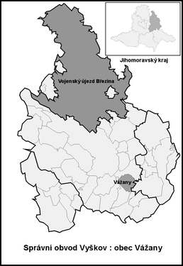
| Location of Vážany in the Vyškov district | ||||

|
||||
Vážany (German Waschan ) is a municipality in the Czech Republic . It is located six kilometers southeast of Vyškov and belongs to the Okres Vyškov .
geography
Vážany is located at the northwestern foot of the Litenčické vrchy . The Lysá hora (361 m) rises to the south-east, the Holý Kopec ( Kahle Mountain , 374 m) in the south-west and the Kopaniny (342 m) to the north-west.
Neighboring towns are Topolany in the north, Moravské Prusy , Boškůvky and Moravské Málkovice in the north-east, Orlovice in the east, Zdravá Voda in the south-east, Pavlovice , Kozlany and Bohdalice in the south, Manerov and Hlubočany in the south-west, Terešov and Zououvalka in the north-west, as well as Nououvalka in the west .
history
The village was first mentioned in a document in 1348 as the property of the Lords of Schwabenitz . In the second half of the 14th century Vážany was divided several times. Different families of the lower nobility took turns as owners of the shares. In 1406 Znata von Meilitz bought part of Vážany. Since 1510 all parts of the village belonged to the Moravské Prusy estate. In 1631 Leo Wilhelm von Kaunitz bought the Moravské Prusy estate with all its accessories and gave it to his lordship in Austerlitz . At the end of 1831, nine residents died in a cholera epidemic . Vážany remained subject to Austerlitz until the middle of the 19th century. The village was parish after Moravské Prusy.
After the abolition of patrimonial Važany / Waschan formed from 1850 a municipality in the district administration Wischau . The volunteer fire brigade was founded in 1882. Since the end of the 19th century the village has been called Vážany . In 1893 558 people lived in the 119 houses in the village. The village school was inaugurated in 1898. In 1911 a cooperative dairy was founded. In 1930 the community had 713 inhabitants. In 1946, after the primary school was closed, a kindergarten was established in the school building. In 1960 there were 647 people living in Vážany. Since 2008 the community has had a coat of arms and a banner.
Community structure
No districts are identified for the municipality of Vážany.
Attractions
- Plague chapel of St. Rosalia, built in 1695 in the Litenčické vrchy
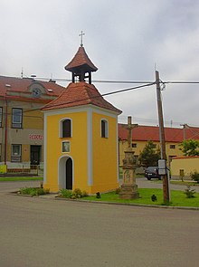
- Bell tower on the village green
- several crosses
- Remains of the Orlov castle, southeast of the village. The complex was probably built in the first half of the 9th century. Before 1200, the castle was expanded into a representative seat of the Orlow Coming John. The castle was destroyed at the beginning of the Hussite Wars.
- desert fortress Moravské Prusy, on a hill northeast of the village, probably arose around 1400 and died out in the middle of the 16th century. In 1591 it was called desolate.
Sons and daughters of the church
- Antonín Procházka (1882–1945), expressionist and cubist painter
Individual evidence
- ↑ Český statistický úřad - The population of the Czech municipalities as of January 1, 2019 (PDF; 7.4 MiB)


