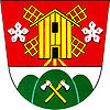
Zelená Hora
| Zelená Hora | ||||
|---|---|---|---|---|
|
||||
| Basic data | ||||
| State : |
|
|||
| Region : | Jihomoravský kraj | |||
| District : | Vyškov | |||
| Area : | 275 ha | |||
| Geographic location : | 49 ° 20 ' N , 17 ° 1' E | |||
| Height: | 368 m nm | |||
| Residents : | 290 (Jan. 1, 2019) | |||
| Postal code : | 683 21 | |||
| License plate : | B. | |||
| traffic | ||||
| Street: | Pustiměř - Podivice | |||
| structure | ||||
| Status: | local community | |||
| Districts: | 1 | |||
| administration | ||||
| Mayor : | Jan Školař (as of 2010) | |||
| Address: | Zelená Hora 32 683 21 Pustiměř |
|||
| Municipality number: | 593702 | |||
| Website : | mesta.obce.cz/zelena-hora | |||
| Location of Zelená Hora in the Vyškov district | ||||

|
||||
Zelená Hora (German Grünberg ) is a municipality in the Czech Republic . It is located six kilometers north of Vyškov at the foot of the Drahaner Bergland and belongs to the Okres Vyškov .
geography
Zelená Hora is located on the southeastern slope of the Drahaner Bergland . In the north is the Březina military training area . At the southwest end of the village there are remains of the old Slavic castle Dolní Mejlice, which is attributed to the Great Moravian Empire . To the east are the remains of the walls of Melice Castle from the 14th century.
Neighboring towns are Drysice in the east, Pustiměř and Pustiměřské Prusy in the south, and Radslavice and Radslavičky in the west.
history
Around 1720 individual houses were built on the site of the village. In 1763, the Olomouc bishop Maximilian von Hamilton left clearing land to his lordly loggers to found a village that initially consisted of six houses and was named Kopčany . In 1766 the village had grown to 21 houses. The place was later referred to as Grünberg .
After the replacement of patrimonial Kopčany / Grünberg formed from 1850 a district of Pustiměř in the district administration Vyškov . The place name Zelená Hora has also been used since the second half of the 19th century . In 1880 Kopčany or Zelená Hora formed an independent municipality. Since 1921 the municipality has had the official name Zelená Hora . During the German occupation in 1940, it was decided and carried out to expand the Wischau firing range into a large military training area for the Wehrmacht . 33 villages had to be cleared for the implementation of the extensive construction work on the Wischau military training area. In the first stage, until October 31, 1941, this also affected Grünberg. At that time the village had 521 inhabitants and consisted of 93 houses. The two windmills on the Nad Bochtálem hill on the eastern edge of the village were demolished in 1941. After the end of the Second World War , residents began to settle in the community again from June 1945. In the 1960s it was incorporated into Pustiměř. As a result of the re-establishment of the Czech state through the collapse of Czechoslovakia , the municipality of Zelená Hora was re-established as an independent administrative unit in 1990.
Community structure
No districts are designated for the municipality of Zelená Hora. The forest house Kotáry belongs to Zelená Hora.
Attractions
- Monument to the evacuation of the village, erected in 1946
- Pustiměř Castle Hill on Pustiměř Street
- Slavic castle stable Dolní Mejlice
- Melice castle ruins
- Bell tower, built in 1818
- baroque statue of St. John of Nepomuk
- Statue of St. Wenceslaus
Web links
- Community website
- Zelená Hora ( Memento of October 12, 2008 in the Internet Archive ) on www.travelatlas.cz
- Castle hill Pustiměř
- Melice Castle


