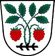
Malínky
| Malínky | ||||
|---|---|---|---|---|
|
||||
| Basic data | ||||
| State : |
|
|||
| Region : | Jihomoravský kraj | |||
| District : | Vyškov | |||
| Area : | 340 ha | |||
| Geographic location : | 49 ° 10 ' N , 17 ° 10' E | |||
| Height: | 320 m nm | |||
| Residents : | 143 (Jan. 1, 2019) | |||
| Postal code : | 683 32 | |||
| License plate : | B. | |||
| traffic | ||||
| Street: | Brno - Uherské Hradiště | |||
| structure | ||||
| Status: | local community | |||
| Districts: | 1 | |||
| administration | ||||
| Mayor : | Jiří Bartošík (as of 2010) | |||
| Address: | Malínky 75 683 33 Nesovice |
|||
| Municipality number: | 593290 | |||
| Website : | www.malinky.cz | |||
| Location of Malínky in the Vyškov district | ||||

|
||||
Malínky (German Malinek , formerly Mallinek ) is a municipality in the Czech Republic . It is located six kilometers north of Koryčany and belongs to the Okres Vyškov .
geography
Malínky is on the left side of the Litava ( Leitha ) at the transition between the Litenčické vrchy , Ždánický les ( Steinitzer Forest ) and Mars Mountains . To the north rises the Chroustová (345 m), in the northeast the Na Pasekách (380 m), southeast the Kraví hora (376 m), in the south the Žaroušky (352 m) and Padělky (332 m) and in the northwest the Galášky (311 m) m). The E 50 / I / 50 road from Brno to Uherské Hradiště runs through Malínky .
Neighboring towns are Kunkovice in the north, Lísky in the Northeast, Chvalnov and Kožušice the east, Střílky , Lískovec the southeast, Dvorek, Blišice, Koryčany and Mouchnice in the south, Nemotice and Snovídky in the southwest, Brankovice in the west and Komorov, Chvalkovice and Nemochovice in the northwest.
history
The first written mention of the village was in 1408 in connection with Jan Beličar von Malínky. The name of the place may be derived from the first name Malen . In 1481 Puta von Lichtenburg sold together with the castle Střílky also his share from Malínky to Johann the Elder of Oynitz. In the 16th century Malínky was attached to the Bučovice manor . At the beginning of the 17th century the village consisted of 21 properties. At this time the princes of Liechtenstein acquired rule. In 1790 49 families lived in the 44 houses of the village. In 1850 Malínky consisted of 58 houses and had 289 inhabitants.
After the abolition of patrimonial Malinky formed a community in the district administration Wischau from 1850 . In 1890 307 people lived in the 61 houses in the village. In 1890 the Liechtensteiners united the lords of Steinitz and Butschowitz to form Gut Butschowitz-Steinitz. The volunteer fire brigade was founded in 1911. Between 1950 and 1960 the community belonged to Okres Bučovice and after its dissolution came back to Okres Vyškov at the beginning of 1961 .
Community structure
No districts are shown for the municipality of Malínky.
Attractions
- Chapel of St. Trinity at the top of the village green, built in the 19th century
- Road cross, erected in 1748
- Kuče natural monument, south of the village, population of drought-loving plants
Individual evidence
- ↑ Český statistický úřad - The population of the Czech municipalities as of January 1, 2019 (PDF; 7.4 MiB)

