
Berkoth
| coat of arms | Germany map | |
|---|---|---|

|
Coordinates: 50 ° 3 ' N , 6 ° 20' E |
|
| Basic data | ||
| State : | Rhineland-Palatinate | |
| County : | Eifel district Bitburg-Prüm | |
| Association municipality : | South Eifel | |
| Height : | 519 m above sea level NHN | |
| Area : | 7.18 km 2 | |
| Residents: | 93 (Dec. 31, 2019) | |
| Population density : | 13 inhabitants per km 2 | |
| Postal code : | 54673 | |
| Area code : | 06564 | |
| License plate : | BIT, PRÜ | |
| Community key : | 07 2 32 011 | |
| LOCODE : | DE B7V | |
| Community structure: | 4 districts | |
| Association administration address: | Pestalozzistraße 7 54673 Neuerburg |
|
| Website : | ||
| Local Mayor : | Helmut Tholl | |
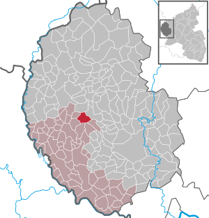
| Location of the local community Berkoth in the Eifelkreis Bitburg-Prüm | ||
  |
||

_01.jpg)
Berkoth is a municipality in the Eifelkreis Bitburg-Prüm in Rhineland-Palatinate . It belongs to the community of southern Eifel .
Geographical location
The place is in the Eifel and includes the districts Berkoth, Heinischseifen, Markstein and Burscheid.
history
Berkoth was first mentioned in the parish chronicle of Ringhuscheid in 1389 , but was probably created around 1100. The name is derived from "Bergroden" or "Birkenroden".
The district Burscheid was first mentioned in the 12th century as a molendium Buorsheit .
Until the end of the 18th century, Burscheid and Berkoth belonged to the Luxembourg rule of Neuerburg . During the French administration (1795-1814) the two localities were administered by the Mairie Weidingen , which belonged to the canton of Neuerburg in the department of forests .
Under the Prussian administration (after 1815) the place belonged first to the mayor's office of Weidingen in the district of Bitburg ( administrative district of Trier ), from 1871 to the mayor's office of Baustert .
After the First World War temporarily occupied by the French , the place has been part of the then newly formed state of Rhineland-Palatinate since 1946 .
The old chapel was built during the Thirty Years War and destroyed in the French Revolution, a new chapel was built in a different location between 1965 and 1967.
On January 1, 2003, the Burscheid community was incorporated into Berkoth.
- Population development
The development of the population of Berkoth, the values from 1871 to 1987 are based on censuses:
|
|
politics
Municipal council
The council in Berkoth consists of six council members, who in the local elections on May 26, 2019 in a majority vote were elected, and the honorary mayor as chairman.
coat of arms
|
|
Blazon : “Shield head in red with four silver battlements. Underneath a three-part shield with flank on the right in green and arrow in silver, with a heart post in silver and birch in green. Left flank in green with a silver ax. " |
| Reasons for the coat of arms: The shield head is based on red and silver from the County of Vianden . The four peaks refer to the districts of Berkoth, Markstein, Heinischseifen and Burscheid. The silver arrow is an attribute of the patron saint Sebastian . The birch symbolizes the place name Berkoth. The ax refers to the clearing of forests. |
The coat of arms was officially awarded to the community of Berkoth in September 2007.
Culture and sights
See: List of Cultural Monuments in Berkoth and List of Natural Monuments in Berkoth
literature
- Ernst Wackenroder (arr.): The art monuments of the Bitburg district (= Paul Clemen [Hrsg.]: The art monuments of the Rhine province . Volume 12 / I ). Trier 1983, ISBN 3-88915-006-3 , p. 30 (315 p., With 12 plates and 227 ills. In the text. Reprinted by the Schwann edition, Düsseldorf 1927).
Web links
- Local website about Berkoth (private website)
- Short portrait of Berkoth ( memento from February 12, 2013 in the web archive archive.today ) on SWR television
- To search for cultural goods of the local community Berkoth in the database of cultural goods in the Trier region .
Individual evidence
- ↑ State Statistical Office of Rhineland-Palatinate - population status 2019, districts, communities, association communities ( help on this ).
- ↑ State Statistical Office Rhineland-Palatinate (ed.): Official directory of the municipalities and parts of the municipality. Status: January 2019 [ Version 2020 is available. ] . S. 98 (PDF; 3 MB).
- ↑ Official municipality directory (= State Statistical Office of Rhineland-Palatinate [Hrsg.]: Statistical volumes . Volume 407 ). Bad Ems February 2016, p. 159 (PDF; 2.8 MB).
- ↑ State Statistical Office Rhineland-Palatinate: My village, my city. Retrieved August 2, 2019 .
- ^ The Regional Returning Officer Rhineland-Palatinate: Local elections 2019, city and municipal council elections. Retrieved August 2, 2019 .
Affler | Alsdorf | Altscheid | Ammeldingen on the Our | Ammeldingen near Neuerburg | Bauler | Berkoth | Berscheid | Biesdorf | Bollendorf | Castle | Dauwelshausen | Echternacherbrück | Eisenach | Emmelbaum | Ernzen | Ferschweiler | Fischbach-Oberraden | Geichlingen | Gemünd | Gentingen | Gilzem | Heilbach | Autumn Mill | Holsthum | Hommerdingen | Huts | Hüttingen near Lahr | Irrel | Karlshausen | Kaschenbach | Keppeshausen | Body | Koxhausen | Kruchten | Lahr | Leimbach | Menningen | Mettendorf | Minden | Muxerath | Nasingen | Neuerburg | Niedergeckler | Niederraden | Niederweis | Niehl | Walnut tree | Obergeckler | Peffingen | Plascheid | Prümzurlay | Rodershausen | Roth an der Our | Schankweiler | Log basket | Chafing | Sevenig near Neuerburg | Sinspelt | Überisenbach | Uppershausen | Utscheid | Waldhof-Falkenstein | Wallendorf | Weidingen | Doubt decision