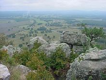
Conway County
 Conway County Courthouse |
|
| administration | |
|---|---|
| US state : | Arkansas |
| Administrative headquarters : | Morrilton |
| Address of the administrative headquarters: |
County Courthouse 117 South Moose Street Morrilton, AR 72110-3400 |
| Foundation : | October 20, 1825 |
| Made up from: | Pulaski County |
| Area code : | 001 501 |
| Demographics | |
| Residents : | 21,273 (2010) |
| Population density : | 14.8 inhabitants / km 2 |
| geography | |
| Total area : | 1468 km² |
| Water surface : | 27 km² |
| map | |
The Conway County is a county in the US state of Arkansas . The county seat is Morrilton .
geography
The county is east of the geographic center of Arkansas and has an area of 1,468 square kilometers, of which 27 square kilometers are water. It borders on the following counties:
| Van Buren County | ||
| Pope County |

|
Faulkner County |
| Yell County | Perry County |
history
| growth of population | |||
|---|---|---|---|
| Census | Residents | ± in% | |
| 1830 | 982 | - | |
| 1840 | 2892 | 194.5% | |
| 1850 | 3583 | 23.9% | |
| 1860 | 6697 | 86.9% | |
| 1870 | 8112 | 21.1% | |
| 1880 | 12,755 | 57.2% | |
| 1890 | 19,459 | 52.6% | |
| 1900 | 19,772 | 1.6% | |
| 1910 | 22,729 | 15% | |
| 1920 | 22,578 | -0.7% | |
| 1930 | 21,949 | -2.8% | |
| 1940 | 21,536 | -1.9% | |
| 1950 | 18,137 | -15.8% | |
| 1960 | 15,430 | -14.9% | |
| 1970 | 16.805 | 8.9% | |
| 1980 | 19,505 | 16.1% | |
| 1990 | 19,151 | -1.8% | |
| 2000 | 20,336 | 6.2% | |
| 2010 | 21,273 | 4.6% | |
| 1830-1890 1900-1990 2010 | |||
Conway County was formed on October 20, 1825 from parts of Pulaski County. It was named after Henry Wharton Conway , a member of the congressional delegation from Arkansas.
In January 1872, the county’s Lewisburg’s first newspaper, Wide Awake, was published. The Western Empire also started in May of the same year . The only daily newspaper still available today is the Petit Jean Country Headlight . The newspaper publisher was founded on April 8, 1874.
In 1889 Conway County gained negative national attention. John Middleton Clayton, the brother of former Governor Powell Clayton , was murdered in Plumerville. John Clayton ran in the 1888 congressional election against Democrat Clifton Rodes Breckinridge and narrowly lost. Clayton had the support of black Republican voters. In Conway County, a ballot box was stolen by four white armed men in a constituency that was mostly black. Clayton fought for the election and drove to Plumerville to investigate the missing votes. On January 29, 1889, he was shot through the window of his pension and died immediately. This incident went down as one of the most fraudulent elections in Arkansas history.
Demographic data
As of the 2010 census , Conway County had 21,273 people in 8,185 households. The population density was 14.8 inhabitants per square kilometer.
The racial the population was composed of 84.2 percent white, 11.2 percent African American, 0.7 percent Native American, 0.4 percent Asian and other ethnic groups; 2.0 percent were descended from two or more races. Regardless of ethnicity, 3.6 percent of the population was Hispanic or Latino of any race.
Statistically, 2.51 people lived in each of the 8,185 households.
24.5 percent of the population were under 18 years old, 60.0 percent were between 18 and 64 and 15.5 percent were 65 years or older. 51.0 percent of the population was female.
The median income for a household was 36,356 USD . The per capita income was $ 19,562. 19.6 percent of the population lived below the poverty line.
cities and communes
- other places
- Austin Township
- Bentley Township
- Bird Township
- Catholic Point Township
- Cedar Falls Township
- Gregory Township
- Griffin Township
- Higgins Township
- Howard Township
- Lick Mountain Township
- Martin Township
- McLaren Township
- Nichols Township
- Old Hickory Township
- Petit Jean Township
- St. Vincent Township
- Steele Township
- Union Township
- Washington Township
- Welborn Township
- White Eagle Township
Individual evidence
- ↑ GNIS-ID: 66846. Retrieved on February 22, 2011 (English).
- ^ US Census Bureau _ Census of Population and Housing.Retrieved February 17, 2011
- ^ Extract from Census.gov.Retrieved February 15, 2011
- ↑ United States Census 2010.Retrieved September 6, 2011
- ^ Extract from the Encyclopedia of Arkansas.Retrieved February 12, 2011
- ^ US Census Bureau, State & County QuickFacts - Conway County. Retrieved September 6, 2011
Web links
- US Census Bureau, State & County QuickFacts - Conway County
- Yahoo Image Search - Conway County
- www.city-data.com - Conway County
- Association of Arkansas Counties
Coordinates: 35 ° 16 ′ N , 92 ° 42 ′ W


