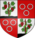
Hurigny
| Hurigny | ||
|---|---|---|

|
|
|
| region | Bourgogne-Franche-Comté | |
| Department | Saône-et-Loire | |
| Arrondissement | Mâcon | |
| Canton | Hurigny (main town) | |
| Community association | Mâconnais Beaujolais Agglomération | |
| Coordinates | 46 ° 21 ′ N , 4 ° 48 ′ E | |
| height | 222-391 m | |
| surface | 9.2 km 2 | |
| Residents | 1,983 (January 1, 2017) | |
| Population density | 216 inhabitants / km 2 | |
| Post Code | 71870 | |
| INSEE code | 71235 | |
| Website | http://www.hurigny.fr/ | |
Hurigny is a French commune with 1,983 inhabitants (as of January 1 2017) in the department of Saone-et-Loire in the region of Bourgogne Franche-Comté . It belongs to the arrondissement of Mâcon and the canton of Hurigny (until 2015: canton of Mâcon-Nord ). The inhabitants are called gueulatis .
geography
Hurigny is located in the Mâconnais in the Bourgogne wine region . Hurigny is surrounded by the neighboring communities of Laizé in the north, Mâcon (exclave Sennecé-les-Mâcon) in the northeast, Sancé in the east, Mâcon in the southeast, Charnay-lès-Mâcon in the south, Prissé in the southwest, Chavagny-les-Chevrières in the west and Southwest and La Roche-Vineuse to the west and northwest.
Population development
| year | 1962 | 1968 | 1975 | 1982 | 1990 | 1999 | 2006 | 2012 |
| Residents | 935 | 1,128 | 1,220 | 1,249 | 1,429 | 1,474 | 1,699 | 1.939 |
Attractions
- Romanesque church
There are several castles in the municipality:
- Hurigny Castle from the 18th century
- Salornay Castle
- Chazoux castle from the 18th / 19th centuries century
- La Fontaine Castle from the 18th century
- Guerret Castle from the 19th century
Web links
Commons : Hurigny - collection of images, videos and audio files

