
Leynes
| Leynes | ||
|---|---|---|

|
|
|
| region | Bourgogne-Franche-Comté | |
| Department | Saône-et-Loire | |
| Arrondissement | Mâcon | |
| Canton | La Chapelle-de-Guinchay | |
| Community association | Mâconnais Beaujolais Agglomération | |
| Coordinates | 46 ° 16 ′ N , 4 ° 44 ′ E | |
| height | 230-515 m | |
| surface | 4.83 km 2 | |
| Residents | 517 (January 1, 2017) | |
| Population density | 107 inhabitants / km 2 | |
| Post Code | 71570 | |
| INSEE code | 71258 | |
| Website | http://www.leynes.fr/ | |
 Town hall (Mairie) of Leynes |
||

Leynes is a French municipality with 517 inhabitants (as of January 1 2017) in the department of Saone-et-Loire in the region of Bourgogne Franche-Comté . The municipality is part of the arrondissement of Mâcon and part of the canton of La Chapelle-de-Guinchay . The inhabitants are called Leynois .
geography
Leynes is located in the Beaujolais countryside , in the Bourgogne wine region ; Here, the Crémant de Bourgogne is mainly produced from the grapes .
Leynes is surrounded by the neighboring communities of Chasselas in the north, Fuissé in the east and northeast, Chaintré in the east, Chânes in the southeast, Saint-Vérand in the south, Pruzilly in the west and southwest and Cenves in the west and northwest.
Population development
| year | 1962 | 1968 | 1975 | 1982 | 1990 | 1999 | 2006 | 2011 | 2016 |
|---|---|---|---|---|---|---|---|---|---|
| Residents | 471 | 472 | 420 | 438 | 468 | 503 | 487 | 494 | 524 |
| Source: Cassini and INSEE | |||||||||
Attractions
- Saint-Vital church
- Les Correaux castle from the 18th century
- Lavernette Castle
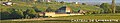
- Leynes Castle from 1423

Saint-Vital church

Les Correaux Castle
Lavernette Castle

Leynes Castle


