Montigny-en-Cambrésis
| Montigny-en-Cambrésis | ||
|---|---|---|

|
|
|
| region | Hauts-de-France | |
| Department | North | |
| Arrondissement | Cambrai | |
| Canton | Le Cateau-Cambrésis | |
| Community association | Caudrésis et Catésis | |
| Coordinates | 50 ° 6 ′ N , 3 ° 25 ′ E | |
| height | 111-150 m | |
| surface | 5.87 km 2 | |
| Residents | 562 (January 1, 2017) | |
| Population density | 96 inhabitants / km 2 | |
| Post Code | 59225 | |
| INSEE code | 59413 | |
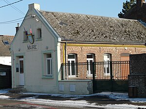
 Mairie Montigny-en-Cambrésis |
||
Montigny-en-Cambrésis is a municipality with 562 inhabitants (at January 1, 2017) in the French department of Nord in the region of Hauts-de-France . It belongs to the canton of Le Cateau-Cambrésis (until 2015 canton of Clary ) in the Arrondissement of Cambrai . It borders on Caudry to the north, Bertry to the east, Clary to the south and Ligny-en-Cambrésis to the west . The inhabitants call themselves Montignaciens .
history
Place names such as Montigniaco, Monteni or Montengni, Montenni, Montegni and Montigni appeared from the 11th to the 13th centuries. The current name is dated to 1931.
Population development
| year | 1962 | 1968 | 1975 | 1982 | 1990 | 1999 | 2008 | 2013 |
|---|---|---|---|---|---|---|---|---|
| Residents | 694 | 691 | 687 | 638 | 642 | 600 | 584 | 579 |
literature
- Le Patrimoine des Communes du Nord. Flohic Editions, Volume 1, Paris 2001, ISBN 2-84234-119-8 , pp. 560-561.
Web links
Commons : Montigny-en-Cambrésis - Collection of images, videos and audio files
