Morkůvky
| Morkůvky | ||||
|---|---|---|---|---|
|
||||
| Basic data | ||||
| State : |
|
|||
| Region : | Jihomoravský kraj | |||
| District : | Břeclav | |||
| Area : | 675 ha | |||
| Geographic location : | 48 ° 58 ' N , 16 ° 52' E | |||
| Height: | 198 m nm | |||
| Residents : | 480 (Jan. 1, 2019) | |||
| Postal code : | 691 72 | |||
| License plate : | B. | |||
| traffic | ||||
| Street: | Klobouky u Brna - Kobylí | |||
| Next international airport : | Brno-Tuřany | |||
| structure | ||||
| Status: | local community | |||
| Districts: | 1 | |||
| administration | ||||
| Mayor : | Brigita Petrášová (as of 2018) | |||
| Address: | Morkůvky 113 691 72 Klobouky u Brna |
|||
| Municipality number: | 584681 | |||
| Website : | www.morkuvky.cz | |||
Morkůvky (German Morkuwek , 1939–45 Morkuwetz ) is a municipality in the Czech Republic . It is four kilometers south of Klobouky u Brna and belongs to the Okres Břeclav .
geography
Morkůvky is located in the southwestern foothills of the Steinitz Forest ( Ždánický les ) in the Boleradická vrchovina. The village extends to the right of the Haraska stream on the northern slope of the Ochozy (319 m). To the north rise the Plunary (336 m) and Harasky ( Harrasberg , 278 m), southeast of the Hotařský kopec (239 m), in the south Ochozy and Hrádek, southwest of the Kuntinov (322 m), in the west the Přední kout (410 m) as well as northwest of the Nedánov (368 m). There are extensive vineyards in the north of the village.
Neighboring towns are Augustinov, Klobouky u Brna and Kašnice in the north, Krumvíř in the northeast, Brumovice in the east, Ostrůvek in the southeast, Kobylí and Bořetice in the south, Němčičky and Horní Bojanovice in the southwest, Boleradice in the west and Diváky and Martinice in the northwest.
history
The village, which belongs to the Boleradice estates, was first mentioned in writing in 1356. Morkůvky was originally laid out on both sides of the Haraska stream, with the old village square opposite today's location on a south-facing slope in a small valley at the foot of the Harasky at the location of the current location Kaštánka was located. The town center was later moved to the crossroads between Boleradice and Klobouky as the population increased. 1417 Morkůvky belonged together with Němčičky Wenzel Czihowka. Other owners were the Vladiken von Zástřizl . From Eliška von Zástřizl Morkůvky and Němčičky went in 1537 to their son Zdeněk Žampach von Potštejn. In 1594 Morkůvky and the Boleradice estate were attached to the Göding estate . The oldest place seal comes from the 17th century. Other owners included the Jakardovský von Sudice, Friedrich von Oppersdorff , Johann Adam Andreas von Liechtenstein and Josef Graf Czobor. He sold the rule to Emperor Franz I in 1762. In Morkůvky, teaching was carried out in a Protestant and a Catholic school since the beginning of the 19th century. Until the middle of the 19th century, the village always remained subject to Göding and owned by the Habsburgs .
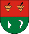
After the abolition of patrimonial Morkůvky formed from 1850 a community in the district administration Auspitz . In 1871 both schools were united. In 1921 Morkůvek had the highest population in its history with 811 inhabitants. After the Okres Hustopeče was abolished, the municipality was assigned to the Okres Břeclav in 1961. Morkůvky has had a coat of arms and a banner since 2000.
Local division
No districts are shown for the municipality of Morkůvky. Morkůvky includes the locality Kaštánka and the single layer Augustinov.
Attractions
- Free-standing bell tower from the 18th century, today it also serves as the entrance gate to the cemetery
- Three-sided Marterl on the Sokolovna at the exit to Boleradice
- František Peřina Museum, established in the previous school in 2006, is a reminder of the life of the pilot and lieutenant general
- Nature reserves Hrádek, Velký Kuntínov, Jesličky, Nosperk, Zázmoníky southwest of the village, protected since 1986
- Hrádek archaeological site on the hill of the same name, with remains of a fortification from the end of the Hallstatt period
- Hotařský Kopec archaeological site, a Slavic burial site with 25 bone graves was found on the hill in 1984. At the northern foot was the village of Topolany, which died out when the Tatar invaded at the beginning of the 13th century.
Sons and daughters of the church
- Josef Huták (1904–1975), painter and draftsman
- František Novotný (1908–1990), painter
- František Peřina (1911–2006), RAF fighter pilot in World War II
- Ludvík Dobeš (1914–1979), painter


