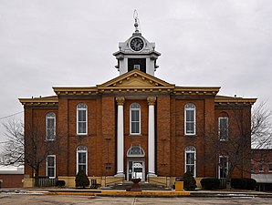
Stoddard County
 Stoddard County Courthouse |
|
| administration | |
|---|---|
| US state : | Missouri |
| Administrative headquarters : | Bloomfield |
| Address of the administrative headquarters: |
County Courthouse P.O. Box 110 Bloomfield, MO 63825-0110 |
| Foundation : | 1835 |
| Area code : | 001 573 |
| Demographics | |
| Residents : | 29,968 (2010) |
| Population density : | 14 inhabitants / km 2 |
| geography | |
| Total area : | 2147 km² |
| Water surface : | 5 km² |
| map | |
The Stoddard County is a county in the US -amerikanischen State Missouri . In 2010 , the county had 29,968 residents and a population density of 14 people per square kilometer. The county seat is Bloomfield .
geography
The county is located almost in the extreme southeast of Missouri, about 25 km to the southwest from Arkansas , about 35 km to the east from Tennessee , Kentucky and the Mississippi River , and covers an area of 2,147 square kilometers, of which 5 square kilometers are water. The following neighboring counties border Stoddard County:
| Wayne County | Bollinger County | Cape Girardeau County , Scott County |

|
||
| Butler County | Dunklin County | New Madrid County |
history
| Population development | |||
|---|---|---|---|
| Census | Residents | ± in% | |
| 1840 | 3153 | - | |
| 1850 | 4277 | 35.6% | |
| 1860 | 7877 | 84.2% | |
| 1870 | 8535 | 8.4% | |
| 1880 | 13,431 | 57.4% | |
| 1890 | 17,827 | 32.7% | |
| 1900 | 24,669 | 38.4% | |
| 1910 | 27,807 | 12.7% | |
| 1920 | 29,755 | 7% | |
| 1930 | 27,452 | -7.7% | |
| 1940 | 33.009 | 20.2% | |
| 1950 | 33,463 | 1.4% | |
| 1960 | 29,490 | -11.9% | |
| 1970 | 25,771 | -12.6% | |
| 1980 | 29,009 | 12.6% | |
| 1990 | 28,895 | -0.4% | |
| 2000 | 29,705 | 2.8% | |
| 2010 | 29,968 | 0.9% | |
| Before 1900 1900–1990 2000 2010 | |||
Stoddard County was formed in 1835. It was named after Amos Stoddard (1762-1813), a former governor of the Louisiana Territory who fell as an officer in the 1812 War .
Demographic data
According to the 2010 census , Stoddard County had 29,968 people in 12,130 households. The population density was 14 inhabitants per square kilometer. Statistically, there were 2.43 people each in the 12,130 households.
The racial the population was composed of 97.3 percent white, 0.9 percent African American, 0.4 percent Native American, 0.2 percent Asian and other ethnic groups; 1.0 percent were descended from two or more races. Hispanic or Latino of any race was 1.2 percent of the population.
22.8 percent of the population were under 18 years old, 59.4 percent were between 18 and 64 and 17.8 percent were 65 years or older. 51.4 percent of the population was female.
The median income for a household was 35,932 USD . The per capita income was $ 20,911. 18 percent of the population lived below the poverty line.
Stoddard County localities
structure
Stoddard County is divided into seven townships :
| Township | Population (2010) |
FIPS |
|---|---|---|
| Castor Township | 5174 | 29-11980 |
| Duck Creek Township | 3492 | 29-20260 |
| Elk Township | 354 | 29-21592 |
| Liberty Township | 14,738 | 29-42356 |
| New Lisbon Township | 966 | 29-52040 |
| Pike Township | 3830 | 29-57548 |
| Richland Township | 1414 | 29-61616 |
See also
Individual evidence
- ↑ GNIS-ID: 758556. Retrieved on February 22, 2011 (English).
- ↑ a b c U.S. Census Bureau, State & County QuickFacts - Stoddard County, MO. Retrieved October 5, 2012
- ^ A b National Association of Counties.Retrieved October 5, 2012
- ^ US Census Bureau - Census of Population and Housing.Retrieved March 15, 2011
- ^ Extract from Census.gov.Retrieved February 18, 2011
- ↑ Missouri Census Data Center ( page no longer available , search in web archives ) Info: The link was automatically marked as defective. Please check the link according to the instructions and then remove this notice. Retrieved April 20, 2012
Web links
Coordinates: 36 ° 52 ′ N , 89 ° 57 ′ W
