Baker County (Florida)
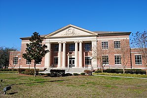
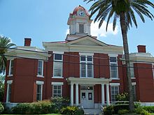
 Baker County Courthouse |
|
| National emblem | |
 seal |
|
| administration | |
|---|---|
| US state : | Florida |
| Administrative headquarters : | Macclenny |
| Address of the administrative headquarters: |
Baker County Board of County Commissioners 55 North 3rd Street 5 Macclenny, Florida 32063 |
| Foundation : | February 8, 1861 |
| Made up from: | New River County |
| Area code : | 001 904 |
| Demographics | |
| Residents : | 27,115 (2010) |
| Population density : | 17.9 inhabitants / km 2 |
| geography | |
| Total area : | 1525 km² |
| Water surface : | 10 km² |
| map | |
| Website : www.bakercountyfl.org | |
The Baker County is a county in the US state of Florida . The county seat is Macclenny . The slogan of Baker County is: "The Small County With Big Ideas ..." (The small county with big ideas ...)
history
Baker County was formed from part of New River County on February 8, 1861 and named after James McNair Baker , a Confederate Senator and later judge. The first county seat was the city of Sanderson. On February 22, 1889 it was decided with 243 to 220 votes that Darbyville, the current Macclenny district capital should be. The first tax officer was DC Prescott. He found that there were 112 sane white men between the ages of 21 and 50. Likewise 212 slaves. For every white man and slave, 50 cents in taxes were set per year. The land was valued at 0.6 percent of its value as a tax.
The main source of income was the cultivation of cotton. When a pest destroyed the cotton seed pods, sugar cane, sweet potatoes, grain and vegetables were grown. Most of the grain came on the market in the form of bulbous bottles. Tobacco cultivation was added later.
geography
The county has an area of 1,525 square kilometers, of which ten square kilometers are water. It is bordered in a clockwise direction by the following counties: Nassau County , Duval County , Clay County , Bradford County , Union County, and Columbia County . Together with the Counties Clay, Duval, Nassau and St. Johns , the county forms the metropolitan area of Jacksonville .
Demographic data
| growth of population | |||
|---|---|---|---|
| Census | Residents | ± in% | |
| 1870 | 1325 | - | |
| 1880 | 2303 | 73.8% | |
| 1890 | 3333 | 44.7% | |
| 1900 | 4516 | 35.5% | |
| 1910 | 4805 | 6.4% | |
| 1920 | 5622 | 17% | |
| 1930 | 6273 | 11.6% | |
| 1940 | 6510 | 3.8% | |
| 1950 | 6313 | -3% | |
| 1960 | 7363 | 16.6% | |
| 1970 | 9242 | 25.5% | |
| 1980 | 15,289 | 65.4% | |
| 1990 | 18,486 | 20.9% | |
| 2000 | 22,259 | 20.4% | |
| 2010 | 27,115 | 21.8% | |
| Before 1900
1900–1990 2000 2010 |
|||

As of the 2010 census , Baker County had 27,115 people in 9,687 households. The population density was 17.9 inhabitants per square kilometer. Ethnically, the population was composed of 83.7% white, 13.6% African American , 0.3% Indian and 0.5% Asian Americans . 0.4% were members of other races and 1.6% of different races. 1.9% of the population was made up of Hispanics or Latinos .
In 2010 children under the age of 18 lived in 41.3% of all households and persons aged 65 or over lived in 23.9% of all households. 76.6% of households were family households (consisting of married couples with or without offspring or a parent with offspring). The average household size was 2.82 people and the average family size was 3.21 people.
28.5% of the population were younger than 20 years, 26.9% were 20 to 39 years old, 28.1% were 40 to 59 years old, and 16.3% were at least 60 years old. The mean age was 36 years. 52.2% of the population were male and 47.8% were female.
The median income for a household in the 47,149 USD , while 17.0% of the population lived below the poverty line.
In 2010, English was the first language of 97.73% of the population, 1.75% spoke Spanish and 0.52% had another mother tongue.
Places in Baker County
Baker County towns with 2010 census residents :
City :
- Macclenny ( County Seat ) - 6,374 residents
Town :
- Glen St. Mary - 437 residents
Web links
Individual evidence
- ↑ GNIS-ID: 306920. Retrieved on February 22, 2011 (English).
- ↑ US Census Bureau - Census of Population and Housing . Retrieved March 15, 2011
- ↑ Extract from Census.gov . Retrieved February 14, 2011
- ↑ census.gov (2000) ( Memento of the original from April 25, 2012 in the Internet Archive ) Info: The archive link was inserted automatically and has not yet been checked. Please check the original and archive link according to the instructions and then remove this notice. ( MS Excel ; 26 kB) Accessed March 31, 2012
- ↑ Extract from census.gov (2010) Retrieved March 31, 2012
- ^ Profile of General Population and Housing Characteristics: 2010 . United States Census Bureau . Retrieved February 17, 2014.
- ↑ Language distribution 2010 . Modern Language Association . Archived from the original on June 19, 2006. Info: The archive link was inserted automatically and has not yet been checked. Please check the original and archive link according to the instructions and then remove this notice. Retrieved February 17, 2014.
Coordinates: 30 ° 19 ′ N , 82 ° 16 ′ W


